

|
|
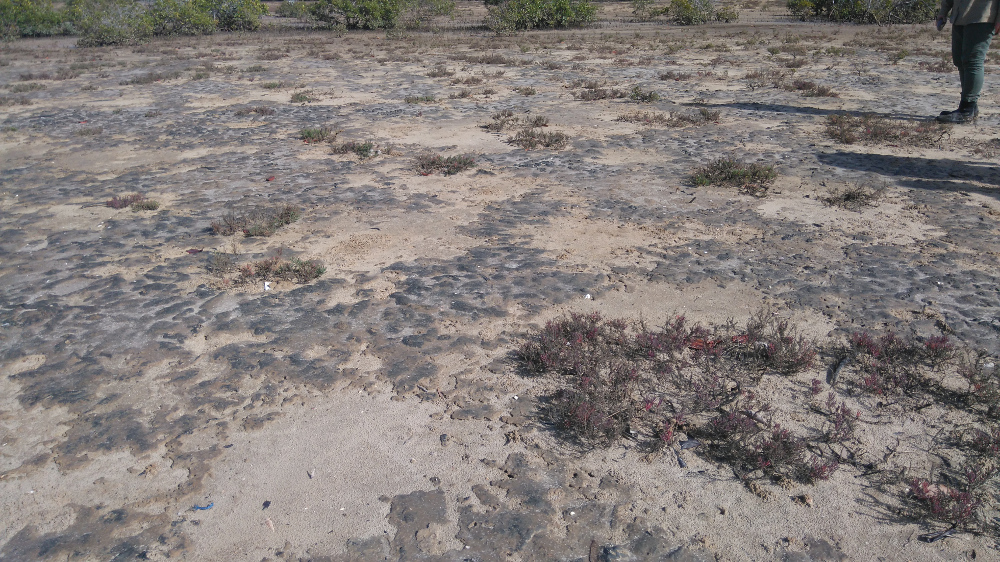
Bare areas above mean sea level (MSL)Short descriptionSaltpan areas above mean sea level with little to no vegetation. Disclaimer: Ecosystem type descriptions are based on biophysical attributes identified in Central Queensland through expert advice and supported by scientific literature. Not all ecosystem types are mapped based on current inventory, and many of the ecosystems described here may also occur in other parts of Queensland.
Classification categoriesSelect from the links below to view related ecosystem type categories Long descriptionSaltpan areas with little to no vegetation, which can be hypersaline depending on tidal influence. Typically they are adjacent to saltmarsh and mangrove communities. The boundary between the bare area and the saltmarsh and mangroves can shift in association with changes in catchment runoff (rainfall, stormwater, altered flows, land use), and, in the longer term, sea level rise. Can be covered with mats of benthic microalgae (BMA) or include channels and pools. Special valuesImportant fisheries habitat that can provide for feeding, growth and reproduction. Vegetated and non-vegetated saltpan ecosystems are used by a high number and diversity of fishes and many of economic importance, particularly in association with intertidal mangrove-lined creeks. Unvegetated saltpan adjacent to coastal wetlands provide feeding areas for high value fisheries species. Fish such as sand whiting, yellow fin bream, threadfin salmon and flathead feed on benthic crustaceans, bivalve molluscs and polychaete worms that are abundant in these bare areas[1]. BMA provides food for crustaceans (e.g. crabs) and molluscs (e.g. whelks). Fiddler and marsh crabs feed in these ecosystems following inundated by rainfall or tide, and shelter in burrows at other times. Can provide habitat for the water mouse (Xeromys myoides)[3], which is Environment Protection and Biodiversity Conservation Act 1999-listed (EPBC-listed). Saltmarsh ecosystems are also EPBC-listed. Potential feeding areas and roosting areas for shorebirds provided by the habitat complex of bare areas adjacent to mangroves. Different species feed and roost in different habitat units of the complex. Diagnostic attributesInundation ‘Intertidal – Medium undifferentiated’, ‘Intertidal – High’, ‘Intertidal – Undifferentiated’, ‘Intertidal – High undifferentiated’, although they occur closer to the higher tidal planes which remain unmapped. QualifiersThe Naturalness qualifier is relevant as tidal inundation may sometimes be modified by infilling and reclamation, barriers, and excavated channels, modifying Inundation and Terrain morphology. Changes in tidal inundation will be reflected by changes in Structural macrobiota (e.g. loss of BMA). Presence of other landuses and changes in hydrology may modify the attributes of this ecosystem type e.g. the presence of BMA. Breaking the BMA mat or crust (e.g. motorbikes and 4WDs) can damage the ecology of the area and bring about erosion, and it may take a long time to restore. These ecosystems fluctuate in extent over time and relevant qualifiers are Period and Trend. Changing tidal inundation due to sea level rise is causing mangroves to colonise the saltmarsh ecosystems (list their numbers)[2]. DistributionSaltpan areas above mean sea level with little to no vegetation are typically associated with broad, flat terrains and areas of low or seasonal rainfall. Notable extensive examples are:
The following relates to distribution of this ecosystem type within the Central Queensland mapping area:
CommentsContains no Structural macrobiota (i.e. unassigned). This area type could be undermapped and may be found within other ecosystem types (e.g. 1, 27 and 119). Other relevant attributes include Consolidation, Energy and Sediment texture as these ecosystems are typically unconsolidated muds and fine sediments in low energy environments. Additional informationField Guide to common saltmarsh plants of Queensland References
Last updated: 18 July 2019 This page should be cited as: Department of Environment, Science and Innovation, Queensland (2019) Bare areas above mean sea level (MSL), WetlandInfo website, accessed 8 May 2025. Available at: https://wetlandinfo.des.qld.gov.au/wetlands/ecology/aquatic-ecosystems-natural/estuarine-marine/descriptions/17/ |
Site footer

 — Department of the Environment, Tourism, Science and Innovation