

|
|
Western Cape and Gulf Freshwater Biogeographic ProvinceWestern Cape and Gulf Freshwater Biogeographic Province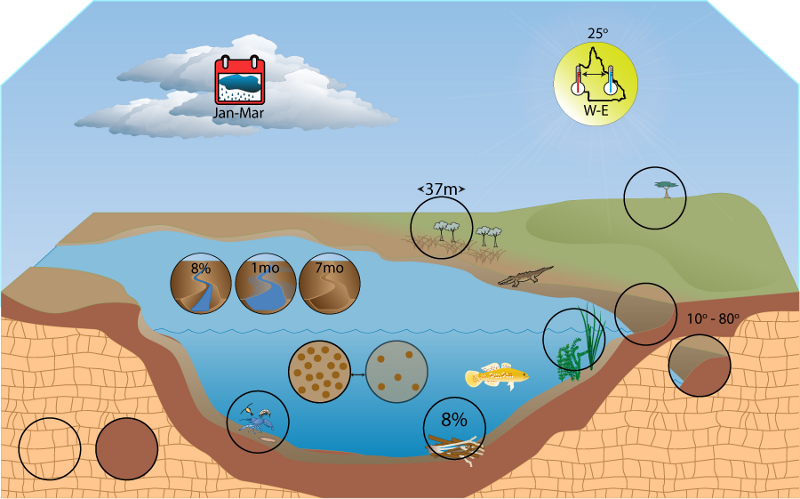 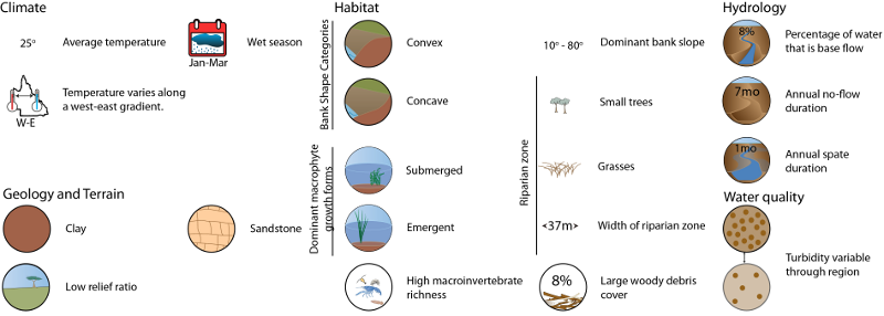 Click on elements of the model or select from the tabs below The Western Cape and Gulf Freshwater Biogeographic Province (FBP) consists of many drainage basins including the Settlement, Mornington Island, Nicholson, Leichardt, Morning, Flinders, Norman, Gilbert, Staaten, Mitchell, Coleman, Holroyd, Archer, Watson, Embley, Wenlock, Ducie, and Normanby. The FBP is located in the north-west of the state and includes the western part of Cape York Peninsula, Gulf Plains, Northwest Highlands, Mitchell Grass Downs, Einasleigh Uplands vegetation bioregions and a very small portion of the Wet Tropics and Desert Uplands vegetation bioregions. Last updated: 22 March 2013 This page should be cited as: Department of Environment, Science and Innovation, Queensland (2013) Western Cape and Gulf Freshwater Biogeographic Province, WetlandInfo website, accessed 25 June 2024. Available at: https://wetlandinfo.des.qld.gov.au/wetlands/ecology/aquatic-ecosystems-natural/riverine/freshwater-biogeo/western-cape-and-gulf/ |
Site footer

 — Department of Environment, Science and Innovation