

|
|
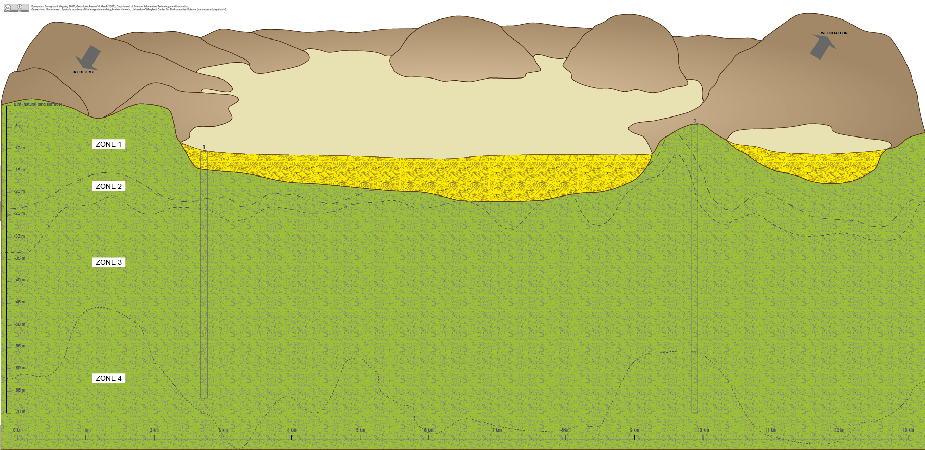
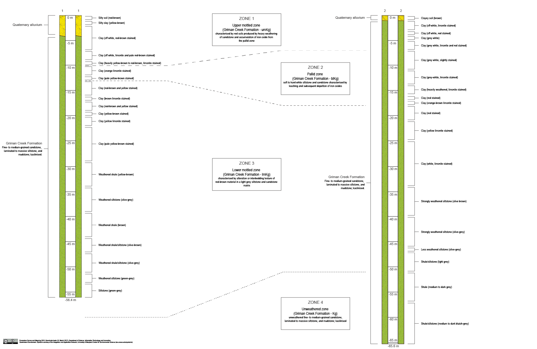
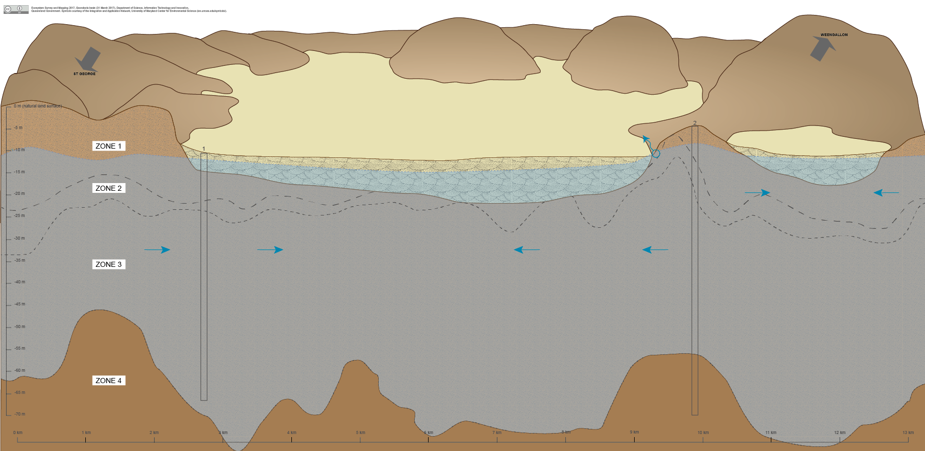
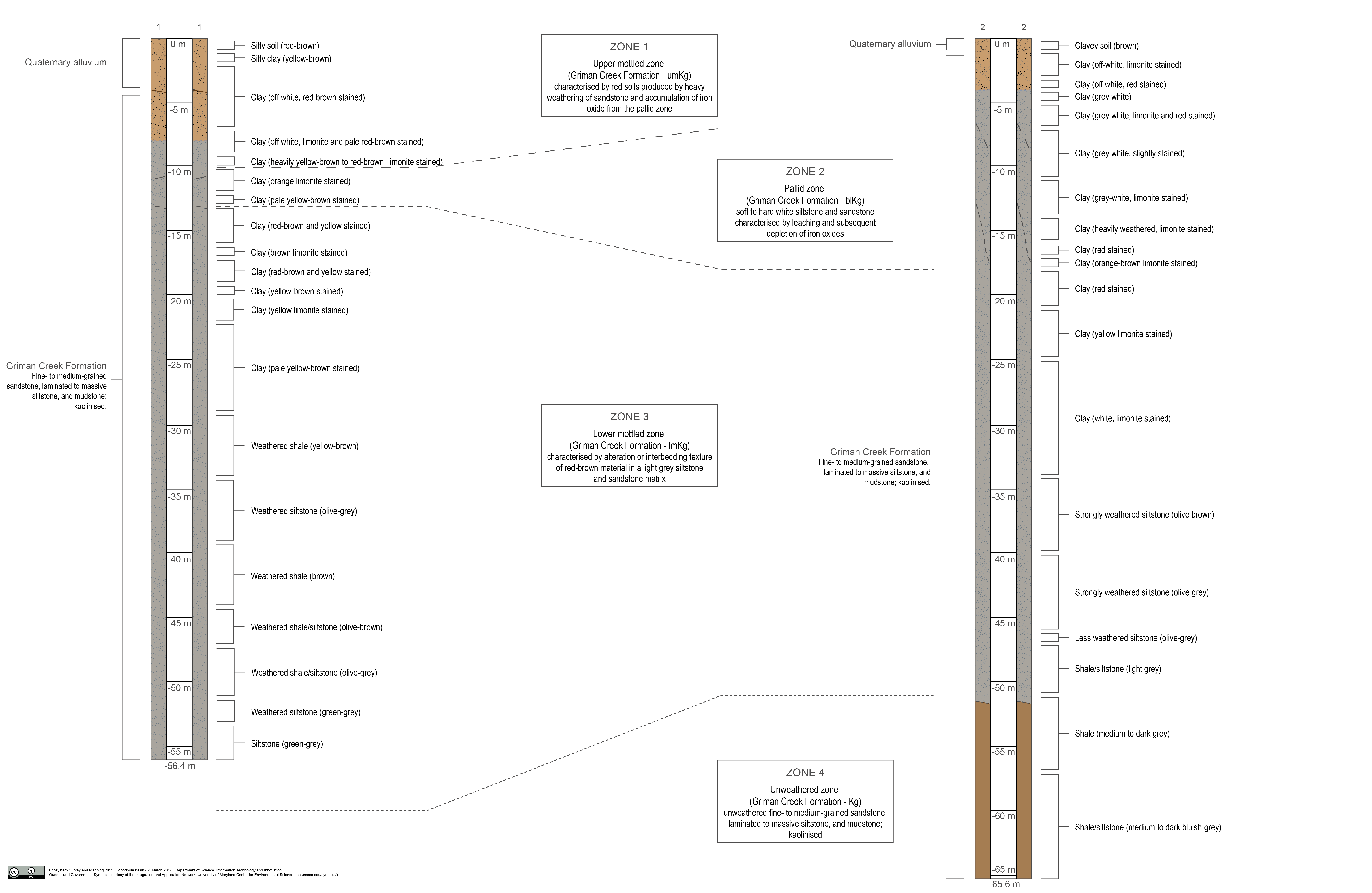
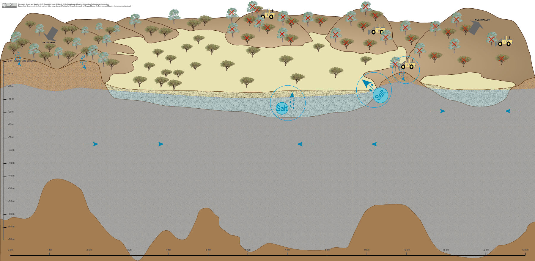
Goondoola BasinGoondoola BasinClick on elements of the model or select from the tabs below Goondoola Basin, located approximately 50 kilometres southeast of St George in the eastern Murray-Darling Basin, is an ancient lake bed in a semi-closed depression. The cracking and non-cracking clays of the lake bed and lower slopes of the surrounding ridges naturally accumulate salt. Historical widespread clearing of native vegetation on the ridges of Goondoola Basin, associated with a history of cultivation and grazing, has increased the rates of deep drainage of water through the soil profile and into the underlying unconfined aquifer[1]. Consequently, rising groundwater tables have mobilised the existing salt stores resulting in localised dryland salinity[1]. While shallow groundwater is present in Goondoola Basin, the groundwater quality prohibits the current ecosystems in this area from using or depending on this water source. Pictorial conceptual model PDF Additional links
References
Last updated: 10 April 2017 This page should be cited as: Queensland Government, Queensland (2017) Goondoola Basin, WetlandInfo website, accessed 30 August 2024. Available at: https://wetlandinfo.des.qld.gov.au/wetlands/ecology/aquatic-ecosystems-natural/groundwater-dependent/goondoola-basin/ |
Site footer

 — Department of Environment, Science and Innovation