

|
|
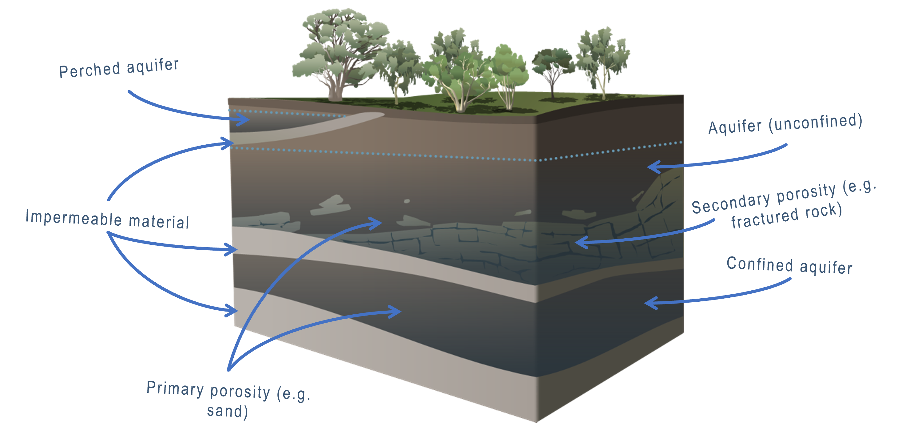
Groundwater rechargeGroundwater recharge is the entry of water into the saturated and capillary zones, into caves, and flow within the saturated zone[1]. 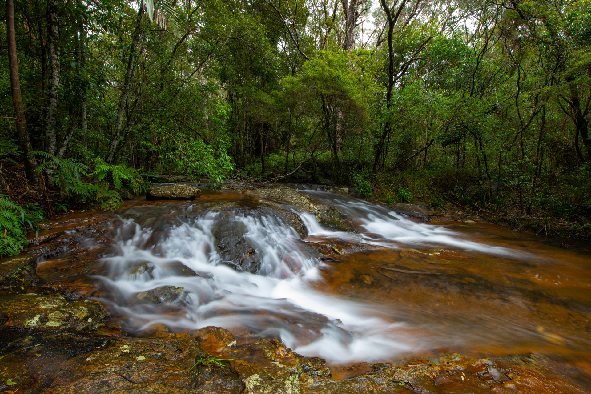
Groundwater is recharged via infiltration and percolation of water from precipitation, runoff, and rivers. This process is part of the water cycle. During this process, water can acquire different trace elements based on the soil and geology along their flow path. Minerals in the sediment and rocks can be released into the water. Groundwater recharge can occur across a range of spatial scales and the duration of recharge also varies significantly. Longer durations of groundwater recharge enable water to acquire more minerals. The substrate’s consolidation, grain size and geology/lithology influences where and how groundwater recharges. Coarse unconsolidated substrates such as sand and gravel have pores between the grains capable of storing water, for example in alluvia on valley floors and in sand systems. Well-drained, permeable rocks such as basalts also store groundwater. Layers of consolidated material (aquitards) prevent water from seeping through, holding groundwater above. Groundwater also seeps into splits or cracks that form in fractured rocks, often associated with folding and faulting of the rock.
Groundwater recharge can be influenced by land use and alterations to surface permeability. For example, urbanisation generally lowers the permeability of the land surface due to the construction of roads and other concrete structures. Lower surface permeability restricts infiltration and reduces any associated groundwater recharge. Vegetation clearing can increase infiltration (as it reduces plant water uptake) and increases associated groundwater recharge. For example clearing basalt slopes overlying a low permeable sandstone base leads to saline groundwater discharge at the boundary between the two rocks. 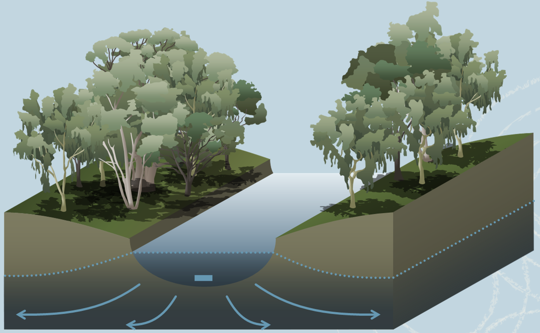 References
Last updated: 19 October 2023 This page should be cited as: Department of Environment, Science and Innovation, Queensland (2023) Groundwater recharge, WetlandInfo website, accessed 25 June 2024. Available at: https://wetlandinfo.des.qld.gov.au/wetlands/ecology/processes-systems/groundwater-recharge/ |
Site footer

 — Department of Environment, Science and Innovation