Quick facts
- Benthic depth
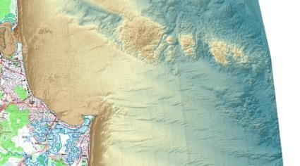
- is the depth of the seafloor using the Australian Height Datum (AHD) and may also be referred to as absolute relief.
Queensland Intertidal and Subtidal Classification Scheme
Complex interactions between mixing and water quality parameters determine the effective euphotic depth[2]. Relevant seascape-level thresholds are:
- intertidal
- -10m (shallow/deep seagrass threshold)
- -60m (limit of shelf upwellings and mixing)*
- -30 to -150m (limits of mesophotic reefs[3])
- -200m which marks the approximate edge of the continental shelf.
*There is also a changeover in ecological communities at 60m due to both light and nutrient availability. Above 60m photoautotrophs occur (i.e. they create their own food using light photosynthesis. This includes plants, and animals having a symbiotic relationship with plants (e.g. zooxanthellae within corals). Below 60m heterotrophs occur ( i.e. they consume other animals and plants for food but may have some photosynthesis as well.)[1]
Benthic depth (depth of the sea floor) is a part of the 'Terrain' theme for attributes used in the Intertidal and Subtidal Classification Scheme.
Attribute category table - Benthic Depth
|
Community
|
Habitat (m)
|
Seascape (m)
|
Subregion (m)
|
Region (m)
|
|
25cm divisions
|
0-1
|
0 - 5
|
0 - 20
|
0 - 60
|
|
25cm divisions
|
1-2
|
|
25cm divisions
|
2-3
|
|
50cm divisions
|
3-4
|
|
50cm divisions
|
4- 5
|
|
1m divisions
|
5 -10
|
5 - 10
|
|
1m divisions
|
10 - 15
|
10 - 15
|
|
1m divisions
|
15 - 20
|
15 - 20
|
|
.. Increment by 5m
|
.. Increment by 5 until 50
|
..Increment by 5 until 40
|
20 - 40
|
|
40 - 50
|
40 - 60
|
|
..Increment by 5m
|
50 - 60
|
50 - 60
|
|
As for Habitat
|
...Increment by 10 until 200
|
60 - 100
|
60 - 100
|
60 - 100
|
|
100 - 150
|
100 - 200
|
100 - 200
|
|
150 - 200
|
|
200 - 220
|
200 - 300
|
200 - 300
|
200 - 500
|
|
... Increment by 20 until 300
|
|
300 - 400
|
300 - 500
|
300 - 500
|
|
...Increment by 100 until 1000
|
500 - 700
|
500 - 1000
|
500 - 1000
|
|
700 - 1000
|
|
1000 - 1500
|
1000 - 1500
|
1000 - 1500
|
1000 - 1500
|
|
below 1500
|
below 1500
|
below 1500
|
below 1500
|
References
- ^ Lesser, MP, Slattery, M, Laverick, JH, Macartney, KJ & Bridge, TC, 'Global community breaks at 60 m on mesophotic coral reefs', Global Ecology and Biogeography. [online], vol. 0, no. 0. Available at: https://onlinelibrary.wiley.com/doi/abs/10.1111/geb.12940 [Accessed 5 July 2019].
- ^ McArthur, MA, Brooke, BP, Przeslawski, R, Ryan, DA, Lucieer, VL, Nichol, S, McCallum, AW, Mellin, C, Cresswell, ID & Radke, LC (2010), 'On the use of abiotic surrogates to describe marine benthic biodiversity', Estuarine, Coastal and Shelf Science, vol. 88, no. 1, pp. 21-32, Elsevier.
- ^ Rocha, LA, Pinheiro, HT, Shepherd, B, Papastamatiou, YP, Luiz, OJ, Pyle, RL & Bongaerts, P (20 July 2018), 'Mesophotic coral ecosystems are threatened and ecologically distinct from shallow water reefs', Science. [online], vol. 361, no. 6399, pp. 281-284. Available at: http://www.sciencemag.org/lookup/doi/10.1126/science.aaq1614 [Accessed 25 March 2019].
Last updated: 15 July 2019
This page should be cited as:
Department of Environment, Science and Innovation, Queensland (2019) Benthic depth, WetlandInfo website, accessed 8 May 2025. Available at: https://wetlandinfo.des.qld.gov.au/wetlands/ecology/aquatic-ecosystems-natural/estuarine-marine/itst/benthic-depth/


 — Department of the Environment, Tourism, Science and Innovation