

|
|
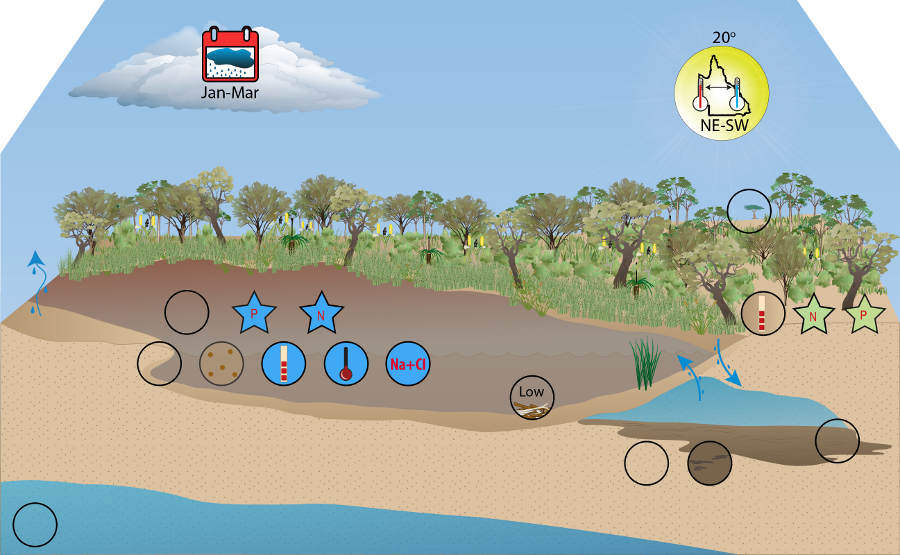
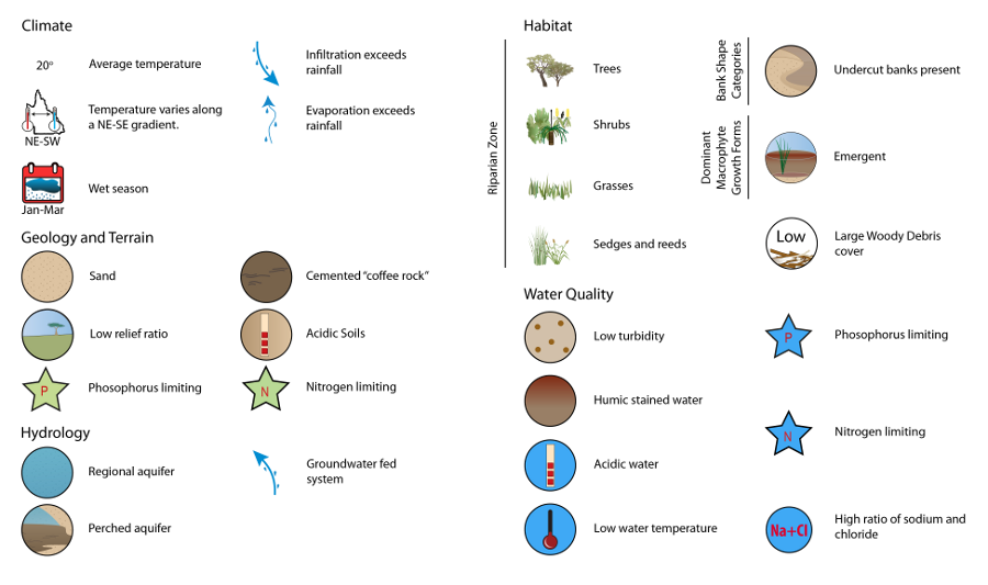
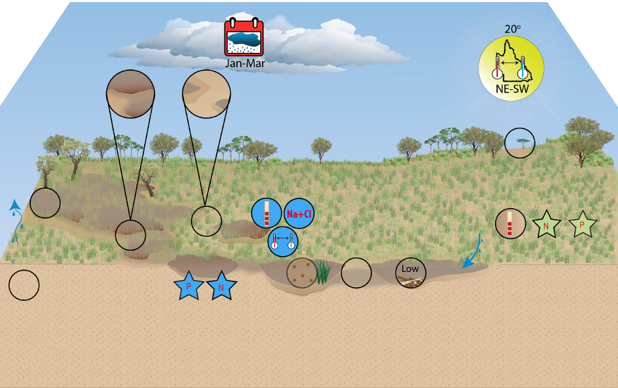
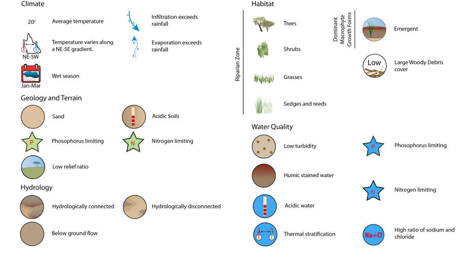
Wallum Freshwater Biogeographic ProvinceWallum Freshwater Biogeographic ProvinceClick on elements of the model or select from the tabs below The Wallum Freshwater Biogeographic Province (FBP) is located on the south-east coast of Queensland, covering the mainland coast from Maryborough to Sandstone Point at Deception Bay and the coastal dune islands of Fraser, Moreton, Bribie and North and South Stradbroke Island. The area is part of a larger assemblage of coastal, lowland dune country extending from Coffs Harbour (NSW) in the south to Gladstone (Qld) in the north[1], and continuing intermittently along the northern Queensland coastline. The FBP falls within the Southeast Queensland bioregion and includes a variety of habitat types such as coastal heathland, swamp sedgeland, and schlerophyll shrubland[3][2]. The term ‘wallum’ was derived from the indigenous word used to describe Banksia aemula, a small tree which characteristically occurs in these areas[3][1]. Wallum riverine systems are characterised by high acidity and sandy substrates with limited nutrient availability. Climate and geology are broadly consistent across the region, while variations in hydrology, water quality and habitat result in two distinctive systems:
MethodsInformation from the State of the Rivers (SoR) project was used to develop habitat characteristics, with some data also drawn from the Queensland Ambient Biological Monitoring Program (ABMAP) in conjunction with expert consultation. ABMAP and its predecessor projects collected information on riverine structural attributes and assessed the ecological conditions of Queensland’s waterways using aquatic macroinvertebrates as indicators[4]. The analyses here utilised only reference condition sites from ABMAP, which aim to represent the pre-development state of the FBP. It is important to note that due to the different information sources used to characterise the Wallum FBP, the habitat characteristics (with the exception of substrate composition and heterogeneity) are not directly comparable to other FBPs. The limited data availability for this region highlights the need for further research and monitoring. References
Last updated: 22 March 2013 This page should be cited as: Department of Environment, Science and Innovation, Queensland (2013) Wallum Freshwater Biogeographic Province, WetlandInfo website, accessed 25 June 2024. Available at: https://wetlandinfo.des.qld.gov.au/wetlands/ecology/aquatic-ecosystems-natural/riverine/freshwater-biogeo/wallum/ |
Site footer

 — Department of Environment, Science and Innovation