

|
|
PeatWhile many people are aware of “peat soils” and “peat wetlands” it is difficult to define what peat actually is, as different academic fields approach the study of peat from different perspectives (e.g., engineering, soil science, botany, agriculture, geology etc.). In general, peat is an organic rich material formed from slowly decomposing vegetation that forms in waterlogged and anaerobic conditions. Peat wetlands, with underlying soils, provide an array of ecosystem services, including climate regulation through carbon sequestration and storage, water storage, filtration and regulation, provision of paleo-environmental archives and recreational opportunities, as well as providing valuable habitat for nationally and internationally important wildlife, including Ramsar sites. Peat wetlands have been identified as a priority for action under a suite of international agreements. The International Union for the Conservation of Nature (IUCN) calls for urgent worldwide action to protect, sustainably manage and restore peatlands and has recommended peatlands be included in all relevant intergovernmental agreements relating to climate change, geodiversity and biodiversity (WCC 2016 Res 043). 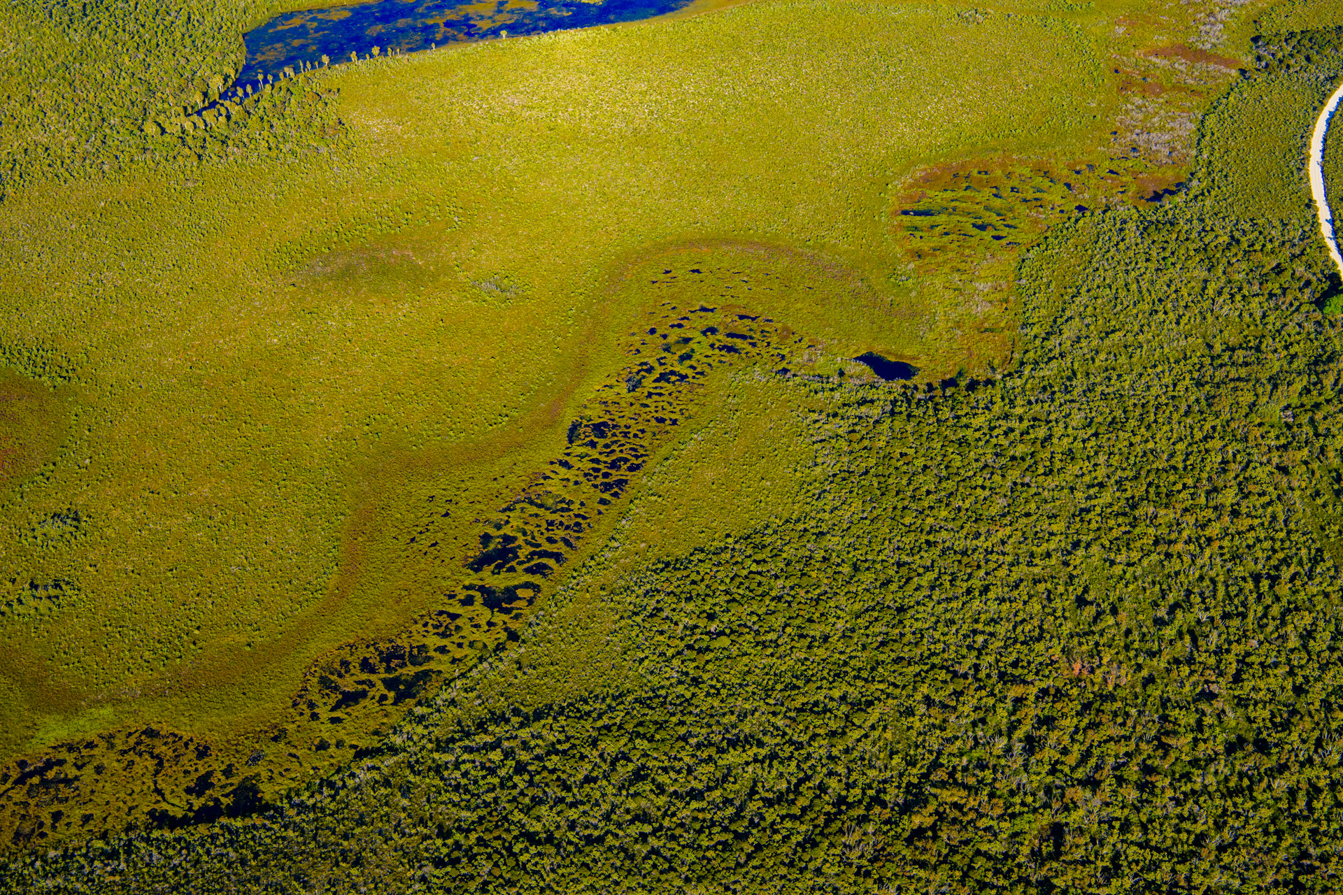 Quick facts
Wetlands with peat soils (peat wetlands) have a valuable role in water storage and regulating floodwaters, storing an estimated 10% of all non-glacial freshwater on Earth[3], despite taking up only 3% of land surface[2]. If the organic matrix of the peat soil dries out, the pore spaces become smaller and the capacity for water storage is reduced. The water storage function of peat provides refugia for species during drought and a water source to humans in some parts of the world. Intact peat soils are the most efficient global store of terrestrial carbon. While they only occupy ~3% of the Earth’s surface, they are estimated to store 460 Gt of carbon which is the equivalent of 75% of all atmospheric carbon[1]. For peat to retain its optimal carbon storage potential, it needs to remain wet. Globally, many peat soils have been dewatered through urbanisation, mining, and agriculture. Draining peat soils can transform them from being a carbon sink to a source of carbon emissions as it exposes peat to the air which triggers decomposition, releasing C02 as a byproduct, also resulting in subsidence of the peat. Peat soils are often classified in accordance with their stage of decomposition, i.e., fibric, hemic and sapric. Fibric peat is the least decomposed, sapric the most and hemic peats are intermediate in decomposition. Drained and/or dry peat is also vulnerable to fire. While some peat wetlands have species that are either adapted or tolerant of fire, fire can have an adverse effect if too intense, too frequent and/or in the wrong season. With the potential for increasing drought under climate change, dry peat wetlands will become increasingly vulnerable to wildfire and they need to be managed carefully, see Planned Burn Guidelines and Regional Ecosystem Fire Management Guidelines. Wetlands with peat soils are found throughout Queensland, occurring in Cape York Peninsula, Wet Tropics, Central Queensland Coast, Einasleigh Uplands and South East Queensland bioregions. The Queensland bioregions with the most peat forming Regional Ecosystems (REs) are the Wet Tropics and South East Queensland. The most common Land Zones in Queensland for peat REs are Land Zone 3 (alluvial river and creek flats) and Land Zone 2 (coastal dunes). Peat wetlands in Queensland are predominantly found in palustrine wetland systems, a few riverine wetlands and lacustrine wetlands. In Queensland, peat forming wetlands tend to be those dominated by sedgelands/grasslands and melaleuca swamps but can also include those dominated by Corymbia/Lophostemon/Eucalyptus spp.; ferns/herblands, coastal heathland shrubs and microphyll to notophyll vine forest. The Moreton Bay, Great Sandy Strait and Shoalwater and Corio Bay Ramsar sites all contain peat wetlands, including the rare, patterned fens which provide valuable habitat for threatened species of fish and acid frogs including the Oxleyan pygmy perch (Nannoperca oxleyana) and honey blue eye (Pseudomugil mellis) fish, and four acid frog species, i.e., Crinia tinnula, Litoria olongburensis, Litoria freycineti and Litoria cooloolensis. These species are highly specialised and endemic to oligotrophic and acidic (pH 3.4-5.5) coastal wetlands, many of which are peat based such as sedgelands and melaleuca dominated wetland communities. References
Last updated: 27 October 2023 This page should be cited as: Department of Environment, Science and Innovation, Queensland (2023) Peat, WetlandInfo website, accessed 25 June 2024. Available at: https://wetlandinfo.des.qld.gov.au/wetlands/ecology/components/substrate/soils/peat/ |
Site footer

 — Department of Environment, Science and Innovation