

|
|
Intertidal substrate below HAT with indeterminate tidal influenceShort descriptionTerrestrial and freshwater ecosystems below Highest Astronomical Tide. Disclaimer: Ecosystem type descriptions are based on biophysical attributes identified in Central Queensland through expert advice and supported by scientific literature. Not all ecosystem types are mapped based on current inventory, and many of the ecosystems described here may also occur in other parts of Queensland.
Classification categoriesSelect from the links below to view related ecosystem type categories Long description
Terrestrial and freshwater ecosystems (e.g. groundwater dependent ecosystems, GDEs) below the mapped level of Highest Astronomical Tide (HAT) and potentially subject to tidal influence. There are two main sub-types.
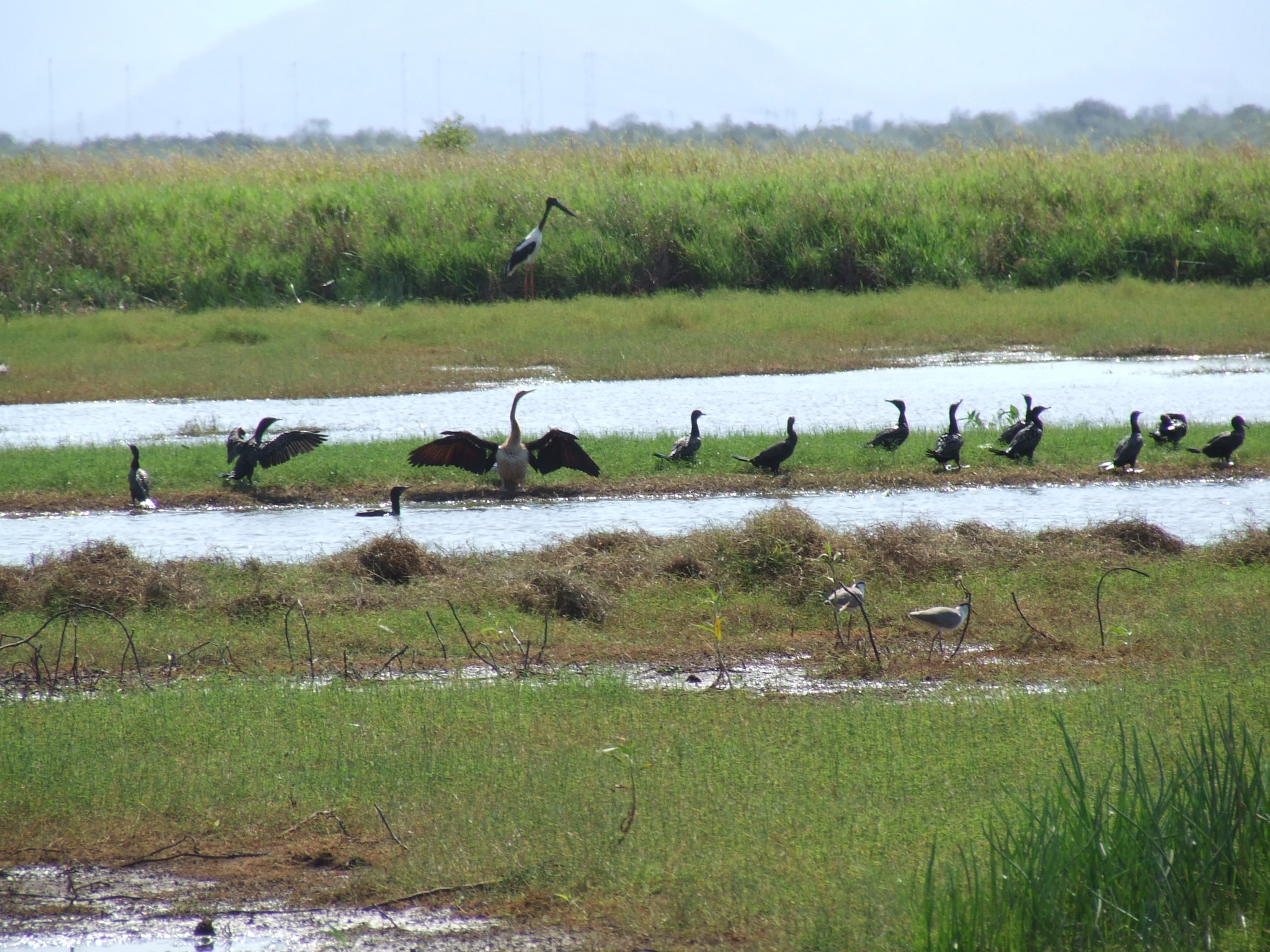
Special valuesWhere remnant ecosystems exist, these are important areas of hydrological connectivity between land and sea and protect brackish to fresh habitat for fish in the upper estuaries of streams. Diadromous fish need these areas for fish passage. Can be important to shorebird feeding, as outlined within the Aquatic Conservation Assessment (ACA). Many shorebirds Environment Protection and Biodiversity Conservation Act 1999-listed species (EPBC). Diagnostic attributesInundation ‘Intertidal – indeterminate’ Structural macrobiota ‘Unknown’ Energy magnitude (wave) ‘Low’, ‘Very low’ Sediment texture ‘MUD’, ‘gravelly MUD’, ‘muddy SAND’, ‘(slightly gravelly) sandy MUD’, ‘(slightly gravelly) MUD’, ‘sandy MUD’, ‘SAND’, ‘(slightly gravelly) SAND’, ‘gravelly muddy SAND’, ‘gravelly SAND’, ‘(slightly gravelly) muddy SAND’, ‘GRAVEL’, ‘muddy GRAVEL’, ‘sandy GRAVEL’, ‘muddy sandy GRAVEL’, Unknown’ (note that the dominant grain size is capitalised) Benthic depth ‘Intertidal (>0m)’ QualifiersSub-type ii (non-remnant) includes modified Naturalness agricultural land as mapped by Queensland Land Use Mapping Program (QLUMP) mapping. Modified Terrain morphology including cut channels, bunds etc. have altered the hydrology of agricultural land such that its tidal influence is minimal. However, irrigated areas may be subject to saline ingress and the groundwater may be salty. Although unmapped, Period and Trend qualifiers are also relevant as the Energy magnitude may also vary seasonally and episodically with respect to wave action and with respect to inundation, as remnant wetland areas may be seasonally inundated with freshwater but then the tidal influence returns with the drying out of the substrate. DistributionRelatively common in developed parts of the state, although typically small areas in between the landwards edge of the mangrove/saltmarsh/grass/sedge complex and terrestrial vegetation. Freshwater vegetation subject to indeterminate tidal vegetation is frequently in deltas and mouths of river systems, or in swales adjoining estuaries. The following relates to distribution of this ecosystem type within the Central Queensland mapping area:
CommentsOther relevant attributes can include Freshwater input volume, Freshwater input source, Tidal range, Terrain relative relief, Terrain morphology, Terrain slope, Terrain pattern and Sediment composition (applied as Sediment texture typology). Refer to freshwater wetlands mapping and Regional Ecosystem mapping for remnant vegetation. Additional InformationGroundwater Dependent Ecosystems - WetlandInfo Land zone definitions - Queensland Government Regional ecosystems - Queensland Government Queensland Land Use Mapping Program (QLUMP) - Queensland Government Last updated: 22 July 2019 This page should be cited as: Department of Environment, Science and Innovation, Queensland (2019) Intertidal substrate below HAT with indeterminate tidal influence, WetlandInfo website, accessed 8 May 2025. Available at: https://wetlandinfo.des.qld.gov.au/wetlands/ecology/aquatic-ecosystems-natural/estuarine-marine/descriptions/119/ |
Site footer

 — Department of the Environment, Tourism, Science and Innovation