

|
|
Exclusion zonesExclusion zones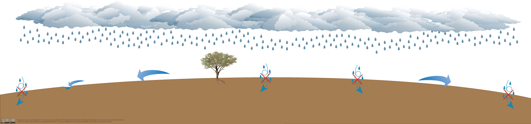
Click on elements of the model or select from the tabs below Some rocks (such as some fine-grained sedimentary rock, metamorphic rock and igneous rock) and unconsolidated sediment (such as clay deposits) have very low permeability. Due to this very low permeability, much of the water from rainfall is unable to infiltrate the land surface and becomes surface water run-off. These very low permeability rocks and sediments do not have enough inter-granular pore space, voids or fractures to contain groundwater or enable flow. As a result of this GDEs are not located in areas within these very low permeability rocks or sediment. Pictorial conceptual model PDF Additional information
Last updated: 12 April 2017 This page should be cited as: Queensland Government, Queensland (2017) Exclusion zones, WetlandInfo website, accessed 18 March 2024. Available at: https://wetlandinfo.des.qld.gov.au/wetlands/ecology/aquatic-ecosystems-natural/groundwater-dependent/exclusion-zones/ |
Site footer

 — Department of Environment, Science and Innovation