Skip links and keyboard navigation

Alluvia—modified (dams)

Alluvia—modified (dams)

Stygofauna Mixing of groundwater and surface water Direction of groundwater movement Direction of groundwater movement Direction of groundwater movement Fish Stygofauna Terrestrial GDE Surface expression GDE GDE Melaleuca spp Terrestrial GDE Direction of groundwater movement Direction of groundwater movement Alluvia Low permeability rock (unsaturated) Eucalyptus spp Melaleuca spp Evapotranspiration Melaleuca spp Evapotranspiration Melaleuca spp Stygofauna Direction of groundwater movement Stygofauna Direction of groundwater movement Surface expression GDE Terrestrial GDE Evapotranspiration Eucalyptus spp Direction or surface water movement Moderate to high permeability rock (saturated) Low permeability rock (unsaturated) Alluvia Alluvia (saturated) Direction of groundwater movement Groundwater leakage Moderate to hight permeability rock Low permeability rock Low permeability rock Alluvia (saturated) Alluvia unsaturated Alluvia (unsaturated)

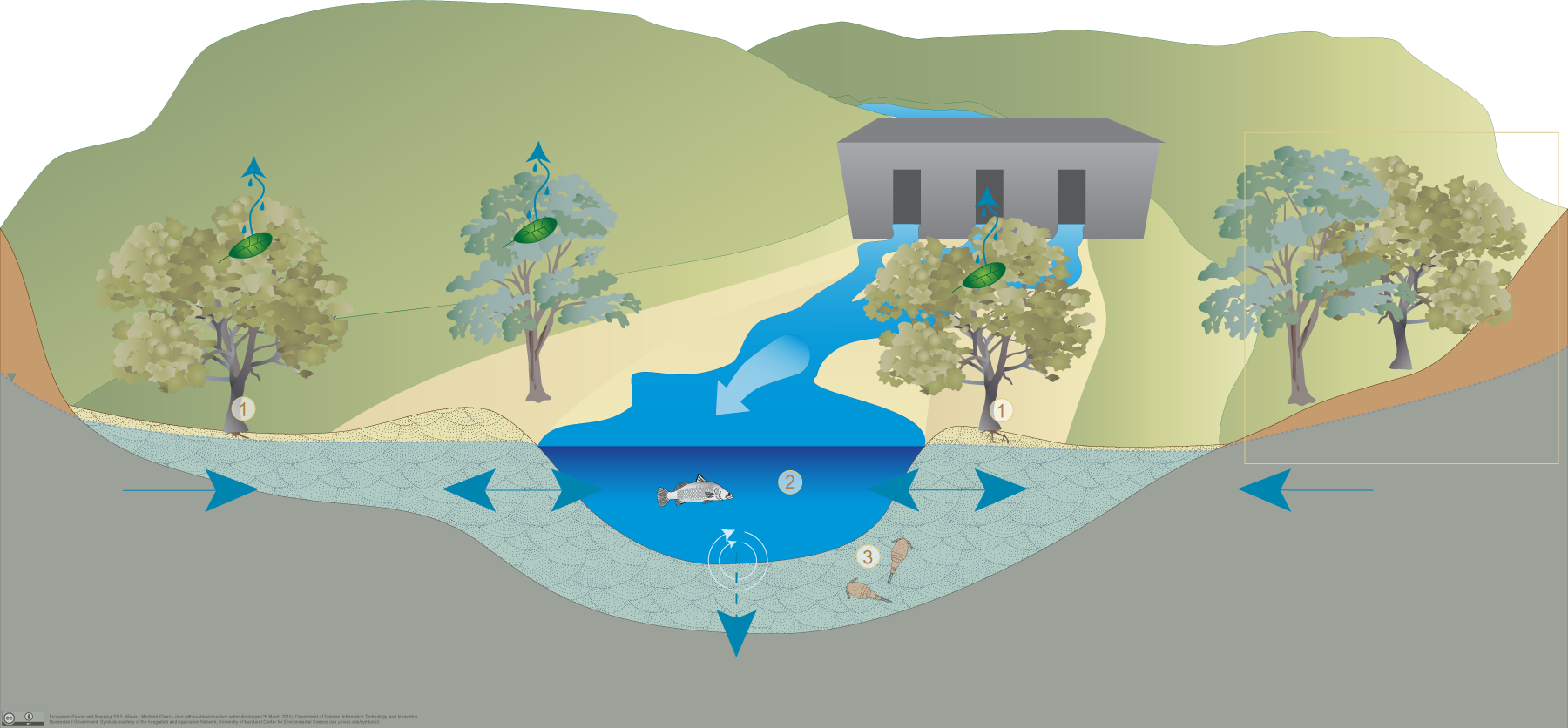
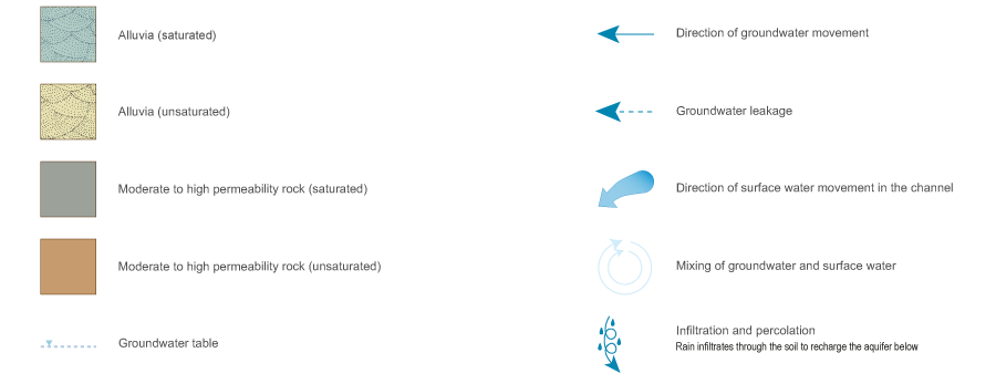
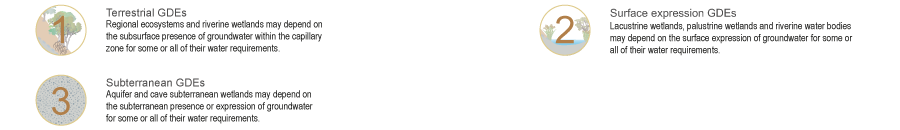
Click on elements of the model or select from the tabs below

Alluvial aquifers with sustained surface water discharge downstream of dam

Alluvial aquifers are formed from particles such as gravel, sand, silt and/or clay deposited by fluvial processes in river channels or on floodplains. These deposits store and transmit water to varying degrees through inter-granular voids. These aquifers may have structures, such as dams, that modify the flow of both surface water and groundwater. Dams that provide a sustained release of surface water may increase recharge from the downstream channel into the alluvial aquifers, resulting in their saturation.

  • Palustrine (e.g. swamps), lacustrine (e.g. lakes) and riverine (e.g. streams and rivers) wetlands on alluvial aquifers with sustained flow from dams may depend on the surface expression of groundwater from these underlying alluvial aquifers.
  • Terrestrial vegetation on alluvial aquifers with sustained flow from dams may depend on the subsurface presence of groundwater, typically using deep roots to access groundwater in the capillary zone above the water table.

Pictorial conceptual model PDF


Last updated: 18 December 2015

This page should be cited as:

Queensland Government, Queensland (2015) Alluvia—modified (dams), WetlandInfo website, accessed 18 March 2024. Available at: https://wetlandinfo.des.qld.gov.au/wetlands/ecology/aquatic-ecosystems-natural/groundwater-dependent/alluvia-dams-sustained/

Queensland Government
WetlandInfo   —   Department of Environment, Science and Innovation