

|
|
HydrologyA wetland aggregation includes wetlands with hydrological, ecological or biological connections. Hydrological connections include surface water flows and groundwater flows. These connections may be permanent, e.g. a stream or groundwater flows, or intermittent such as periodic flooding. A super reach is a section of river subject to similar floodplain scale influences and energy conditions. Includes the channel, or multiple channels, and floodplain.
Quick facts
Hydrology – Aggregation/Super reachSelect from the tabs below
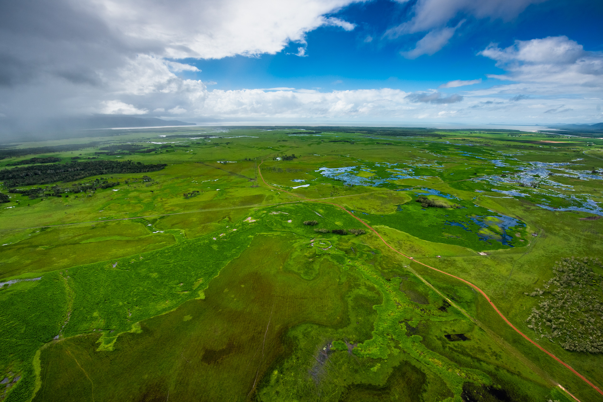 Wetland aggregation hydrologyAggregations are defined by their connectivity. Hydrological connections include surface water flows and groundwater flows. These connections may be permanent, for example, a stream or groundwater flows, or intermittent, such as periodic flooding. Aquatic ecosystem connectivity refers to the connections between and within aquatic ecosystems. Links between water-dependent ecosystems allow migration, colonisation and reproduction of species. These connections also enable nutrients and carbon to be transported throughout the system to support the healthy functioning and biodiversity of rivers, floodplains and wetlands[1]. The aggregated effects of multiple wetlands in the landscape can differ considerably from the functions observed at individual wetland scales. This applies to provisioning of ecosystem services such as coastal protection, biodiversity support, groundwater level and soil moisture regulation, flood regulation and contaminant retention. Parallel and circular flow-paths, through which wetlands are interconnected in the landscape, may largely control such scale-function differences[5]. As surface water expands in wet periods, surface-water connections occur between many depressional wetlands and streams. Wetlands can merge with, or spill into, other wetlands and the stream network as surface water expands. Understanding how wetlands that cyclically or variably contribute water to streams interact is important for accurately predicting stream flow, particularly during high flow events[6]. Super-reach hydrologyIn a super reach water flows are divided among the two or more channels (in contrast to a reach which generally refers to a single channel). Not all channels will necessarily flow at the same time. A super reach is connected with its floodplain. Water flows onto the floodplain in flood conditions, and returns to the channels as the flood recedes. Water also flows up lower lying channels, for example into billabongs. Subsurface flows enter the channels from the floodplain. Older water is pushed out by newer water entering the ground was as infiltration. Parafluvial flows beneath the channels may flow more directly downgradient, using the shortest path, in contrast to the meanders of the surface channels[2]. Paleochannels on floodplains may take water flows but do not take bed sediment. Paleochannels have often become infilled with sediment as a result of fluvial geomorphological processes[4]. 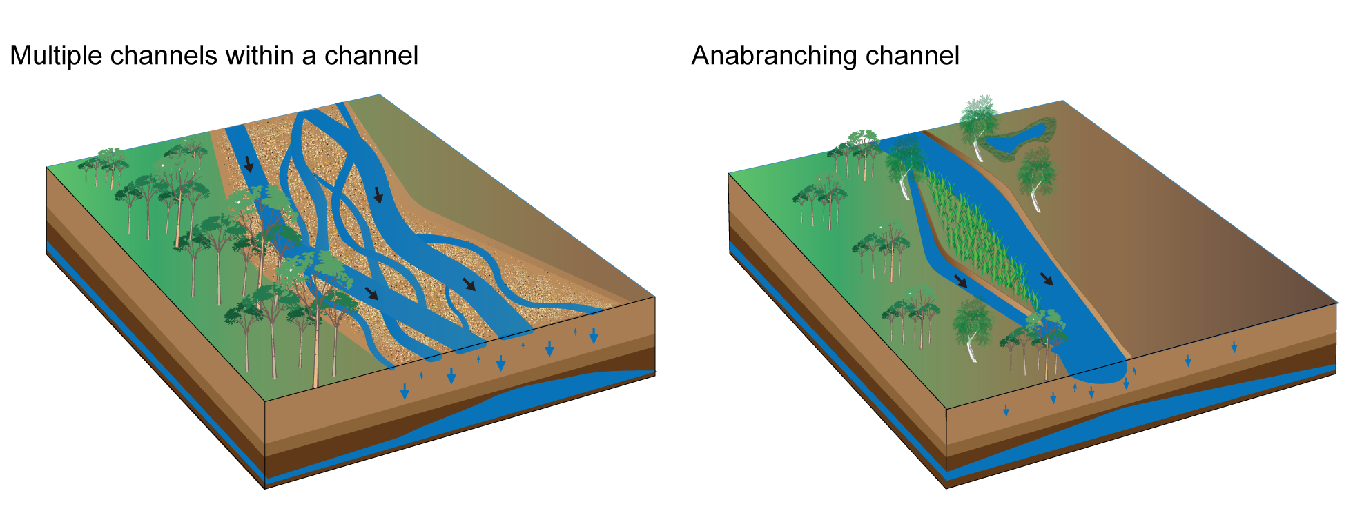 References
Last updated: 18 October 2023 This page should be cited as: Department of Environment, Science and Innovation, Queensland (2023) Hydrology – Aggregation/Super reach, WetlandInfo website, accessed 8 May 2025. Available at: https://wetlandinfo.des.qld.gov.au/wetlands/ecology/processes-systems/water/hydrology/superreach-aggregation.html |

Site footer

 — Department of the Environment, Tourism, Science and Innovation