

|
|
Coastal and subcoastal non-floodplain soil lakeCoastal and subcoastal non-floodplain soil lake – Flooding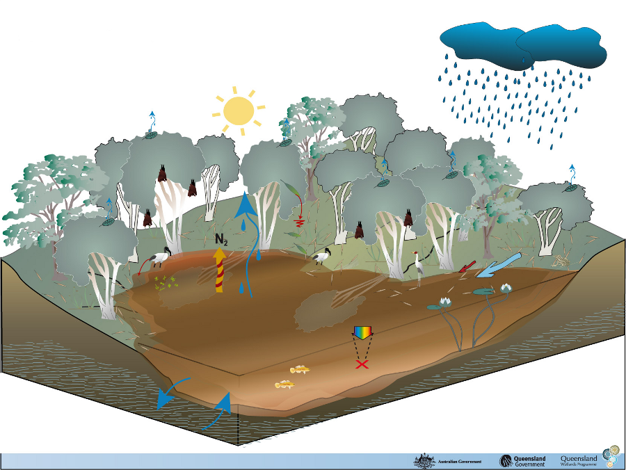 Click on elements of the model or select from the tabs below Stage 1: First Big Flush
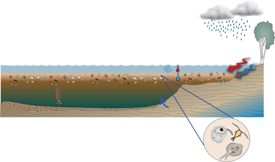
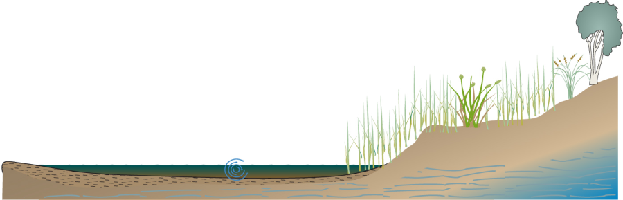
During periods of high surface flow into lakes, either through rainfall in the catchment and/or river flooding (if it is a floodplain lake), surface storm water flow is usually turbid compared to clearer groundwater base flows. This entering water is usually cooler than the well-mixed surface layer (the epilimnion) and warmer than the colder, deeper layer (the hypolimnion), and so settles between these two zones, blocking light to the water below and the bottom sediments. The turbid surface water entering carries nutrients and organic matter. These stimulate zooplankton growth and suppress phytoplankton growth by blocking light. The water column is typically heterotrophic at this stage. Following the turbid water inflow, particles settle over time according to size. As the particle size distribution changes over time, so do the zooplankton and microcrustacean species that graze on it (e.g. there is a shift in Daphnia species (small planktonic crustaceans) as particle size fractions change). Clear water also enters the lake through hyporheic flow if the lake is part of a floodplain system, is proximate enough to the flowing channel system and if the substrate is conducive to such flow. Stage 2
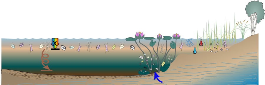
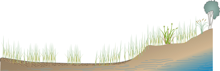
Over time, particles continue to settle out of the water column. Light could still be blocked by suspended particles and Coloured Dissolved Organic Matter (CDOM). However, unless there is a significant amount of resuspension (which can be caused by wave action), the water tends to become clearer to some extent. Emergent vegetation flourishes, providing a substrate for microbes and epiphytes to grow on and a source of detritus for other organisms. The depth is continually getting shallower due to evaporation, unless groundwater (including hyporheic flow) can supplement the water lost through evaporation. Lakes that receive groundwater can typically become clearer than those that don’t, as they are provided with a source of clear water that dilutes the sediment and organic matter particles over time. Stage 3
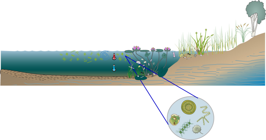
As the turbidity clears, light can penetrate deeper into the water column, allowing phytoplankton to grow. The water column becomes autotrophic and plants grow in the water column. Reeds and other vegetation continue to grow in the shallower areas while emergent and submergent plants flourish in the deeper areas. Less available nutrients in the water column reduce the growth of microbes and epiphytes. Lakes may stratify if climatic and other conditions are suitable. As the water level drops, plants can continue to colonise the area. The shape, bathymetry and substrate of the waterbody play a significant role in determining the rate and type of plant colonisation. Stage 4
As water continues to evaporate and the depth gets shallower and shallower, solutes (such as salts) are continually concentrated. The depth of wind mixing increases proportionally, until it can reach the bottom of the lake and stir up the bottom sediment, bringing nutrients stored in the sediments into the water column, potentially stimulating zooplankton and microcrustacean growth and reducing water clarity for plants. This can lead to a similar ecological situation as Stage 2. Stage 5
Some waterbodies dry out completely as a natural part of their life cycle. These are referred to as ephemeral waterbodies. Typically the plants and animals associated with these areas are adapted to survive the wet and dry cycles and in some cases, require them in order to complete their life cycles. The presence of vegetation is influenced by the surface they are growing on and therefore gives some indication of the level and type of hydrological activity of the site. Dense long-lived perennial vegetation suggests a low energy (slow flowing) environment with little deposition, probably occurring over a long period of time. Annual vegetation may also indicate a low energy environment but with a shorter duration of stability. Lack of vegetation or burying of vegetation distinguishes a more active environment. Vegetation cover, type and density also influence the surface resistance to erosion. Last updated: 22 March 2013 This page should be cited as: Department of Environment, Science and Innovation, Queensland (2013) Coastal and subcoastal non-floodplain soil lake – Flooding, WetlandInfo website, accessed 8 May 2025. Available at: https://wetlandinfo.des.qld.gov.au/wetlands/ecology/aquatic-ecosystems-natural/lacustrine/non-floodplain-soil-lake/flooding.html |


Site footer

 — Department of the Environment, Tourism, Science and Innovation