

|
|
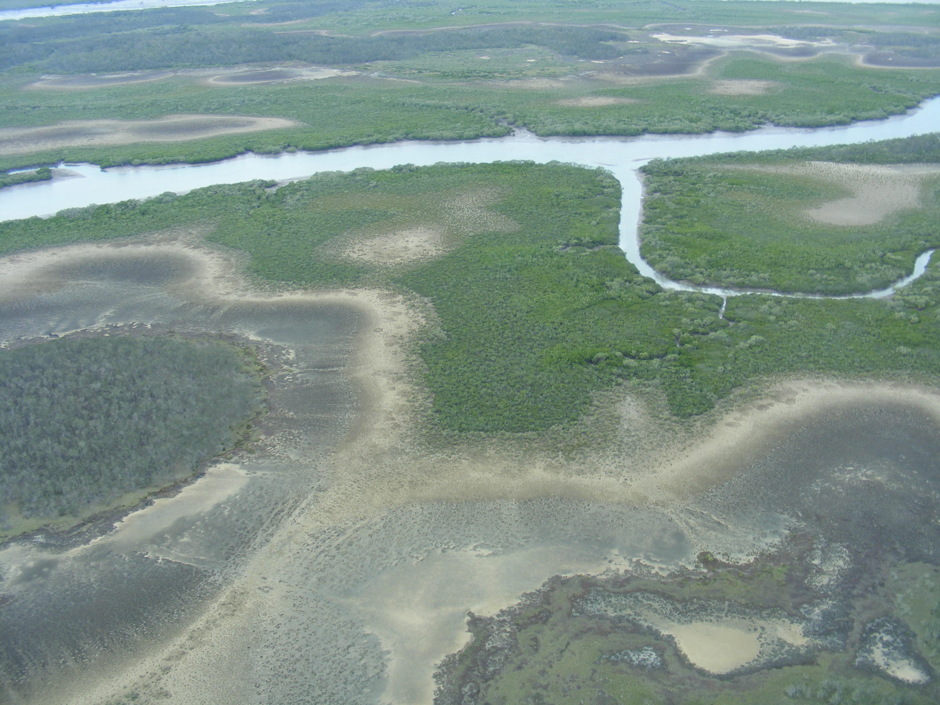
Mangroves undifferentiatedShort descriptionIntertidal vegetation dominated by mangroves. Disclaimer: Ecosystem type descriptions are based on biophysical attributes identified in Central Queensland through expert advice and supported by scientific literature. Not all ecosystem types are mapped based on current inventory, and many of the ecosystems described here may also occur in other parts of Queensland.
Classification categoriesSelect from the links below to view related ecosystem type categories Long descriptionIntertidal vegetation on Quaternary estuarine deposits but infrequently inundated and dominated by mangroves, such as Aegiceras corniculatum, Ceriops australis, Excoecaria agallocha, Bruguiera spp. or Lumnitzera racemose. Can also include sparse trees such as Casuarina glauca, Melaleuca spp. and Eucalyptus tereticornis. May also include sparse shrubs such as Myoporum acuminatum and sparse ground covers such as Sporobolus virginicus, Vincetoxicum carnosum, Fimbristylis ferruginea, Cyperus scariosus, Cyperus polystachyos, Gymnanthera oblonga, Acrostichum speciosum and Centella asiatica[6]. Special valuesCan provide some of the values associated with mangroves such as:
Diagnostic attributesInundation 'Intertidal – Lower low', 'Intertidal – Mid low', 'Intertidal – Upper low', 'Intertidal – Low undifferentiated', 'Intertidal – Lower medium', 'Intertidal – Upper-medium', 'Intertidal – Medium undifferentiated', 'Intertidal – High', 'Intertidal – Undifferentiated', 'Intertidal – High undifferentiated' although above mean sea level Structural macrobiota 'Mangroves' QualifiersNo qualifiers mapped however Period and Trend are relevant as mangrove extent can be influenced by sea level rise. DistributionWorldwide there are about 65 recognised species of mangrove plants. Of which, 34 species, with three hybrids are known to occur in Queensland[4]. In Queensland, mangroves grow in tropical and temperate areas and diversity generally increases towards the equator. For example, there are 31 species of mangrove plants recorded in the Daintree region, eight species in south-east Queensland, and two species in southern temperate Australia. The north-east coast of Australia was close to the centre of mangrove origin and dispersal. The climate is similar to that under which they first evolved, and the sheltered shallow waters of numerous estuaries are ideal for growth[5][3]. Environmental influences include Inundation, wave energy, soils (waterlogging, unstable and oxygen-deficient), drainage and nutrient levels. Some species are more suited to each of these conditions than others, which has led to the clear zonation in mangrove forests. The following relates to distribution of this ecosystem type within the Central Queensland mapping area:
CommentsOther relevant attributes include Consolidation, Energy and Sediment texture as mangroves typically occur on unconsolidated muds and fine sediments in low energy environments. Additional Information
References
Last updated: 22 July 2019 This page should be cited as: Department of Environment, Science and Innovation, Queensland (2019) Mangroves undifferentiated, WetlandInfo website, accessed 8 May 2025. Available at: https://wetlandinfo.des.qld.gov.au/wetlands/ecology/aquatic-ecosystems-natural/estuarine-marine/descriptions/5/ |
Site footer

 — Department of the Environment, Tourism, Science and Innovation