

|
|
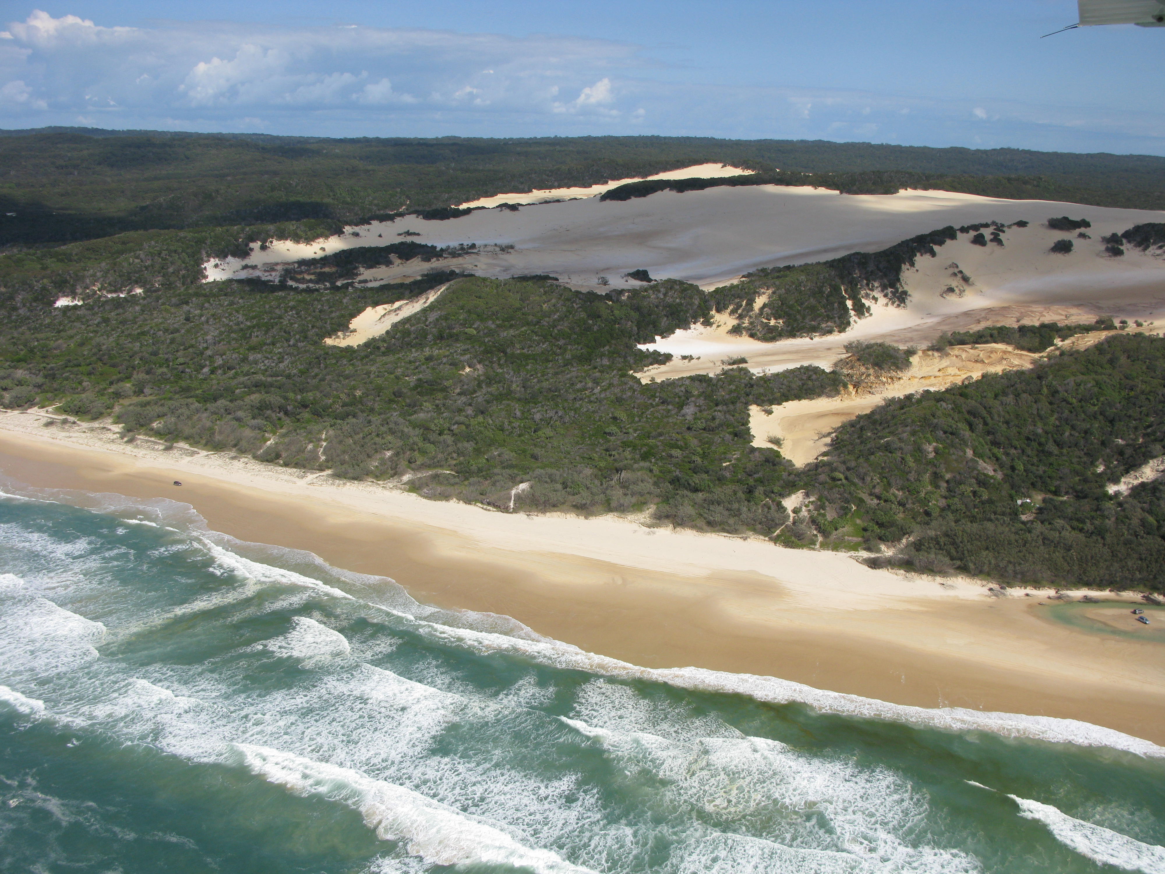
Subtidal high energy over sandShort descriptionSubtidal high energy sandy ecosystems including sandy channels and subtidal sandbanks, beach gutters, tidal sand shoals. Disclaimer: Ecosystem type descriptions are based on biophysical attributes identified in Central Queensland through expert advice and supported by scientific literature. Not all ecosystem types are mapped based on current inventory, and many of the ecosystems described here may also occur in other parts of Queensland.
Classification categoriesSelect from the links below to view related ecosystem type categories Long descriptionSubtidal very high to moderate energy sandy ecosystems including sandy channels and subtidal sandbanks, beach gutters, tidal sand shoals are highly variable systems which are subject to fluctuations of weather systems, wind and tides. Sands are transported by longshore drift along the entire east coast of southern Australia to Breaksea Spit, off K'gari (Fraser Island)[1]. Offshore of creek/river mouths, sandy beaches, moving dune fields (fossilised), longshore drift, more transport during cyclone or east coast low (reconfiguring the whole shoreline). These ecosystems may be periodically associated with submerged intermediate (coffee rock) reefs (see type 101) Special valuesSubtidal high energy sand systems are important for recreational fisheries, such as the east coast of Fraser Island where migrating fish including tailor and dart form an important recreational and tourist fishery[3]. Entrances of estuaries (such as the Wide Bay Bar) and creeks (such as Baffle Creek etc.) are important areas for fish passage and spawning[4]. Diagnostic attributes:Inundation ‘Subtidal’ Sediment texture ‘Sand’, ‘(slightly gravelly) Sand’, ‘gravelly muddy Sand’, ‘gravelly Sand’, ‘(slightly gravelly) muddy Sand’ Energy magnitude (wave) ‘Medium’, ‘High’, Very high’ QualifiersAlthough unmapped, Period and Trend qualifiers are relevant here as high wave energy can be amplified during storm events such as cyclones and east coast lows and during floods. Riverine energy during flood events can re-shape shorelines, especially at the mouth of estuaries (such as the Burnett, Kolan, Littabella and Baffle estuaries after the 2011, 12 and 13 floods). Entire river systems can be re-shaped and new entrances created. Away from river systems and in association with exposed sandy beaches, vast sand systems can be transported in a single storm event. Periodic sand movement can reveal subtidal coffee rock reefs (see type 101). DistributionWithin Queensland, high wave energy sandy beaches are generally found from Breaksea Spit north of Fraser Island southward to the New South Wales border. Areas of high current energy are found around the entrances of river systems and passages, such as the Wide Bay Bar. The following relates to distribution of this ecosystem type within the Central Queensland mapping area:
CommentsThis typology is restricted to wave energy. Application of the Energy source attribute in a typology combining both wave and current energy datasets to produce a dataset reflecting seabed stress would result in a mappable type if used to split unconsolidated types. Additional InformationReferences
Last updated: 12 July 2019 This page should be cited as: Department of Environment, Science and Innovation, Queensland (2019) Subtidal high energy over sand, WetlandInfo website, accessed 8 May 2025. Available at: https://wetlandinfo.des.qld.gov.au/wetlands/ecology/aquatic-ecosystems-natural/estuarine-marine/descriptions/104/ |
Site footer

 — Department of the Environment, Tourism, Science and Innovation