

|
|
Ross Catchment StoryThe catchment stories use real maps that can be interrogated, zoomed in and moved to explore the area in more detail. They take users through multiple maps, images and videos to provide engaging, in-depth information. Quick facts
Quick linksTranscriptRoss Catchment StoryThis catchment story is part of a series prepared for the catchments of Queensland. Table of Contents
Understanding how water flows in the catchmentTo effectively manage a catchment it is important to have a collective understanding of how the catchment works. This map journal gathers information from experts and other data sources to provide that understanding. The information was gathered using the walking the landscapeprocess, where experts systematically worked through a catchment in a facilitated workshop, to incorporate diverse knowledge on the landscape features and processes, both natural and human. It focused on water flow and the key factors that affect water movement. The map journal was prepared by the Queensland Wetlands Program in the Queensland Department of Environment and Science in collaboration with local partners. How to view this Map Journal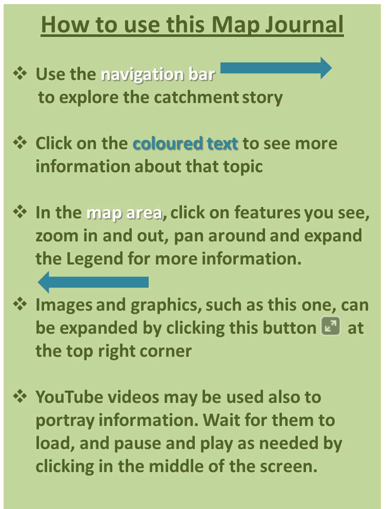
This map journal is best viewed in Chrome or Firefox, not Explorer. Main image. The lower Ross River near Kelso - provided by Tourism and Events Queensland. Map Journal for the Ross Catchment - water movementThis map journal describes the location, extent and values of the Ross catchment*. It demonstrates the key features which influence water flow, including geology, topography, rainfall and runoff, natural features, human modifications and land uses. Knowing how water moves in the landscape is fundamental to sustainably managing the catchment and the services it provides. Blacks Weir overtopping - provided by John Gunn. Main image. Mangrove-lined Sandfly Creek and the eastern slopes of Mount Elliot with metal refinery far right - provided by the Department of Agriculture and Fisheries *The use of the terms 'catchment', 'sub-catchment', 'basin' and 'sub-basin' are sometimes used interchangeably. In this map journal the term 'catchment' has been used. Ross Catchment StoryThe Ross catchment is located in north Queensland and is part of the North Queensland Dry Tropics NRM Region. The catchment falls within the Townsville City Council area. The catchment includes large rural; and urban residential areas and part of the City of Townsville. The catchment covers approximately 1,218 square kilometres (click for animation). The main waterway is the Ross River, together with many smaller waterways including Central, Six Mile, Landsdowne, Antill Plains, Sachs, Stuart, Alligator and Crocodile creeks. All waterways (click for animation) flow to the Great Barrier Reef (GBR), via Cleveland Bay. The GBR is World Heritage-listed and a marine park. The Ross catchment is adjacent to the Bohle, Black, Upper Burdekin and Haughton catchments. There are hydrological connections between these catchments through surface flow, stormwater and groundwater. There is a drop-down legend for most maps and it can be accessed by clicking on 'LEGEND' at the top right of the map. On this map you can use the drop down legend for the land use. There are also 'pop-ups' for most mapping features - simply click on the mapping of interest for more information. Main image. Looking across upper Stuart Creek to Alligator Creek and Cape Cleveland, from Mount Stuart - provided by John Gunn. Values of the catchment—key featuresKey features of the Ross catchment include:
*Aerial imagery sourced from QImagery. Main image. Aplins Weir and weir pool, looking downstream - provided by John Gunn. Values of the catchment—economicThe Ross catchment supports many different land uses*, including grazing on native pastures, residential and associated services, horticulture, industry and defence. There are small areas of mining and several Key Resource Areas.** Mango farming on the alluvium near the Ross River dam wall - provided by John Gunn. Horses of the Upper Ross River, with the Pinnacles in the background - provide by John Gunn. Urban residential lake development in the Idalia area - provided by John Gunn. Main image. Cattle grazing on native pastures in the Alligator Creek subcatchment - provided by John Gunn. *Australian Land Use Management Classification (Department of Agriculture and Water Resources 2010) - see links at the end of this map journal for further information. **Hard rock, gravel and sand extraction shown is within KRAs (Key Resource Areas) only. KRAs are identified locations containing important extractive resources of state or regional significance worthy of protection for future use. Some KRAs include existing extractive operations (see link at the end of map journal for more information). Values of the catchment—environmental and socialThe Ross catchment provides important habitat for many marine, estuarine, freshwater and terrestrial species. Estuarine crocodile shot on the lower Ross River in 1928 - provided by Jim Tait. The catchment includes several protected areas and a nature refuge. Protected areas also provide for recreational activities such as ;bush walking, bird watching, swimming, camping, boating and fishing. These activities not only provide substantial social and health benefits but they are also very important for tourism. Plumed whistling ducks on Stuart Creek - provided by John Gunn. The wetlands and creeks of the catchment provide habitat for many important aquatic species, including plants, fish and birds. Estuarine areas also support important plants (mangrove, saltmarsh and seagrass), estuarine crocodiles, marine turtles, marine mammals and fisheries species. Information about the different types of wetlands shown in this mapping is providedhere. The catchment includes part of the Ramsar-listed Bowling Green Bay, several DIWA-listed wetlands (Directory of Important Wetlands in Australia), declared Fish Habitat Areas* and Dugong Protection Areas. Many of the species in the catchment have lifecycles with connections to the GBR, which is World Heritage-listed and a marine park. Crocodile Creek mangrove, saltmarsh and clay pan communities, part of the Ramsar-listed Bowling Green Bay - provided by Department of Agriculture and Fisheries; Queensland Government. Main image. Water skiing on the lower Ross River - provided by Tourism and Events Queensland/Budd Photography. *Declared Fish Habitat Area Plans (Queensland Government 2016) - see links at the end of this map journal for further information. Natural features—geology and topographySeveral different rock types combine to make up the geology of the Ross catchment. This map journal refers to mafite and felsite geologies, collectively given these rock types have a similar influence of hydrology. Conceptual models for several of the catchment's geology types are provided below. Main image. Looking across the Upper Ross River alluvial flat that extends into the Bohle River, from the Ross River Dam wall - provided by John Gunn. Natural features—rainfallThe Ross catchment receives high to very high rainfall, with 80 per cent during the wet season. Average annual rainfall* of mostly 701 to 1,001 millimetres per year with up to 3,201 millimetres per year over higher elevations of Mount Elliot. Mean monthly rainfall for years 1940 to 2018** Total annual rainfall from 1940 to 2017** Water being released from the Ross River Dam spillway - provided by John Gunn. *This dataset depicts the 50-year mean annual rainfall isoheyts (contours) over Queensland for the period 1920 to 1969. The dataset was produced from the mean annual rainfall of as many locations as possible including private collections. Incomplete datasets were `made whole` by calculating values for missing periods through correlation with adjacent rainfall stations. **Bureau of Meterology (2018) - see links at the end of this map journal. Natural features—vegetationVegetation affects how water flows through the catchment, and this process is affected by land use and management practices. Vegetation slows water, retaining it longer in the landscape and recharging groundwater aquifers, and reducing the erosion potential and the loss of soil from the catchment. Grass-lined swale with melaleuca trees, Oonoonba - provided by John Gunn. Several different vegetation types combine to make up the original native (preclearing) vegetation of the Ross catchment.* Much of the catchment has been cleared or partially-cleared for a range of rural and urban land uses. Some of the cleared vegetation has regrown** since initial clearing. Explore the swipe map showing preclearing vegetation on the right and remnant vegetation (including regrowth) on the left, using either of the options below.***
These developments and activities change the shape of the landscape and can modify water flow patterns. Cats claw creeper (weed) growing on riparian vegetation of Stuart Creek, showing tress that have been pulled into the creek by the weed - provided by John Gunn. Main image. Eucalypt woodland on the slopes of the Upper Ross River subcatchment,looking towards the Hervey Range - provided by John Gunn. **Smaller areas of regrowth are not shown in this mapping. This dataset was prepared to support certain category C additions to the Regulated Vegetation Management Map under the Vegetation Management (Reinstatement) and Other Legislation Amendment Bill 2016. This dataset is described as: The 2013 areas of non-remnant native woody vegetation that have not been cleared between 1988 and 2014 that are homogenous for at least 0.5 hectare and occur in clumps of at least 2 hectares in coastal regions and 5 hectares elsewhere. ***This application takes time to load. Modified features—infrastructure, dams, weirs and boresBuildings and important infrastructure such as roads, railways and creek crossings create barriers and impermeable surfaces that redirect water through single points or culverts, leading to channeling of water. This increases the rate of flow and the potential for erosion. Modifications to channels, such as straightening and diversions, can also increase flow rates.* Dams and weirs also modify natural water flow patterns, by holding water that would otherwise flow straight into the stream network. The catchment has many rural water storages (farm dams), the relatively large Ross River Dam impounding Lake Ross, the major weirs of Black School (Blacks), Gleeson and Alpins (tidal interface) and several constructed lakes in the Idalia area. Causeway on constructed lakes in the Idalia area - provided by John Gunn. Ross River Dam is a shallow leaky dam that sits on alluvium over the Hervey Range plateau; it was designed for flood mitigation and can receive water from the Burdekin Falls Dam (inter-basin transfer). Historically Ross Creek was connected to the Ross River with Ross Island to the east, however this was disconnected by the placement of a landfill in the 1970s. This infrastructure can also affect fish passage. The Ross River Dam has an eel-way. There are also many bores**, which extract water for livestock and domestic uses and can influence groundwater. The road along the Ross River Dam wall - provided by John Gunn. The Ross River Dam spillway - provided by John Gunn. Water releasing through the Ross River Dam spillway - provided by John Gunn. Main image. Highway over Stuart Creek - provided by John Gunn. *Townsville City Council provides access to asset infrastructure, contours, planning scheme zoning, overlay maps including storm tide, etc. - see links at the end of this map journal for further information. **Taken from database storing registered water bore data from private water bores and Queensland Government groundwater investigation and monitoring bores. Modified features—sedimentIncreases in the volume and speed of runoff, and disturbed vegetation through activities such as construction or grazing, can increase erosion in the landscape and the stream channels. This can result in sediment being carried downstream and reduced water quality. The construction stage of a development typically generates more sediment in runoff than more mature stages of a development. Freshwater wetland with melaleuca, Cape Cleveland - provided by Townsville City Council. The suspended sediment of most risk to the GBR is the fine fraction. This is the component that contains most of the nitrogen and phosphorus content (and other potential contaminants such as metals), travels widely in flood plumes rather than all depositing near the river mouth, and is very effective at reducing light when in suspension. Furthermore, the impacts of suspended sediment contributes to the cumulative impacts of other stressors (e.g. fresh-water flood plumes, elevated nutrients, impacts from cyclones, increasing sea surface temperatures) to increase the overall impact on organisms of the GBR. Main image. Sediment plume in Cleveland Bay - provided by John Gunn. Water QualityWater quality is influenced by diffuse runoff and point source inputs. Runoff is from a variety of land uses, including rural, residential, industrial and commercial areas. Urban residential development on constructed lakes in the Idalia area - provided by John Gunn. Diffuse runoff includes on-site sewage facilities (e.g. septic tanks) and stormwater discharges, particularly from low permeability surfaces common in urban areas. The concentration of potential contaminants in the stormwater discharge depends on the land use of the area. Many rural areas and more densely populated rural-residential areas use on-site sewage facilities. Point source inputs include sewage treatment plants (STPs). Information regarding monitoring sites (gauging stations*) and catchment load monitoring** can be found in the reference section at the end of this map journal. Main image. Coastal waters showing the Cleveland Bay Water Purification Plant (Sewage Treatment Plant) (left) and Stuart Creek (right) - provided by John Gunn. *Water Monitoring Information Portal (Queensland Government 2017)see links at the end of this map journal for further information. **Great Barrier Reef Catchment Loads Modelling Program (Queensland Government, 2017); Reef 2050 Water Quality Improvement Plan 2017-2022. Queensland Government (2018); Reef 2050 Water Quality Improvement Plan - Report cards (Queensland Government 2017)see links at the end of this map journal for further information. Water flowWater flows across the landscape into the Ross River and other waterways (click for animation)*. The remaining water either sinks into the ground where it supports a variety of terrestrial and groundwater dependent ecosystems or is used for other purposes. The smaller channels and gullies eventually flatten out to form larger waterways that flow through lower lying land. They pass through unconsolidated areas which store and release water, prolonging the time streams flow. Stuart Creek after rainfall - provided by Conservation Volunteers Australia. The Gleeson Weir overtopping provided by John Gunn.Main image. Water released through the Ross River Dam spillway - provided by John Gunn. *Please note this application takes time to load. *Please note this application takes time to load. The main areasA 'catchment' is an area with a natural boundary (for example ridges, hills or mountains) where all surface water drains to a common channel to form rivers or creeks.* The Ross catchment is listed as a single catchment but consists of several distinct areas that have similar characteristics:
Main image. Mount Stuart - provided by John Gunn. *Definition sourced from the City of Gold Coast website - see links at the end of this map journal. Upper Ross River
Looking along the Ross River Dam wall towards the Hervey Range - provided by John Gunn. Signage at the Ross River Dam - provided by John Gunn. Main image. Looking across Lake Ross from the dam wall - provided by John Gunn. Toonpan Lagoon
Six Mile Creek
Antill Plains Creek
Main image. Looking across Antill Plains towards Mount Elliot, from Mount Stuart - provided by John Gunn. *This map journals refers to mafite and felsite geologies collectively given these rock types have a similar influence of hydrology. Sachs Creek
Main image. Looking towards Oaky Valley, Sachs Creek and Lake Ross from Mount Stuart - provided by John Gunn. *This map journals refers to mafite and felsite geologies collectively given these rock types have a similar influence of hydrology. Mount Stuart
Flow in Hell Hole Creek - provided by NQ Dry Tropics. Main image. Small tributary in the Mount Stuart subcatchment - provided by John Gunn *This map journals refers to mafite and felsite geologies collectively given these rock types have a similar influence of hydrology. Lower Ross River
The Riverway development on the lower Ross River - provided by Tourism and Events Queensland/Budd Photography. The mouth of the Ross River showing the urban centre (left), Stuart Creek (right) and Magnetic Island in the background - provided by John Gunn. Main image. Lake development at Edgewater Court, Idalia - provided by John Gunn. *This map journals refers to mafite and felsites geologies collectively given these rock types have a similar influence of hydrology. Stuart Creek including Sandfly Creek
Recreational use of Stuart Creek, upstream of the highway - provided by NQ Dry Tropics. Railway crossing and small pool on Stuart Creek - provided by John Gunn. Grazing land in the Stuart Creek catchment - provided by John Gunn. Main image. Stuart Creek following rain - provided by Conservation Volunteers Australia. *This map journals refers to mafite and felsite geologies collectively given these rock types have a similar influence of hydrology. Alligator Creek
The track to Alligator Creek Falls - provided by Tourism and Events Queensland/Budd Photography. Alligator Creek with metal refinery in the background (right) - provided by Department of Agriculture and Fisheries ©Queensland Government. Main image. Upper Alligator Creek - provided by Tourism and Events Queensland. *This map journals refers to mafite and felsite geologies collectively given these rock types have a similar influence of hydrology. Crocodle Creek
Main image. Crocodile Creek with Mount Elliot in the background - provided by John Gunn. *This map journals refers to mafite and felsite geologies collectively given these rock types have a similar influence of hydrology. Cocoa Creek
Main image. Lower Crocodile Creek (front), Cocoa Creek (mid) and Cape Cleveland (back) - provided by John Gunn. Cape Clevland
Freshwater wetland, Cape Cleveland area - provided by Townsville City Council. Main image. Brolgas on wetlands in the Cape Cleveland area - provided by Townsville City Council. *This map journals refers to mafite and felsite geologies collectively given these rock types have a similar influence of hydrology. ConclusionThe Ross catchment shows how natural and modified features within the landscape impact on how water flows. These issues need to be managed to ensure that the significant natural (and social) values of the catchment are protected, and to minimise impacts on the multitude of values within the catchment and downstream in the GBR, while providing for residential, water supply, farming and other important land uses of the catchment. Knowing how the catchment functions is also important for future planning, including climate resilience. With this knowledge, we can make better decisions about how we manage this vital area. Main image. Mount Stuart, Lavarack Barracks and suburban Townsville with Mount Elliot in the background - provided by John Gunn. AcknowledgementsDeveloped by the Queensland Wetlands Programin the Department of Environment and Sciencein partnership with the Dry Tropics Partnership for Healthy Watersand other local partners: Conservation Volunteers Australia C & R Consulting Coastal Dry Tropics Landcare Incorporated Department of Defence Earth Environmental Energy Queensland Department of Natural Resources, Mines and Energy Great Barrier Reef Marine Park Authority James Cook University Landcare Office of the Great Barrier Reef Queensland Parks and Wildlife Service This resource should be cited as: Walking the Landscape – Ross Catchment Map Journal v1.0 (2018), presentation, Department of Environment and Science, Queensland. Images provided by Budd Photography, Conservation Volunteers Australia, Department of Fisheries and Agriculture, John Gunn, NQ Dry Tropics, Jim Tait, Tourism and Events Queensland and Townsville Regional Council. The Queensland Wetlands Program supports projects and activities that result in long-term benefits to the sustainable management, wise use and protection of wetlands in Queensland. The tools developed by the Program help wetlands landholders, managers and decision makers in government and industry. Contact wetlands♲des.qld.gov.au or visit wetlandinfo.des.qld.gov.au DisclaimerThis map journal has been prepared with all due diligence and care, based on the best available information at the time of publication. The department holds no responsibility for any errors or omissions within the document. Any decisions made by other parties based on this document are solely the responsibility of those parties. Information contained in this education module is from a number of sources and, as such, does not necessarily represent government or departmental policy. Data sources, links and informationSoftware UsedArcGIS for Desktop | ArcGIS Online | Story Map Journal Some of the information used to put together this Map Journal can be viewed on the QLD Globe. The Queensland Globe is an interactive online tool that can be opened inside the Google Earth™ application. Queensland Globe allows you to view and explore Queensland spatial data and imagery. You can also download a cadastral SmartMap or purchase and download a current titles search. More information about the layers used can be found here: Flooding Information Townsville City Council Other References Bureau of Meterology (2018)Climate Data Online[webpage] Accessed 27 September 2018 City of Gold Coast (2021) About water catchments. [webpage] Accessed 25 August 2021 23 August 2018Queensland Government (2016) Declared Fish Habitat Area Plans [webpage] Accessed 23 August 2018 Queensland Government (2017) Key Resource Areas in Queensland [webpage] Accessed 23 August 2018 Queensland Government (2018) Water Quality Information Portal [webpage] Accessed 23 August 2018 Townsville City Council (2018) Townsville MAPS Premium [webpage] Accessed 17 September 2018 Last updated: 25 August 2021 This page should be cited as: Department of Environment, Science and Innovation, Queensland (2021) Ross Catchment Story, WetlandInfo website, accessed 8 May 2025. Available at: https://wetlandinfo.des.qld.gov.au/wetlands/ecology/processes-systems/water/catchment-stories/transcript-ross.html |
Site footer

 — Department of the Environment, Tourism, Science and Innovation