

|
|
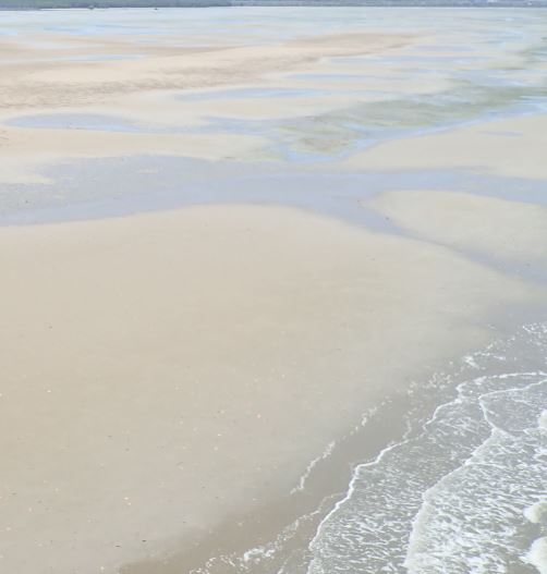
Intertidal unknown energy over sandShort descriptionIntertidal sand-dominated substrate where energy is unknown. Disclaimer: Ecosystem type descriptions are based on biophysical attributes identified in Central Queensland through expert advice and supported by scientific literature. Not all ecosystem types are mapped based on current inventory, and many of the ecosystems described here may also occur in other parts of Queensland.
Classification categoriesSelect from the links below to view related ecosystem type categories Long descriptionIntertidal sand-dominated substrate where energy is unknown, including low energy beaches, banks, flats, plains and high energy beaches, banks, shoals and moving dune fields (fossilised). May have similar values to low (type 31) and high (type 30) energy sand ecosystems depending on energy. High energy beaches are generally highly variable systems which are subject to fluctuations of weather systems, wind and tides. Wave action can move vast amounts of sand, particularly if there is a cyclone or low, which can reconfigure long sections of coastline. Subject to longshore drift. Mobile fauna include ghost crabs, beach worms, pippis (eugaris or wongs) and other burrowing bivalves, gastropods, scavenging fauna associated with flotsam (e.g. driftwood, macroalgae, amphipods). Turtle nesting, shorebird, seabird and raptor feeding, dingoes and other scavenging fauna (crabs, gulls). Low energy sandy ecosystems include intertidal low to very low energy over sand, including beaches, banks, flats and plains subject to little or no wave action (i.e. the wave climate generally consists of 0.5 – 0.8m swells). The majority of low energy sandy beaches are influenced by a combination of tidal and wave energy. Special valuesCritical to turtle nesting and shorebird feeding[2]. Marine turtles and many shorebirds are Environment Protection and Biodiversity Conservation Act 1999-listed species (EPBC). These ecosystems are highly valued for recreation fishing and 4WD-ing which may compete with habitats for nesting and roosting shorebirds and seabirds[1]. Entrances of estuaries and creeks are important areas for fish passage and spawning[4]. Groundwater influence in some places seeping out of the large sand masses. These areas are likely to contain unmapped areas of seagrass which are potential habitat for dugong and green turtles. Diagnostic attributesInundation 'Intertidal – Lower low', 'Intertidal – Mid low', 'Intertidal – Upper low', 'Intertidal – Low undifferentiated', 'Intertidal – Lower medium', 'Intertidal – Upper-medium', 'Intertidal – Medium undifferentiated', 'Intertidal – High', 'Intertidal – Undifferentiated', 'Intertidal – High undifferentiated' Sediment texture 'Sand (slightly gravelly)', 'Sand', 'Gravelly muddy sand', 'gravelly sand', '(slightly gravelly) muddy sand' Energy magnitude 'Unknown' QualifiersAlthough unmapped, Period and Trend qualifiers are relevant here as high wave energy can be amplified during storm events such as cyclones and east coast lows and during floods. Riverine energy during flood events can re-shape shorelines, especially at the mouth of estuaries. Entire river systems can be re-shaped and new entrances created. Away from river systems and in association with exposed sandy beaches, vast sand systems can be transported in a single storm event. The Naturalness qualifier is relevant on sandy beaches that have been armoured in an attempt to prevent property loss e.g. buildings. Refer to types (30 and 31). For thousands of years, Traditional Owners caught and ate large numbers of shellfish species in and around the Queensland coast. Often they would cook the meat and use the shells for a number of purposes, or dispose of shells in large dump sites called shell middens. Shell middens have provided important information and clues about Traditional Owners and the environment they lived in. The middens tell the story of the Traditional Owners’ diet, food sources and species available and the impact of environmental changes on biodiversity and marine ecosystems[3]. Some of these ecosystems may be adjacent to boulder breakwaters constructed to lessen wave energy, or armoured shorelines. DistributionLarge areas up and down the exposed Queensland coast. The northern-most limit of high energy shorelines along the Queensland coast are K'gari and Double Island Point. K'gari and the Great Barrier Reef form a barrier to wave energy. The following relates to distribution of this ecosystem type within the Central Queensland mapping area:
CommentsRefer to types (30 and 31) for relevant attributes. Additional InformationUnderstanding coastal erosion on beaches References
Last updated: 16 July 2019 This page should be cited as: Department of Environment, Science and Innovation, Queensland (2019) Intertidal unknown energy over sand, WetlandInfo website, accessed 25 June 2024. Available at: https://wetlandinfo.des.qld.gov.au/wetlands/ecology/aquatic-ecosystems-natural/estuarine-marine/descriptions/36/ |
Site footer

 — Department of Environment, Science and Innovation