

|
|
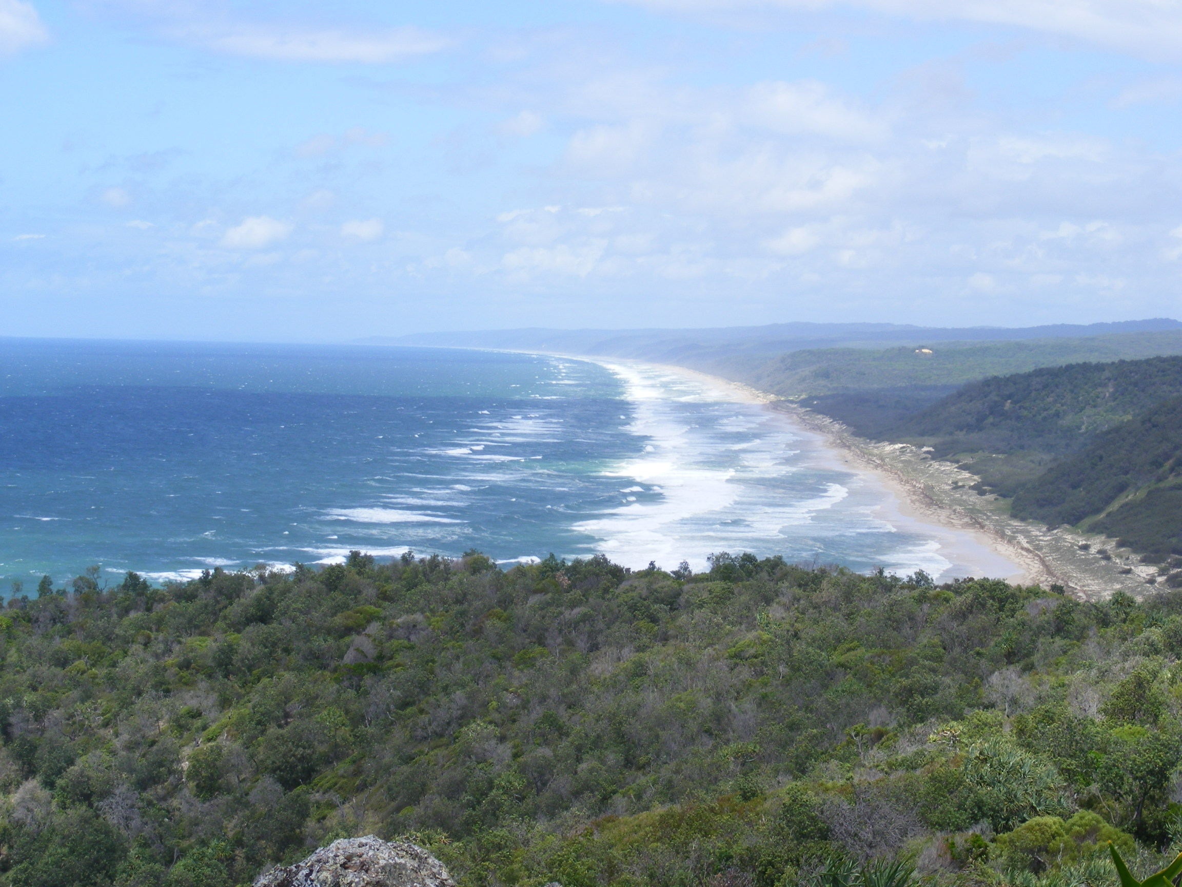
Intertidal high energy over sandShort descriptionIntertidal high energy over sand, including beaches, banks and shoals. Disclaimer: Ecosystem type descriptions are based on biophysical attributes identified in Central Queensland through expert advice and supported by scientific literature. Not all ecosystem types are mapped based on current inventory, and many of the ecosystems described here may also occur in other parts of Queensland.
Classification categoriesSelect from the links below to view related ecosystem type categories Long descriptionIntertidal very high to moderate wave energy over sand, including beaches, banks, shoals and moving dune fields (fossilised), becoming potentially highly mobile during storm events (e.g. cyclones, east coast lows). Highly variable systems which are subject to fluctuations of weather systems, wind and tides. Wave action can move vast amounts of sand, particularly if there is a cyclone or low, which can reconfigure long sections of coastline. Subject to longshore drift, which is a process where waves wash sand onto a beach and out again, zigzagging the sand movement parallel to the coastline. Mobile fauna include ghost crabs, beach worms, pippis (eugaris or wongs) and other burrowing bivalves and gastropods, and scavenging fauna associated with flotsam, such as amphipods associated with driftwood and macroalgae. Turtle nesting, shorebird, seabird and raptor feeding, dingoes and other scavenging fauna (crabs, gulls). May include Intertidal very high to medium wave energy over coffee rock on a sandy beach, which is exposed and buried by sand deposition associated with wave action (e.g. storm events, cyclones, longshore drift). Special valuesCritical to turtle nesting. Marine turtles and many shorebirds are Environment Protection and Biodiversity Conservation Act 1999-listed species (EPBC). These ecosystems are highly valued for recreation such as swimming, fishing and 4WD-ing which may compete with habitats for nesting and roosting shorebirds and seabirds[1]. The Surf Life Saving Association's Australian Beach Safety and Management Program has sponsored a set of guidelines to the beaches of the Australian coastline. Beaches of the Queensland coast: Cooktown to Coolangatta[3] is a detailed analysis of the beach systems of Queensland. Refer to this document for physical attributes, processes. Diagnostic attributesInundation 'Intertidal – Lower low', 'Intertidal – Mid low', 'Intertidal – Upper low', 'Intertidal – Low undifferentiated', 'Intertidal – Lower medium', 'Intertidal – Upper-medium', 'Intertidal – Medium undifferentiated', 'Intertidal – High', 'Intertidal – Undifferentiated', 'Intertidal – High undifferentiated' Sediment texture 'Sand (slightly gravelly)', 'Sand', 'Gravelly muddy sand, gravelly sand', '((slightly gravelly) muddy sand)' Energy magnitude (wave) 'Medium', 'High', 'Very high' QualifiersPeriod and Trend qualifiers are relevant here as high wave energy can be amplified during storm events such as cyclones and east coast lows and during floods. Intertidal high wave energy over coffee rock on a sandy beach ecosystem type may be a co-type of this ecosystem type in large sand systems, where they are periodically uncovered and covered by highly mobile sand. Riverine energy during flood events can re-shape shorelines, especially at the mouth of estuaries (such as the Burnett, Kolan, Littabella and Baffle estuaries after the 2011, 2012 and 2013 floods). Entire river systems can be re-shaped and new entrances created. Away from river systems and in association with exposed sandy beaches, vast sand systems can be transported in a single storm event. The Naturalness qualifier is relevant as some shorelines may have been armoured in an attempt to prevent property losses due to beach erosion, and groynes or rock walls have been built to maintain boat passage through riverine entrances. DistributionLarge areas up and down the exposed Queensland coast predominantly south-east Queensland. The northern-most limit of high energy shorelines along the Queensland coast are K'gari and Double Island Point. K'gari and the Great Barrier Reef form a barrier to wave energy[3]. Sand has been transported by longshore drift from as far away as Victoria, forming a series of large sand islands along the Queensland coastline until it reaches Breaksea Spit, north of K'gari (Frasier Island) where the waters discharging from Hervey Bay spill the sands over the continental shelf into the abyss[2]. The following relates to distribution of this ecosystem type within the Central Queensland mapping area:
CommentsThis typology is restricted to wave energy. Application of the Energy source attribute in a typology combining both wave and current energy datasets to produce a dataset reflecting seabed stress would result in a mappable type if used to split unconsolidated types. Factors influencing beaches include Sediment texture, wave energy and Tidal range[3]. Changes in Terrain slope and Morphology are relevant to different parts of the beach system and changes in wave energy contribute to dune formation. Additional InformationCoastal sand masses (beach ridges) - WetlandInfo Understanding coastal erosion on beaches
References
Last updated: 18 July 2019 This page should be cited as: Department of Environment, Science and Innovation, Queensland (2019) Intertidal high energy over sand, WetlandInfo website, accessed 8 May 2025. Available at: https://wetlandinfo.des.qld.gov.au/wetlands/ecology/aquatic-ecosystems-natural/estuarine-marine/descriptions/30/ |
Site footer

 — Department of the Environment, Tourism, Science and Innovation