

|
|
Intertidal low energy over bouldersShort descriptionIntertidal low energy over boulders of any substrate composition. Disclaimer: Ecosystem type descriptions are based on biophysical attributes identified in Central Queensland through expert advice and supported by scientific literature. Not all ecosystem types are mapped based on current inventory, and many of the ecosystems described here may also occur in other parts of Queensland.
Classification categoriesSelect from the links below to view related ecosystem type categories Long description
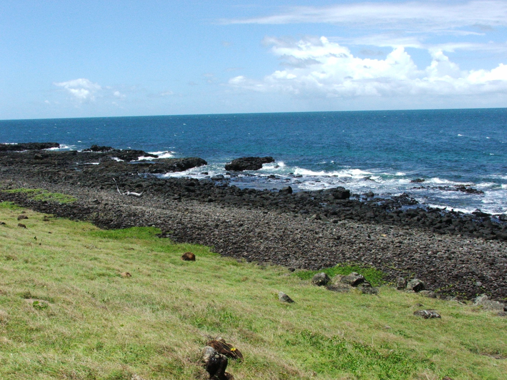
Intertidal low to very low energy boulder ecosystems can be of any Substrate composition, either terrigenous (i.e. fragmented rock or coffee rock) or carbonate origin (e.g. larger coral rubble). Boulders are defined as exceeding 25.6cm in diameter. They can be either adjacent to consolidated intertidal or subtidal ecosystems, or exist in isolated patches. Many boulder ecosystems are yet to be surveyed for biota. Typically these shores exhibit a narrow zonation with more diverse communities than the high energy boulders, such as oysters and barnacles and some areas where corals and other fauna may be present. Boulders are likely to have different biota according to their Substrate composition and Lithology, and within the context of surrounding ecosystems. The cracks between the boulders and spaces below are also important habitat for the attachment of biota, and these and other structurally complex areas act as refuges for fish to protect them from predators. Depending on conditions for biota settlement, boulders may have coral growth in which case they are mapped as intertidal coral[2][3]. Also includes rocky creek banks and intertidal rock bars. Shorebird feeding habitat for resident species such as the beach stone curlew and sooty oyster catchers[1]. Boulders result from a wide variety of erosion processes on land and in the sea, and many factors influence how they break down from parent rock or pavement etc. For example, intertidal boulders may occur within estuaries and rivers where riverine flow has eroded down geological formations. More friable substrates such as coffee rock may break off steep-sided cliffs to fall into intertidal areas. The Substrate composition and its Lithology will determine the size and shape of the boulders, influencing how they break away from parent material and the structural complexity of the terrain (i.e. the Terrain roughness). Factors such as the density and orientation of jointing and bedding planes or fault lines influence how the rock breaks up[4]. Special valuesMore microhabitats and possibly fauna diversity than on consolidated substrates, due to the presence crevices, pools, variations in energy. This ecosystem type could potentially include Traditional Owner fish traps (see Type 24). Diagnostic attributesInundation 'Intertidal – Lower low', 'Intertidal – Mid low', 'Intertidal – Upper low', 'Intertidal – Low undifferentiated', 'Intertidal – Lower medium', 'Intertidal – Upper-medium', 'Intertidal – Medium undifferentiated', 'Intertidal – High', 'Intertidal – Undifferentiated', 'Intertidal – High undifferentiated' Energy magnitude (wave) 'Low', 'Very low' Sediment texture 'Boulders' QualifiersCan also include modified ecosystem types such as intertidal parts of boulder rock walls, groynes and port infrastructure. The biota growing on these ecosystems may be different from that growing on natural rocky or coffee rock ecosystems. The rock walls themselves can substantially modify tidal currents and Sediment texture. The attributes of Consolidation, Substrate grain size and Inundation may be modified by fish traps. DistributionK'gari (Fraser Island) and the Great Barrier Reef form a barrier to wave energy at a regional to national scale[3]. The northern-most limits of high energy rocky shorelines along the Queensland coast are K'gari and Double Island Point. K'gari and Double Island Point also mark a delineation in terms of subtropical and temperate species compositions of molluscs and barnacles[3][2]. From Point Vernon northward the biota has tropical affinities, although low energy boulder shorelines also occur within Moreton Bay[3][2]. Many boulder ecosystems are yet to be surveyed for biota. The following relates to distribution of this ecosystem type within the Central Queensland mapping area:
CommentsRelevant additional attributes include Substrate composition, Energy source and magnitude and Lithology. Additional InformationRocky shore - Queensland Government Intertidal rocky shores - Queensland Museum Intertidal rocky shores - Museum of Tropical Queensland References
Last updated: 18 July 2019 This page should be cited as: Department of Environment, Science and Innovation, Queensland (2019) Intertidal low energy over boulders , WetlandInfo website, accessed 8 May 2025. Available at: https://wetlandinfo.des.qld.gov.au/wetlands/ecology/aquatic-ecosystems-natural/estuarine-marine/descriptions/35/ |
Site footer

 — Department of the Environment, Tourism, Science and Innovation