

|
|
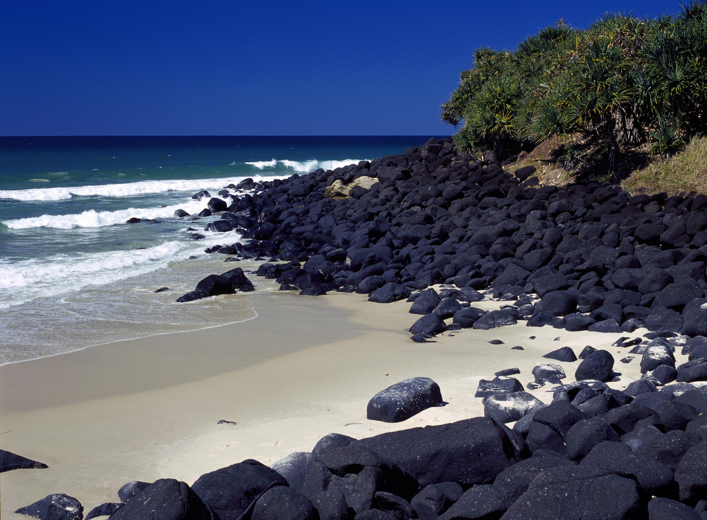
Intertidal high energy over bouldersShort descriptionIntertidal high energy over boulders of terrigenous origin. Disclaimer: Ecosystem type descriptions are based on biophysical attributes identified in Central Queensland through expert advice and supported by scientific literature. Not all ecosystem types are mapped based on current inventory, and many of the ecosystems described here may also occur in other parts of Queensland.
Classification categoriesSelect from the links below to view related ecosystem type categories Long descriptionIntertidal very high to medium energy over boulders with geology of mineral rock or chemical origin (terrigenous). Boulders are defined as exceeding 25.6cm in diameter, of any Substrate composition, and can include terrigenous origin (i.e. fragmented rock or coffee rock) or carbonate origin (e.g. larger coral rubble). They can be either adjacent to consolidated intertidal or subtidal ecosystems, or exist in isolated patches. Very high and high oceanic wave energy on these shorelines creates a splash zone above the usual tidal limits with a characteristic biota of barnacles and periwinkles. Tidal inundation also creates strong faunal zonation from highest to lowest tidal extremes - periwinkle, barnacles, tubeworms and finally ascidians and/or macroalgae. There is also energy-based zonation along the shore with a typically windward environment (high energy with south-easterly aspect) and typically leeward environment (lower energy with northerly aspect), with different species composition in each area (i.e. microhabitats). Boulders result from a wide variety of erosion processes on land and in the sea, and many factors influence how they break down from parent rock or pavement etc. For example, boulders may occur beneath high wave energy ecosystems, where platforms have been subject to wave action and broken down into fragments on the sea floor. On coral platforms, boulders may be thrown across the reef by cyclone action. Intertidal boulders may also occur within estuaries and rivers where riverine flow has eroded down geological formations. More friable substrates such as coffee rock may break off steep-sided cliffs to fall into intertidal areas[6]. The Substrate composition and its Lithology will determine the size and shape of the boulders, influencing how they break away from parent material and the structural complexity of the Terrain, i.e. the Terrain roughness. There is no typical biota occurring on intertidal boulders, although as for consolidated ecosystem types, boulders are likely to have different biota according to their Substrate composition and Lithology, and within the context of surrounding ecosystems. The cracks between the boulders and spaces below are also important habitat for the attachment of biota, providing moist refuges for molluscs, crustaceans, ascidians, anemones and echinoderms[1]. These and other structurally complex areas act as refuges for fish, to protect them from predators, and fulfil a nursery role[2]. Special valuesMore variation in microhabitats than on consolidated substrates, notably variation in attributes of Terrain roughness, slope and morphology and associated hydrodynamic changes in Energy source (i.e. waves) and magnitude. Higher faunal diversity is likely to be associated with these crevices and pools of variable energy. Eddies forming in the lee of headlands (where high energy boulders are likely to occur) tend to concentrate larval settlement, resulting in higher benthic diversities in the lee of topographic features[4]. Tidal pools form above the water mark and provide submerged habitat for typically subtidal species[1]. Diagnostic attributesInundation 'Intertidal – Lower low', 'Intertidal – Mid low', 'Intertidal – Upper low', 'Intertidal – Low undifferentiated', 'Intertidal – Lower medium', 'Intertidal – Upper-medium', 'Intertidal – Medium undifferentiated', 'Intertidal – High', 'Intertidal – Undifferentiated', 'Intertidal – High undifferentiated' Energy magnitude (wave) 'Very high', 'High', 'Medium' Energy magnitude 'Unknown' Sediment texture 'Boulders' QualifiersPeriod and Trend qualifiers are likely to change slowly in boulder ecosystems, however high wave energy impacts during extreme events may move boulders. The Naturalness qualifier is relevant to boulder breakwaters constructed to lessen wave energy for example around river entrances etc. DistributionK'gari (Fraser Island) and the Great Barrier Reef form a barrier to wave energy at a regional to national scale[5]. The northern-most limits of high energy rocky shorelines along the Queensland coast are K'gari and Double Island Point. K'gari and Double Island Point also mark a delineation in terms of subtropical and temperate species compositions of molluscs and barnacles[5][3]. Many boulder ecosystems are yet to be surveyed for biota. The following relates to distribution of this ecosystem type within the Central Queensland mapping area:
CommentsRelevant additional attributes include Substrate composition, Energy source and Energy magnitude, Lithology. Additional InformationRocky shore - Queensland Government Intertidal rocky shores - Queensland Museum Intertidal rocky shores - Museum of Tropical Queensland Indigenous Fish Traps and Weirs of Queensland - Rowland and Ulm 2011 References
Last updated: 12 July 2019 This page should be cited as: Department of Environment, Science and Innovation, Queensland (2019) Intertidal high energy over boulders , WetlandInfo website, accessed 25 June 2024. Available at: https://wetlandinfo.des.qld.gov.au/wetlands/ecology/aquatic-ecosystems-natural/estuarine-marine/descriptions/34/ |
Site footer

 — Department of Environment, Science and Innovation