|
|
Classification categories
Select from the links below to view related ecosystem type categories
Long description
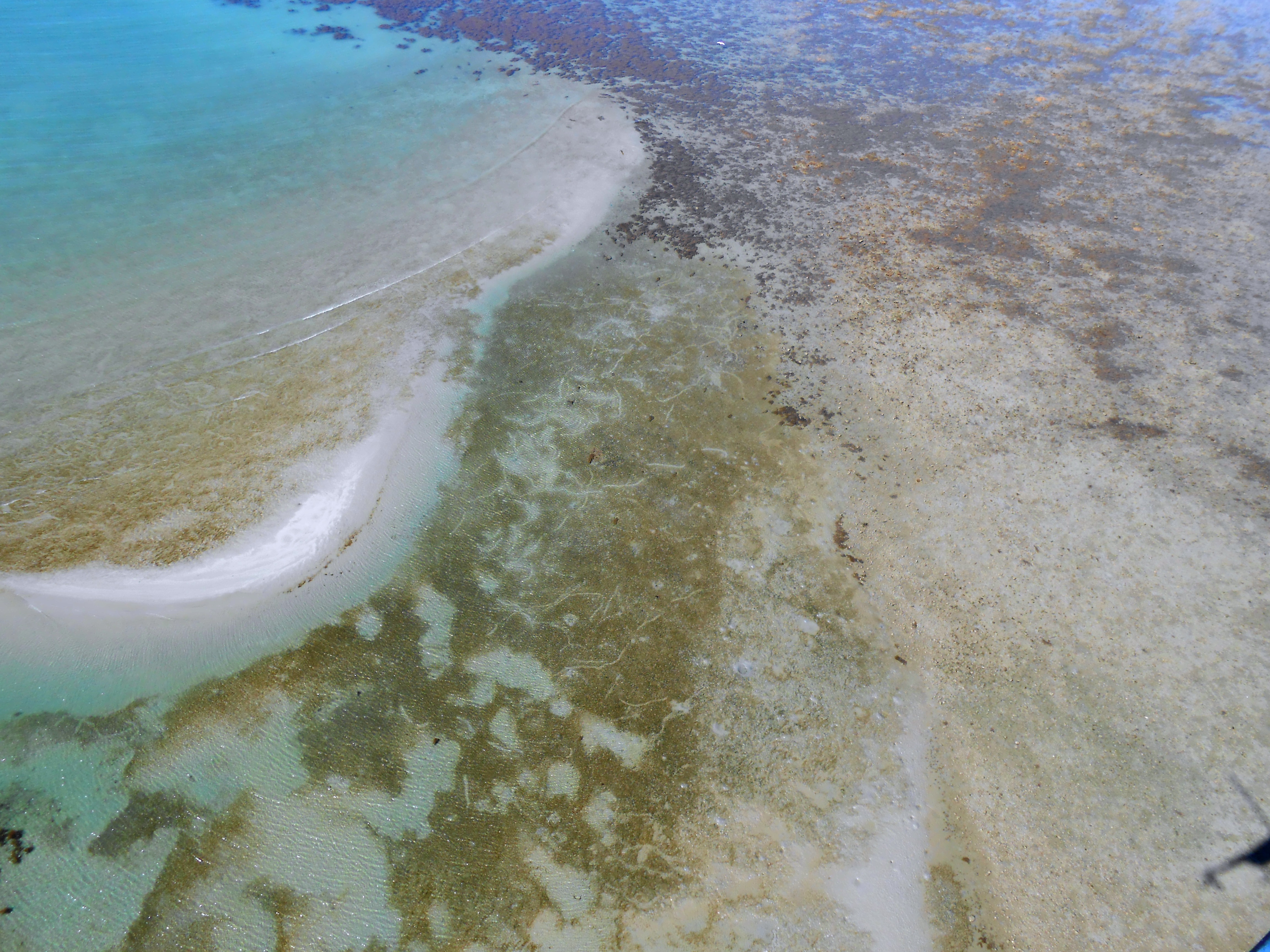
Intertidal seagrass meadows dominated by unknown or unspecified growth form, which can include: Zostera muelleri subsp. capricorni*, Cymodocea rotundata, Cymodocea serrulata, Enhalus acoroides, Halodule pinifolia, Halodule uninervis, Halophila spp., Thalassia hemprichii, Thalassodendron ciliatum and Syringodium isoetifolium.
Seagrasses are not a taxonomically unified group, but rather an ecological group that arose through convergent evolution and includes several different families. They are all flowering plants that live underwater and need light to photosynthesise. They also produce seeds. They grow on muds, sands and fine gravels which may be mobile, leading to changes in seagrass composition and extent over time (see qualifiers - Period, Trend and Cover). Meadows may include other structural macrobiota, such as: encrusting algae, erect macrophyte algae, bryozoans, sponges and molluscs (e.g. bivalves, cockles, whelks, razor clam beds), together with mobile invertebrate fauna, such as: sea cucumbers, crabs (e.g. commercial sand crabs and other portunids) and polychaete worms.
*Revision of Zostera capricorni has resulted in classification to subspecies. In Queensland, Zostera capricorni has been revised to Zostera muelleri subsp. capricorni[7].
Special values
Seagrasses provide a wide range of services, including:
- primary production, carbon fixation and nutrient removal
- support numerous herbivore and detritivore-based food webs, including food for dugongs and green turtles (mostly H. uninervis and H. ovalis), and many fisheries species (e.g. prawns and fishes) and others (e.g. razor clam)
- fisheries habitat (e.g. food, refuge and reproduction)
- coastal protection, erosion control and sediment capture
- tourism, recreation, education and research[11][19][8].
The fisheries value of seagrass habitat as nursery grounds for juvenile commercial fish and prawn species in Queensland is well documented[16][20]. Sea cucumbers may also be collected from seagrass meadows for commercial aquaculture. Not only do seagrass provide habitat for fish, but the proximity of seagrass meadows to other ecosystems (mangroves, coral reefs) increases their abundance in these ecosystems[6][12]. This is especially important for mobile biota which move between these different seascapes for different life functions (e.g. feeding, breeding, life stages etc.)[13].
Seagrass meadows, particularly those containing H. uninervis and H. ovalis, provide food for dugong[19] and green sea turtles[9]. Dugongs feed mostly on the roots of mostly H. uninervis whereas green turtles tend to graze the leaves of mostly H. ovalis. Halodule uninervis[19] and H. ovalis [14] are reported to be the most nutritious seagrasses due to high nitrogen and starch content. Grazing of H. uninervis and H. ovalis has been shown to increase production of a nitrogen-rich standing crop[14][1][9].
Diagnostic attributes
Inundation 'Intertidal – Lower low', 'Intertidal – Mid low', 'Intertidal – Upper low', 'Intertidal – Low undifferentiated', 'Intertidal – Lower medium', 'Intertidal – Upper-medium', 'Intertidal – Medium undifferentiated', 'Intertidal – High', 'Intertidal – Undifferentiated', 'Intertidal – High undifferentiated', although usually occurring below mean sea level.
Structural macrobiota 'Seagrass – fern-like', Seagrass – cylindrical', 'Seagrass – other or unspecified'
Qualifiers
Seagrass ecosystems vary in Period and Trend (seasonally and from year to year).
Distribution
Seagrass meadows grow throughout the world’s coastal waters, with large areas along Queensland’s coastline. Approximately 58 species of seagrass have been recorded across the globe with about 30 recorded in Australian waters and at least 15 in Queensland[15].
The following relates to distribution of this ecosystem type within the Central Queensland mapping area:
- Seagrass mapping represents the maximum known extent of that ecosystem since 2000 and details concerning period and trend of each meadow are documented within the structural macrobiota attribute dataset.
- Based on the available data in the Central Queensland mapping area, intertidal seagrass meadows dominated by unknown or unspecified growth form can include: C. serrulata, H. uninervis, H. decipiens, H. ovalis, H. spinulosa, S. isoetifolium and Z. muelleri [5][2]. Where mapping data is available this type typically represents H. spinulosa or S. isoetifolium.
- In Port Curtis, Z. muelleri dominated meadows on muddy sediments whereas H. uninervis dominated meadows on sandy sediments. Halophila ovalis dominated meadows adjacent to disturbance and H. decipiens and H. spinulosa dominated deeper subtidal waters only.
- Extensive seagrass meadows in Port Curtis are the only described large area of seagrass between Hervey Bay and Shoalwater Bay, and are therefore very important regionally[16][5].
- Spatial Inventory of seagrass in Hervey Bay, its tributaries/estuaries and the Great Sandy Strait was last updated in 2003 and seagrass meadows may have changed in extent since it was last mapped. Some estuarine seagrasses were mapped only once at a very broad scale 1984-88[10] and may or may represent the current seagrass extent.
- Baffle Creek supports estuarine seagrass as initially mapped in 2007 and confirmed by observations in 2018 (Andrew Olds and Chris Henderson pers. comm.)[17]
- Halodule uninervis and H. ovalis provide food for dugong[19] and green sea turtles[9], and both of these species were observed in Port Curtis during recent seagrass surveys[16].
- Thalassia hemprichii does not occur in Central Queensland.
- Mapping represents locations that seagrass has been recorded at some point in time, and therefore locations where seagrass may grow now or in the future providing environmental conditions are suitable (e.g. wave action, Water clarity, sediment stability, temperature and the presence of nutrients and other potential contaminants). The species composition, extent and biomass of seagrass meadows can vary seasonally and between years. Seasonally the extent and biomass of seagrass meadows along the Queensland east coast are typically maximal in late spring and summer, and minimal over winter[2][5][18].
Other relevant attributes include Water clarity, Energy magnitude and Energy source (wave) together with Sediment texture, Freshwater volume and Trace elements. Seagrasses need light to be able to photosynthesise and turbid water inhibits light penetration, thus the depth that light can penetrate is a major control. Severe storms (cyclones), and/or high rainfall, river discharge and the associated low Water clarity and high concentrations of nutrients and other potential contaminants, and sediment deposition leads to seagrass loss (see SeagrassWatch annual reports for inshore seagrass monitoring in the Great Barrier Reef Marine Park[11][3]. Trace elements (nutrients N, P), herbicides and other contaminants are known to affect seagrass health and other structural macrobiota including epiphytic algae and macroalgae are indicators of high nutrients.
Marine heatwaves can also negatively impact seagrass meadows[4][11].
Seagrass – Queensland Government
Case study: Hervey Bay seagrass and dugong – Queensland Government
Seagrass – Department of the Environment, Tourism, Science and Innovation
Saltmarshes, seagrasses and algae – Queensland Department of Primary Industries
Seagrass-Watch: guides and manuals
Seagrasses in Queensland (pamphlet)
Seagrasses – Australian Institute of Marine Science
Seagrass – A Vulnerability Assessment for the Great Barrier Reef
Seagrass Restoration Network
References
- ^ Aragones, LV, Lawler, IR, Foley, WJ & Marsh, H (October 2006), 'Dugong grazing and turtle cropping: grazing optimization in tropical seagrass systems?', Oecologia. [online], vol. 149, no. 4, pp. 635-647. Available at: http://link.springer.com/10.1007/s00442-006-0477-1 [Accessed 3 April 2019].
- ^ a b Bruinsma, C & Danaher, K (2001), Queensland Coastal Wetland Resources: Round Hill Head to Tin Can Inlet.. [online], vol. QI99081, Department of Primary Industries, Queensland Government., Brisbane. Available at: http://era.daf.qld.gov.au/id/eprint/3545/.
- ^ Campbell, SJ & McKenzie, LJ (2004), 'Flood related loss and recovery of intertidal seagrass meadows in southern Queensland, Australia', Estuarine, Coastal and Shelf Science, vol. 60, no. 3, pp. 477-490, Elsevier.
- ^ Collier, CJ, Ow, YX, Langlois, L, Uthicke, S, Johansson, CL, O'Brien, KR, Hrebien, V & Adams, MP (23 August 2017), 'Optimum Temperatures for Net Primary Productivity of Three Tropical Seagrass Species', Frontiers in Plant Science. [online], vol. 8. Available at: http://journal.frontiersin.org/article/10.3389/fpls.2017.01446/full [Accessed 5 April 2019].
- ^ a b c Danaher, K, Rasheed, M & Thomas, R (2005), The intertidal wetlands of Port Curtis, Department of Primary Industries and Fisheries.
- ^ Gilby, B, Olds, A, Connolly, R, Maxwell, P, Henderson, C & Schlacher, T (8 February 2018), 'Seagrass meadows shape fish assemblages across estuarine seascapes', Marine Ecology Progress Series. [online], vol. 588, pp. 179-189. Available at: http://www.int-res.com/abstracts/meps/v588/p179-189/ [Accessed 15 March 2019].
- ^ Jacobs, S & Les, D (26 October 2009), 'New combinations in Zostera (Zosteraceae)', Telopea. [online], vol. 12, no. 3, pp. 419-423. Available at: http://plantnet.rbgsyd.nsw.gov.au/emuwebnswlive/objects/common/webmedia.php?irn=55023&reftable=ebibliography [Accessed 25 March 2019].
- ^ Kilminster, K, McMahon, K, Waycott, M, Kendrick, GA, Scanes, P, McKenzie, L, O'Brien, KR, Lyons, M, Ferguson, A & Maxwell, P (2005), 'Unravelling complexity in seagrass systems for management: Australia as a microcosm', Science of the Total Environment, vol. 534, pp. 97-109, Elsevier.
- ^ a b c Kuiper-Linley, M, Johnson, CR & Lanyon, JM (2007), 'Effects of simulated green turtle regrazing on seagrass abundance, growth and nutritional status in Moreton Bay, south-east Queensland, Australia', Marine and Freshwater Research. [online], vol. 58, no. 5, p. 492. Available at: http://www.publish.csiro.au/?paper=MF06241 [Accessed 5 April 2019].
- ^ Lee Long, W, Mellors, J & Coles, R (1993), 'Seagrasses between Cape York and Hervey Bay, Queensland, Australia', Marine and Freshwater Research. [online], vol. 44, no. 1, p. 19. Available at: http://www.publish.csiro.au/?paper=MF9930019 [Accessed 5 April 2019].
- ^ a b c McKenzie, LJ, Collier, CJ, Langlois, LA, Yoshida, RL, Smith, N & Waycott, M (2018), Marine Monitoring Program: Annual Report for inshore seagrass monitoring 2016-2017. Report for the Great Barrier Reef Marine Park Authority. [online], p. 248pp., Great Barrier Reef Marine Park Authority, Townsville. Available at: http://elibrary.gbrmpa.gov.au/jspui/handle/11017/3398.
- ^ Olds, AD, Connolly, RM, Pitt, KA & Maxwell, PS (2012), 'Primacy of seascape connectivity effects in structuring coral reef fish assemblages', Marine Ecology Progress Series, vol. 462, pp. 191-203, Inter-Research, Nordbuente 23 Oldendorf/Luhe 21385 Germany.
- ^ Olds, AD, Connolly, RM, Pitt, KA, Pittman, SJ, Maxwell, PS, Huijbers, CM, Moore, BR, Albert, S, Rissik, D, Babcock, RC & Schlacher, TA (January 2016), 'Quantifying the conservation value of seascape connectivity: a global synthesis: The conservation value of seascape connectivity', Global Ecology and Biogeography. [online], vol. 25, no. 1, pp. 3-15. Available at: http://doi.wiley.com/10.1111/geb.12388 [Accessed 31 May 2019].
- ^ a b Preen, AR, Long, WJL & Coles, RG (1995), 'Flood and cyclone related loss, and partial recovery, of more than 1000 km 2 of seagrass in Hervey Bay, Queensland, Australia', Aquatic Botany, vol. 52, no. 1, pp. 3-17, Elsevier.
- ^ Queensland Government, Seagrasses in Queensland. [online], Department of Primary Industries and Fisheries. Available at: https://www.seagrasswatch.org/wp-content/uploads/Resources/Brochure-Poster/Brochure/PDF/Seagrasses_in_Queensland_Fisheries_Info_Pamphlet.pdf.
- ^ a b c Rasheed, MA, Lee Long, WJ, McKenzie, LJ, Roder, CA, Roelofs, AJ & Coles, RG (1996), Port of Karumba: seagrass monitoring baseline surveys, Dry-season (Oct.) 1994 - Wet-season (Mar.) 1995, Ports Corp. of Queensland, Brisbane, Qld..
- ^ Scheltinga, DM & Moss, A (2007), A framework for assessing the health of coastal waters: a trial of the national set of estuarine, coastal and marine indicators in Queensland. June 2007 Final report (condensed version). [online], Environmental Protection Agency Queensland, prepared for the National Land & Water Resources Audit, Canberra. Available at: https://www.researchgate.net/publication/237620104_A_framework_for_assessing_the_health_of_coastal_waters_a_trial_of_the_national_set_of_estuarine_coastal_and_marine_indicators_in_Queensland.
- ^ Sheaves, M (2005), 'Nature and consequences of biological connectivity in mangrove systems', Marine Ecology Progress Series. [online], vol. 302, pp. 293-305. Available at: http://www.int-res.com/abstracts/meps/v302/p293-305/ [Accessed 15 March 2019].
- ^ a b c d Sheppard, JK, Preen, AR, Marsh, H, Lawler, IR, Whiting, SD & Jones, RE (2006), 'Movement heterogeneity of dugongs, Dugong dugon(Müller), over large spatial scales', Journal of experimental marine biology and ecology, vol. 334, no. 1, pp. 64-83, Elsevier.
- ^ Watson, R, Coles, R & Lee Long, W (1993), 'Simulation estimates of annual yield and landed value for commercial penaeid prawns from a tropical seagrass habitat, Northern Queensland, Australia', Marine and Freshwater Research. [online], vol. 44, no. 1, p. 211. Available at: http://www.publish.csiro.au/?paper=MF9930211 [Accessed 8 April 2019].
Last updated: 22 July 2019
This page should be cited as:
Department of Environment, Science and Innovation, Queensland (2019) Intertidal other seagrass, WetlandInfo website, accessed 8 May 2025. Available at: https://wetlandinfo.des.qld.gov.au/wetlands/ecology/aquatic-ecosystems-natural/estuarine-marine/descriptions/15/
|


 — Department of the Environment, Tourism, Science and Innovation