

|
|
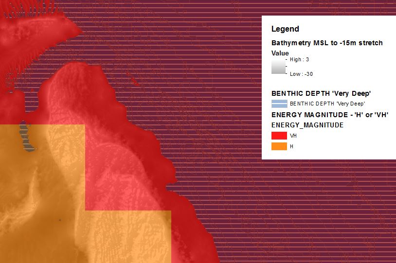
High energy over unknown substrate in very deep waterShort descriptionSubtidal high energy areas in very deep water (>30m). Disclaimer: Ecosystem type descriptions are based on biophysical attributes identified in Central Queensland through expert advice and supported by scientific literature. Not all ecosystem types are mapped based on current inventory, and many of the ecosystems described here may also occur in other parts of Queensland.
Classification categoriesSelect from the links below to view related ecosystem type categories Long descriptionSubtidal very high to medium energy areas in very deep water (>30m). These comprise two different subtypes: (a) high wave energy magnitude in deep water is unlikely to be identifiable in the mapping area, as high energy is usually is shallower water. Relevant information is the wavelength of the wave, and the depth of the wave (i.e. the wave base). Oceanic waves may have a longer wavelength and areas subject to high wave energy frequently are those experiencing storms such as east coast lows. Typically deeper waters such as Breaksea Spit and Fraser Island southward and subject to east coast lows may potentially experience high wave energy in in water deeper than 30 metres only during storm events, substrate not mapped, no data available; (b) high Energy magnitude, deep water areas affected by current energy – are unmapped in this typology. Application of the current energy dataset would result in a mappable type if used to split unconsolidated types. Special valuesHigh Energy magnitude, deep water areas resulting from current energy (unmapped) potentially provide habitat for filter feeders (e.g. sponges, sea whips, sea fans etc.). Diagnostic attributes:Inundation ‘Subtidal’ Benthic depth ‘Very deep (>30m)’ Energy magnitude (wave) ‘Medium’, ‘High’, ‘Very high’ Consolidation 'Unknown' Structural macrobiota 'Unknown' Sediment texture 'Unknown' Substrate composition 'Unknown' QualifiersPeriod and Trend qualifiers are relevant as deep wave action mainly occurs during cyclones and storm events such as east coast lows. DistributionThis type was created to deal with very deep areas where there was no mapping of either consolidation, sediment texture or biota. Likely to be in very deep channels experiencing high current stress e.g. palaeochannels >30m depth, deep tidal passages or wonky holes[1]. The following relates to distribution of this ecosystem type within the Central Queensland mapping area:
CommentsApplying the Energy source attribute in a typology combining both wave and current energy datasets and their Energy magnitudes would result in a seabed stress map that would produce a mappable type. If bathymetry mapping is sufficiently high resolution, Terrain morphology may help identify deep holes and channels. Ideally, to map this this type it needs to be combined with another attribute e.g. Consolidation is ‘unconsolidated’. References
Last updated: 12 July 2019 This page should be cited as: Department of Environment, Science and Innovation, Queensland (2019) High energy over unknown substrate in very deep water, WetlandInfo website, accessed 8 May 2025. Available at: https://wetlandinfo.des.qld.gov.au/wetlands/ecology/aquatic-ecosystems-natural/estuarine-marine/descriptions/112/ |
Site footer

 — Department of the Environment, Tourism, Science and Innovation