

|
|
Calcareous consolidated or intermediate substrateShort descriptionConsolidated or intermediate substrates with calcareous substrate composition. Disclaimer: Ecosystem type descriptions are based on biophysical attributes identified in Central Queensland through expert advice and supported by scientific literature. Not all ecosystem types are mapped based on current inventory, and many of the ecosystems described here may also occur in other parts of Queensland.
Classification categoriesSelect from the links below to view related ecosystem type categories Long descriptionConsolidated or intermediate substrates with calcareous Substrate composition, which are either:
Depending on the depth of subtype (a), they may warrant splitting, on the basis that those below 30 metres depth may potentially be mesophotic coral ecosystems (MCEs) (i.e. low light coral ecosystems), which are ecologically distinct from shallow water reefs[9] (see types 76, 84, 68, 91, 117). The presence of carbonate on the sea floor comes from a variety of sources including coral, shell, foraminifera. The presence of a veneer of carbonate is diagnostic of true coral platform reef, and can be only precisely known if coral cores or coral rubble are taken[12][4] . Potentially these ecosystems are platform coral reefs, fringing coral reef or terrigenous coral communities, but no surveys are available to indicate the spatial extent of corals. Calcification by coral reef organisms (chiefly hard corals and crustose coralline algae) is a function of light availability, seawater aragonite saturation and temperature[5]. Shelf edge reefs and some MCEs are growing on a framework of Pleistocene coral reefs, that is, they have true carbonate platform. The majority of fringing reefs of the coastal Great Barrier Reef began their growth on unconsolidated sediments and few originated on rock[10]. Fringing reefs are those attached to the shore and can grow on either unconsolidated clay, sand, gravel, boulder or rock (either terrigenous rock from the land, or ‘the bones of their ancestors’ i.e. Pleistocene reef of carbonate). This ecosystem type includes:
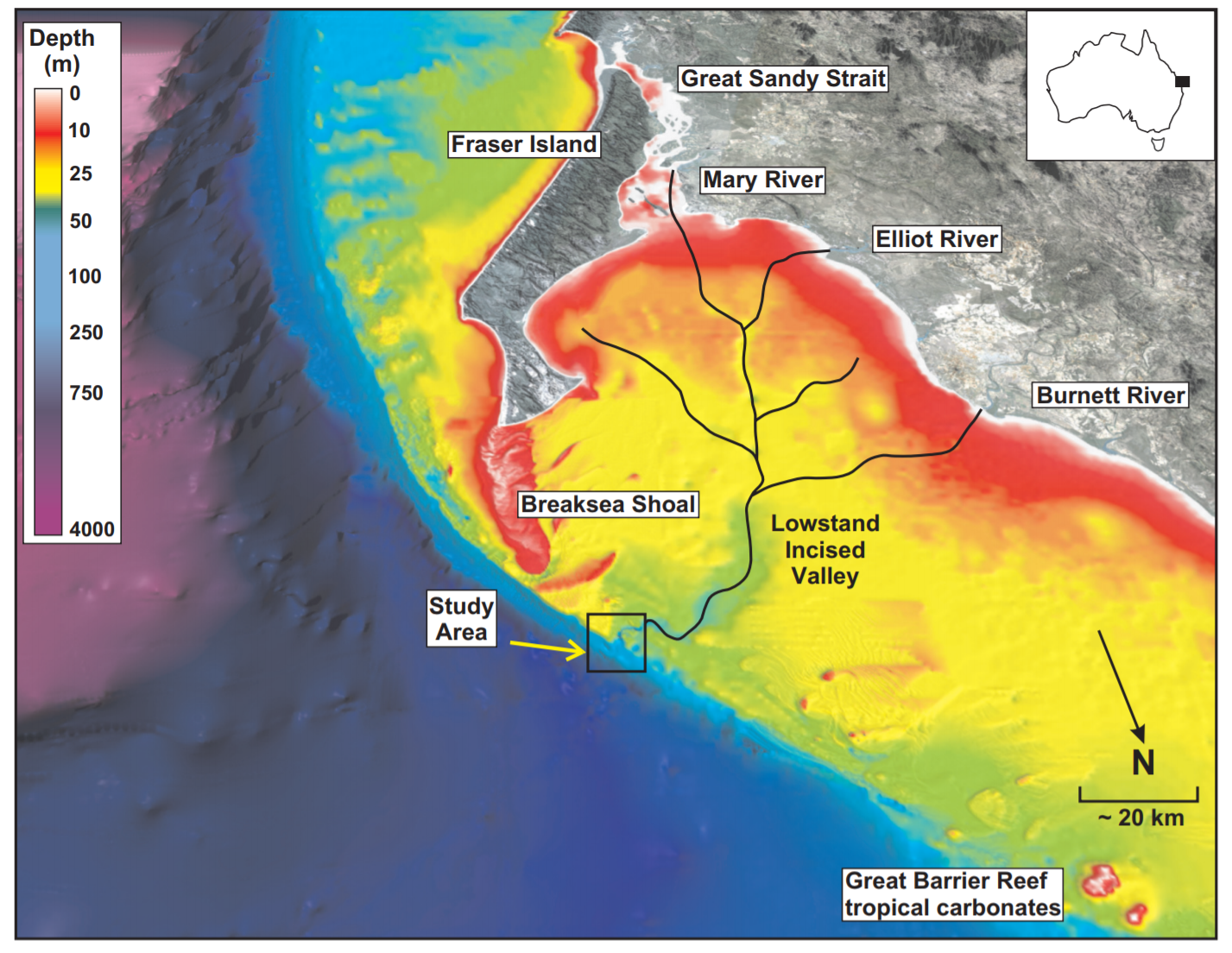
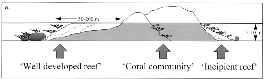
Figure 1 below is highly relevant to nearshore reefs, explains the difference between well-developed fringing reef, incipient reef and coral community[11].
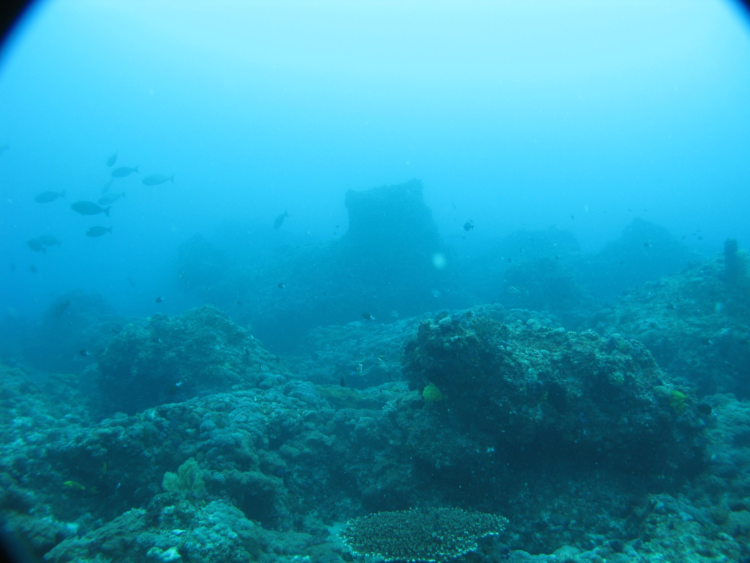
Special valuesCorals grow on the ‘bones of their ancestors’ and subtype (a) ecosystems are potentially either true coral reefs occurring in shallow water (less than 30 metres), or MCEs in depths greater than 30 metres[3]. Reefs with point coral survey information need further investigation to document the extent of the coral. Consolidated carbonate provides living structure for biodiverse communities. Diagnostic attributesInundation 'Subtidal' Consolidation 'Consolidated', 'Intermediate' Substrate composition 'Calcareous' QualifiersThe Cover qualifier is relevant with respect to the percentage of carbonate in samples. DistributionIn general, mainland fringing reefs occur around the Whitsundays and Cairns northward. Inshore reef growth of the southern Great Barrier Reef (south of 21 degrees South) is considered poor, related to turbidity controls on coral carbonate production and accumulation. Carbonate reefs occur in waters where there is sufficient water clarity and conditions for calcification to occur, and global maps of reef accretion have been produced[5]. Carbonate reefal areas occur along the edge of Queensland’s continental shelf and within Torres Strait, including in very deep waters where they potentially contain MCEs, representing old coral reefs from ancient shorelines[3]. The extent of carbonate reefs is better known on the edge of the continental shelf than the inner shelf, where multi-beam sonar bathymetry surveys are lacking[1]. Carbonate reefs also occur on the mid-shelf and inner shelf, and occasionally along the mainland shoreline. Old carbonate reefs occur in Moreton Bay[7]. This ecosystem type represents a default type where coral monitoring and inventory may have occurred (and be quantitative and statistically significant but not spatial) but the extent of coral is yet to be mapped. The following relates to distribution of this ecosystem type within the Central Queensland mapping area:
  CommentsTypology mapping of fringing reefs on the Queensland coastline is unresolved and needs further investigation incorporating spatial attributes such as width of the reef flat (i.e. distance between the coastline and the edge of coral growth). Benthic depth will characterise reefs as shallow (less than 10 metres), deep (10 to 30 metres) or MCEs (beyond 30 metres deep). Terrain morphology is relevant to the ridges and peaks that form consolidated, calcareous reef, also Terrain roughness (‘ruggedness’) will indicate reefal areas potentially MCEs (e.g. central Great Barrier Reef[2], and Lord Howe Island[6]). Spatial attributes including distance from the shore and dimensions (length, width etc.) will further inform geomorphological classification of these reefs. A better understanding of coral reef ecosystems will be gained by the addition of georeferenced photos to field monitoring inventory, and expansion from monitoring to the inventory of ecosystem extent. Detailed mapping of Substrate composition will enable ecosystems to be characterised as coral reef or coral community. Water pH is relevant as ocean acidification may inhibit carbonate production. Additional InformationCorals of the World - Australian Institute of Marine Science References
Last updated: 18 July 2019 This page should be cited as: Department of Environment, Science and Innovation, Queensland (2019) Calcareous consolidated or intermediate substrate, WetlandInfo website, accessed 8 May 2025. Available at: https://wetlandinfo.des.qld.gov.au/wetlands/ecology/aquatic-ecosystems-natural/estuarine-marine/descriptions/100/ |
Site footer

 — Department of the Environment, Tourism, Science and Innovation