

|
|
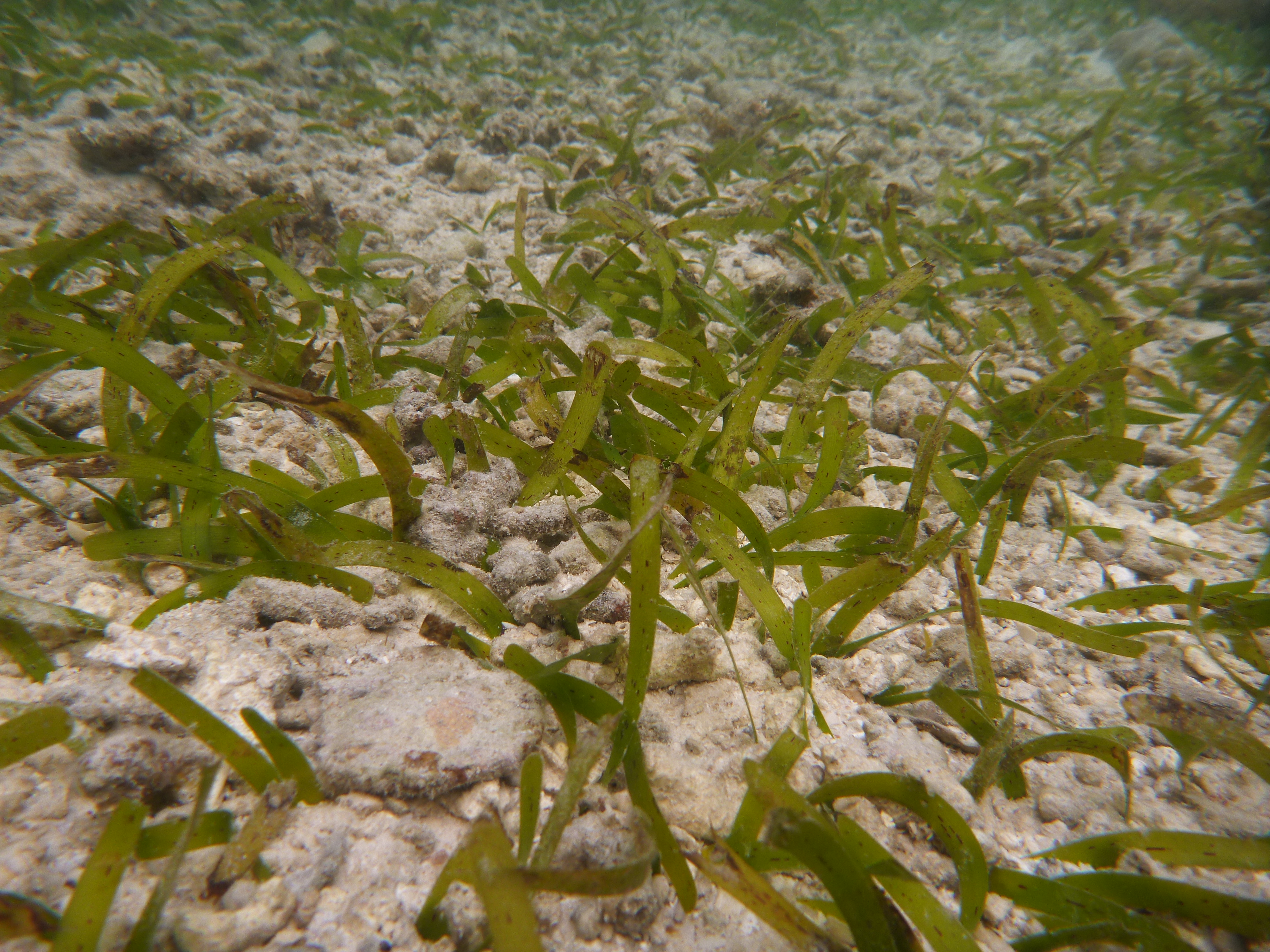
Other seagrass in shallow waterShort descriptionShallow subtidal seagrass meadows dominated by unknown or unspecified growth form. Disclaimer: Ecosystem type descriptions are based on biophysical attributes identified in Central Queensland through expert advice and supported by scientific literature. Not all ecosystem types are mapped based on current inventory, and many of the ecosystems described here may also occur in other parts of Queensland.
Classification categoriesSelect from the links below to view related ecosystem type categories Long descriptionShallow (less than 10 metres) subtidal seagrass meadows dominated by unknown or unspecified growth form, which can include Zostera muelleri subsp. capricorni*, Cymodocea rotundata, Cymodocea serrulata, Enhalus acoroides, Halodule pinifolia, Halodule uninervis, Halophila spp., Thalassia hemprichii, Thalassodendron ciliatum and/or Syringodium isoetifolium. Seagrasses are not a taxonomically unified group, but rather an ecological group that arose through convergent evolution and includes several different families. They are all flowering plants that live underwater and need light to photosynthesise. They also produce seeds. They grow on muds, sands and fine gravels which may be mobile. Meadows may include other Structural macrobiota such as encrusting algae, erect macrophyte algae, bryozoans, sponges and molluscs (e.g. bivalves, cockles, whelks, razor clam beds), together with mobile invertebrate fauna such as sea cucumbers, crabs (e.g. commercial sand crabs and other portunids) and polychaete worms. *Revision of Zostera capricorni has resulted in classification to subspecies. In Queensland, Zostera capricorni has been revised to Zostera muelleri subsp. capricorni[8]. Special valuesSeagrasses provide a wide range of services, including:
The fisheries value of seagrass habitat as nursery grounds for juvenile commercial fish and prawn species in Queensland is well documented[13][17]. Not only do seagrass provide habitat for fish, but the proximity of seagrass meadows to other ecosystems (mangroves, coral reefs) increases their abundance in these ecosystems[6][12]. Diagnostic attributesInundation 'Subtidal' Structural macrobiota 'Seagrass - other' Benthic depth 'Shallow (<10m)' QualifiersSeagrass ecosystems vary in Period and Trend (seasonally and from year to year). The species composition, extent and biomass of seagrass meadows can vary seasonally and between years. The extent and biomass of seagrass meadows along the Queensland east coast are typically maximal in late spring and summer, and minimal over winter[1][15]. DistributionSeagrass meadows grow throughout the world’s coastal waters, with large areas along Queensland’s coastline. Approximately 58 species of seagrass have been recorded across the globe with about 30 recorded in Australian waters and at least 15 in Queensland (SeagrassWatch). Most tropical and sub-tropical species are found in water less than 10 metres deep. Of the 13 species identified in north-eastern Queensland all occurred in water depths less than 6 metres below mean sea level (MSL) and only four occurred in water more than 20 metres below MSL[10]. Three general depth zones of seagrass species composition for tropical waters have been observed including a shallow zone less than 6 metres deep with high species diversity, likely to include all species found in a region; a zone between 6 and 11 metres where the most commonly found seagrasses were the pioneering Halodule and Halophila species; and a zone deeper than 11 metres where only species of the genus Halophila were commonly found[3]. Seagrasses form dynamic communities of mixed species. Enhalus acoroides, T. hemprichii and T. ciliatum are considered persistent whereas Cymodocea spp. and S. isoetifolium are considered opportunistic, Z. muelleri and H. uninervis are considered colonising to opportunistic. Wide strap seagrasses are typically more enduring than early colonising species of Halophila spp., with Zostera spp. forming both transitory and enduring meadows. Transitory meadows increase and decrease in extent and biomass seasonally, and can re-establish following complete loss through sexual reproduction. Enduring meadows may fluctuate but generally remain to some extent through seasons and years[9]. The following relates to distribution of this ecosystem type within the Central Queensland mapping area:
CommentsOther relevant attributes include Water clarity, Sediment texture, and Trace elements, together with Energy magnitude, Energy source (wave) and Freshwater volume however deeper seagrass tend to be less influenced by energy and freshwater except in a severe storm. Seagrasses need light to be able to photosynthesise and turbid water inhibits light penetration, thus the Benthic depth that light can penetrate is a major control. Severe storms (cyclones), and/or high rainfall, river discharge and the associated low Water clarity and high concentrations of nutrients and other potential contaminants, and sediment deposition leads to seagrass loss (see SeagrassWatch annual reports for inshore seagrass monitoring in the Great Barrier Reef Marine Park[11][2]). Trace elements (nutrients N, P), herbicides and other contaminants are known to affect seagrass health and other Structural macrobiota. This includes epiphytic algae and macroalgae which are indicators of high nutrients. Water temperature is also relevant. Marine heatwaves can also negatively impact seagrass meadows[4][11]. Shallow subtidal meadows are generally less susceptible to air and surface temperature than intertidal seagrasses, but more susceptible than deeper seagrasses[7]. Mapping represents locations where seagrass has been recorded at some point in time, and therefore locations where seagrass may grow now or in the future providing environmental conditions are suitable (e.g. wave action, Water clarity, Sediment stability, Temperature and Trace elements (the presence of nutrients and other potential contaminants)). Additional InformationSeagrass - Queensland Government Seagrass (Case study: Hervey Bay seagrass and dugong) - Queensland Government Saltmarshes, seagrasses and algae - Department of Agriculture and Fisheries Seagrasses in Queensland (pamphlet) Seagrass - Department of Environment, Science and Innovation Seagrasses - Australian Institute of Marine Science References
Last updated: 19 July 2019 This page should be cited as: Department of Environment, Science and Innovation, Queensland (2019) Other seagrass in shallow water, WetlandInfo website, accessed 25 June 2024. Available at: https://wetlandinfo.des.qld.gov.au/wetlands/ecology/aquatic-ecosystems-natural/estuarine-marine/descriptions/52/ |
Site footer

 — Department of Environment, Science and Innovation