|
|
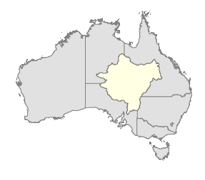
Lake Eyre Basin River Health AssessmentCoverageThe map below highlights the areas where sampling has occurred for this program. Click on the map to view information about the drainage basins in this area.  The Lake Eyre Basin River Health Assessment is an inter-governmental monitoring program. The Department of the Environment, Tourism, Science and Innovation conducts monitoring in the Queensland component of the Lake Eyre Basin. Program start date2011 Program end dateReview of program 10 years from commencement Objectives of the programTo gain an understanding of the Lake Eyre Basin condition in order to:
Who is involved?Lead organisationDepartment of Natural Resources and Mines Contact details of lead organisation:water.monitoring♲dnrm.qld.gov.auPartner organisationsSouth Australian Government, Northern Territory Government and the Commonwealth Government List of indicators monitoredFish assemblages
Waterbirds (not included at present)
Vegetation (not included at present)
Vegetation (nationally important wetlands) – (not included at present)
Physical habitats – (not included at present)
Water Quality – (spot readings only)
Hydrology – (data from gauging stations and data loggers)
Scale of programBasin scale Brief description of sampling locations
Frequency of monitoringAnnual base monitoring, mid-term assessment in fifth year and full assessment in tenth year Where is the program reported?Lake Eyre Basin Agreement publications Last updated: 22 March 2013 This page should be cited as: Department of Environment, Science and Innovation, Queensland (2013) Lake Eyre Basin River Health Assessment, WetlandInfo website, accessed 8 May 2025. Available at: https://wetlandinfo.des.qld.gov.au/wetlands/assessment/monitoring/current-and-future-monitoring/lake-eyre-basin-river-health.html |

 — Department of the Environment, Tourism, Science and Innovation

