

|
|
Monitoring pressure and state (extent and condition)Monitoring wetlands involves measuring wetland features over time that are known to indicate changes in the:
This information is collected to reveal changes and trends. Wetland inventories are the collection of standardised data about wetlands from available data sources or through surveys. Wetland assessments use data from wetland inventories - and analyse this data again criteria using specialised methodologies.
Quick facts
Monitoring There are many different reasons why wetlands monitoring may be required, e.g. it is important to know if the extent of a wetland is increasing or decreasing in size and if the wetland is changing in any ways. The information gathered can guide prioritisation for funding as well as helping inform, and evaluate the effectiveness of wetland management. Sewage treatment facilities (STPs) and monitoring point locations in Queensland are available as part of the point-source monitoring program page. Other water quality, water quantity and aquatic ecosystem monitoring information is available here The information may also be searched for through the WetlandMaps and WetlandSummary—facts and maps tools. Why do we monitor wetlands?
There are many different reasons why wetlands monitoring may be required, e.g. it is important to know if the extent of a wetland is increasing or decreasing in size and if the wetland is changing in any ways. The information gathered can guide prioritisation for funding as well as helping inform, and evaluate the effectiveness of wetland management. One form of monitoring referred to as surveillance monitoring, involves regularly collecting data to identify changes in the condition or extent of the wetland. Committing to a wetlands monitoring program involves the long-term collection of data, which can have high ongoing costs. If the monitoring program is not well developed, or the objectives are unclear, the data collected may not answer the key questions necessary for the success of the program. Any monitoring program involves the use of indicators. These are specific aspects of wetlands that can be measured and provide meaningful information. Examples of wetland indicators include:
Both high level (e.g. change in wetland vegetation) and more specific, detailed indicators or ‘measures’ (e.g. types of vegetation changes) may be required and are combined to provide an overall indicator result. Before undertaking any monitoring activity it is important to have an understanding of how the wetland functions, including the natural variability within the wetland and the impacts of pressures on the wetland processes. This information can be summarised in the form of wetland conceptual models or conceptual diagrams, which can then be used to guide the development of indicators for wetlands. The importance of scale in wetlands monitoring
It is important to be able to monitor wetlands at many scales. The 5 major scales include:
Monitoring Queensland wetlands
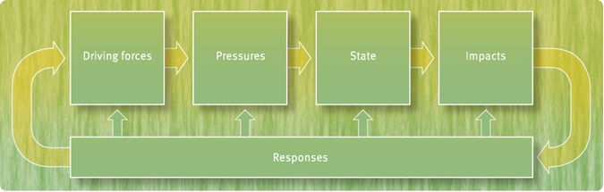
The DPSIR (driving forces, pressures, state, impacts and responses) framework provides a system of monitoring both the pressure and state for wetlands at a broad scale within an adaptive management framework. The state of wetlands are determined by changes in wetland extent and condition. Results are reported in the Queensland State of the Environment Report and the Reef Report card. The extent of wetlands is a key indicator of their status. Because of the highly variable nature of wetlands their extent is not easy to measure. Queensland monitors the change in extent of wetlands using statewide mapping datasets. Monitoring the extent of wetlands only partially helps answer questions about their condition and impacts of pressures on them. For example, while a wetland may exist, its condition may be so degraded that it does not perform well as a wetland or provide the range of values that it would if in a better condition. While many organisations and groups are carrying out wetland condition monitoring activities, it is not always possible to compile this information at a state level because of variation in the following factors:
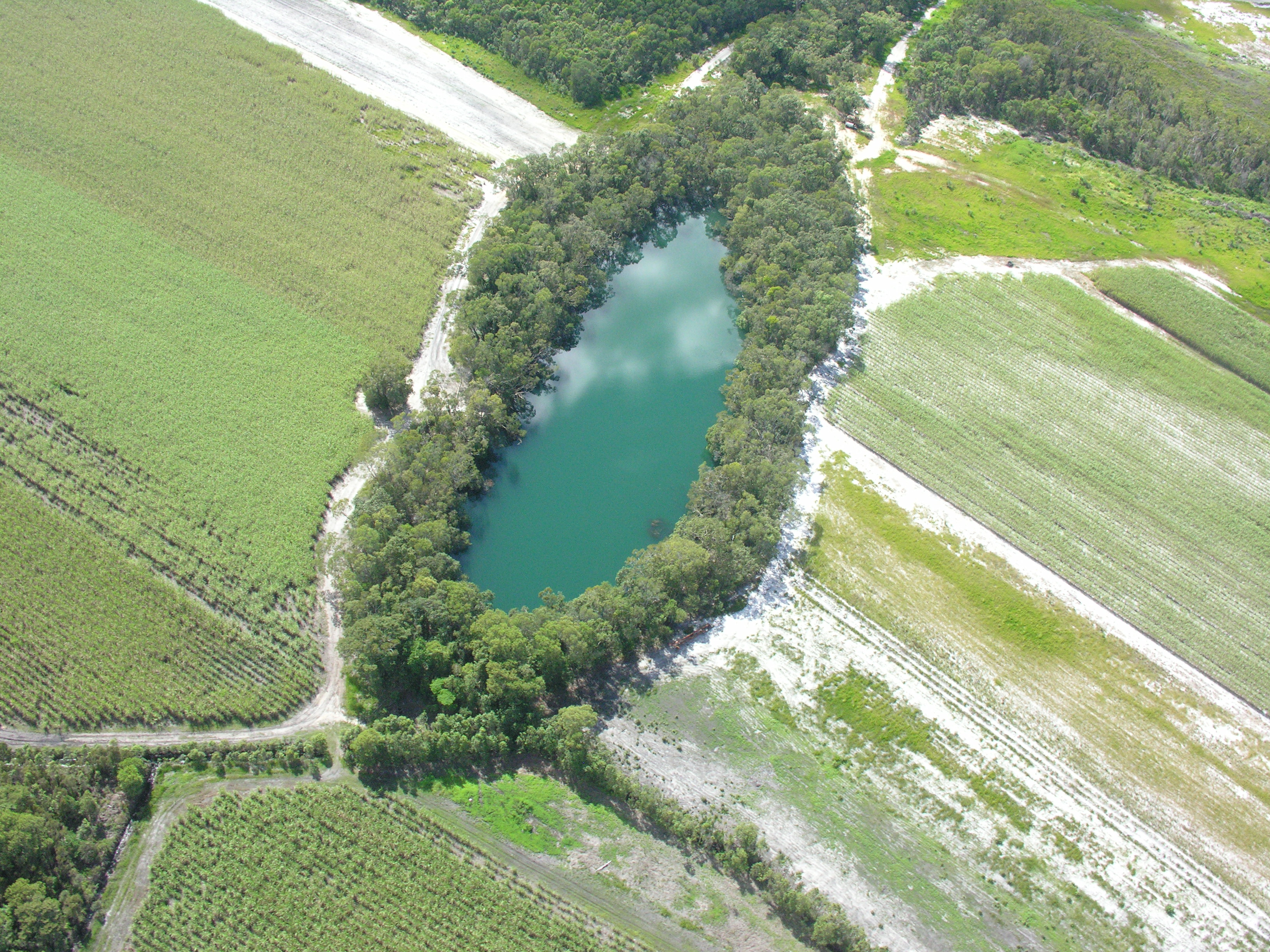
A landscape hazard assessment for wetlands in the Great Barrier Reef catchment This report details the approach taken to assess hazards to lacustrine and palustrine wetlands in the Great Barrier Reef (GBR) catchments in Queensland. It provides a landscape scale assessment of hazard (as opposed to fully quantified 'risk') arising from land-use, and is conducted as a desktop GIS analysis. Additional information
Pages under this sectionLast updated: 28 September 2021 This page should be cited as: Department of Environment, Science and Innovation, Queensland (2021) Monitoring pressure and state (extent and condition), WetlandInfo website, accessed 18 March 2024. Available at: https://wetlandinfo.des.qld.gov.au/wetlands/assessment/monitoring/ |
Site footer

 — Department of Environment, Science and Innovation