

|
|
Rock ramp fishwayRock ramp fishway – Planning and design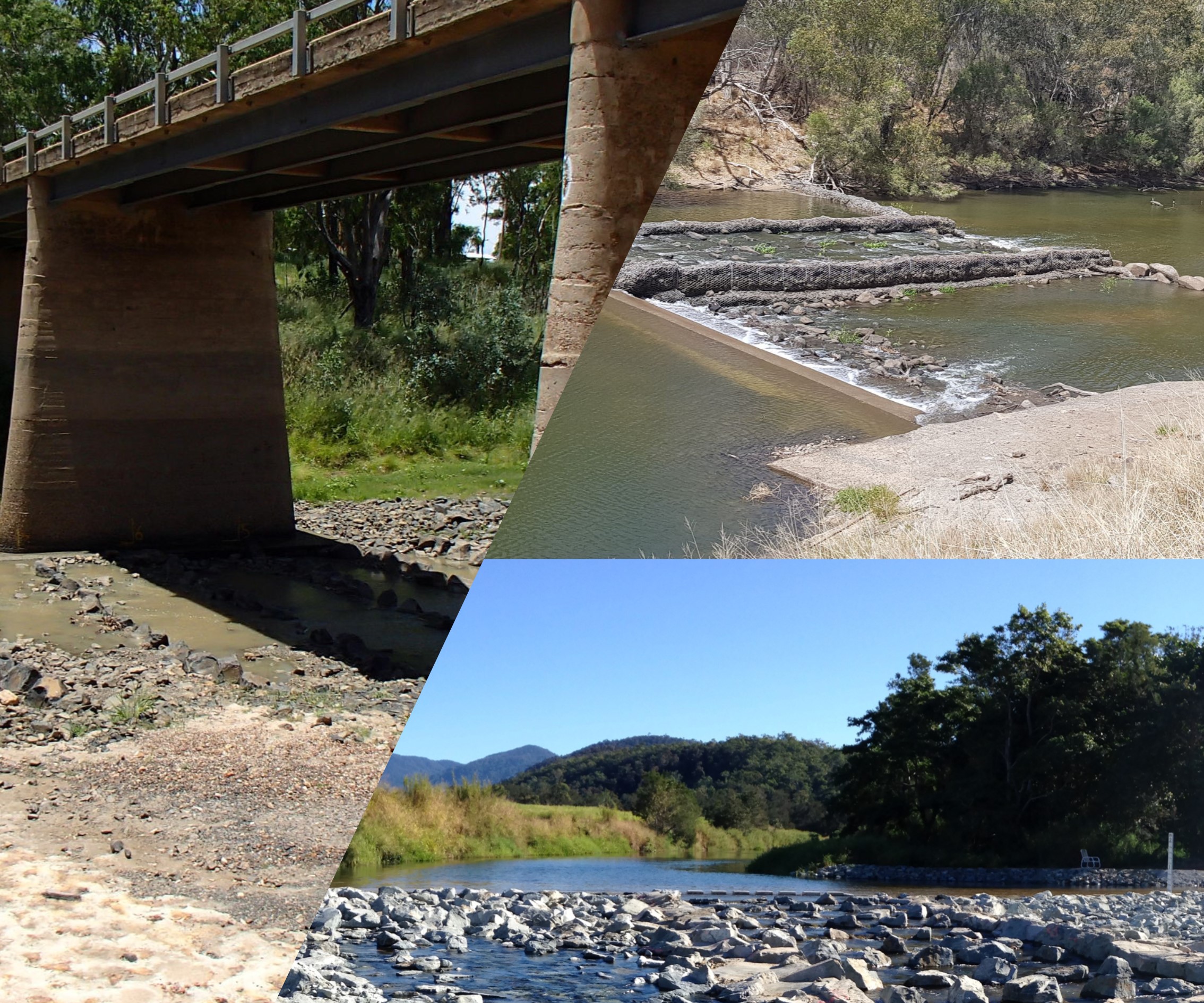 Select from the tabs below In addition to the general information for all fishway types, the following applies to rock ramp fishways. SizingThe internal hydraulics of rock ramp fishways are highly variable, and each rock ramp is hydraulically unique and varies according to flow. Headwater depth entering the fishway channel should be less than or equal to the tailwater depth leaving the fishway channel, within the specified operating range of a rock ramp fishway. Recent observations from the monitoring of rock ramp fishways in north Queensland[1] indicate that rather than engaging the whole pool in dissipating energy, deliberately designing for non-uniform hydraulic conditions, with continuous pathways of very low turbulence, will further improve passage of small bodied fish. SlopeA common ramp slope for Australian fishes is between 1:20 and 1:30 (vertical:horizontal)[4][5]. Slot widthThe width of the gaps between rocks in a rock ramp fishway (slots) influence hydraulics and fish passage. Slot width, combined with head loss and depth, determine the overall discharge of water from the fishway, and hence the turbulence within each pool. Where there is a need to pass large fish, there is also a need to widen the slots. Water velocityHead loss for a rock ramp fishway is a site-specific decision, as it influences water velocity. The irregular placement of rocks, and variation in rock sizes used, in a rock ramp makes it difficult to produce consistent head losses throughout the ramp. It is most useful to set a maximum head loss standard, and at the weir crest there should be little, if any, head drop[4]. Throughout Australia, rock ramp fishways typically have a maximum head loss of 100 mm[2][4]), however, it has also been demonstrated that effective head loss can range between 75 and 100 mm, depending on the fish species present[4]. A series of rock ramps can be linked by deep resting pools to cater for larger drops[2], creating a bypass fishway. To simplify construction and the difficulty of using varying rock sizes, instead of trying to make each head loss exactly the same, head loss ≤120 mm has been successful. It is important to note that these values are simplistic performance measures because they are point source measurements that do not account for turbulence or the diversity of hydraulic pathways in a rock fishway. For example, head loss is not a good indicator of water velocity at the shallow marginal areas of rock ramp fishways because roughness has a much greater effect in shallow water. Some small fish utilise the low velocities generated by the roughness of the rocks in the shallow margins to ascend a fishway[4]. TurbulenceTurbulence within rock fishways is poorly understood. Rock fishways should include hydraulic diversity so that fish can choose their ascent path. Turbulence should be minimised, with little white water in the fishway pools[4]. Long rock ramp fishways can include resting pools that allow for fishes to rest and regain their energy, including those that may not complete their ascent during daylight or may descend the fishway when the light fades. Resting pools may enable fish to remain in the fishway overnight in a long fishway, however more data is required. Resting pools typically have four times the volume of standard pools and occur every metre rise in vertical elevation. They are most commonly used in vertical slot fishways but are also used in rock ramp, bypass, trapezoidal and Denil fishways[3]. Disclaimer: In addition to the standard disclaimer located at the bottom of the page, please note the Fishways (biopassage structures) disclaimer. References
Last updated: 10 May 2021 This page should be cited as: Department of Environment, Science and Innovation, Queensland (2021) Rock ramp fishway – Planning and design, WetlandInfo website, accessed 8 May 2025. Available at: https://wetlandinfo.des.qld.gov.au/wetlands/management/fish-passage/technologies/fishway-options/rock-ramp/planning-design.html |
Site footer

 — Department of the Environment, Tourism, Science and Innovation