

|
|
Biopassage structure (fishway) mappingThe gathering of information on biopassage structures (i.e. fishways, fish ladders) has been a collaborative effort between the Queensland Government, biopassage experts, fisheries biologists, and Natural Resource Management groups. This datasets purpose is to represent all current biopassage structures in Queensland as a spatial data source. Note that this dataset will be updated regularly, however, may not include the latest developments. 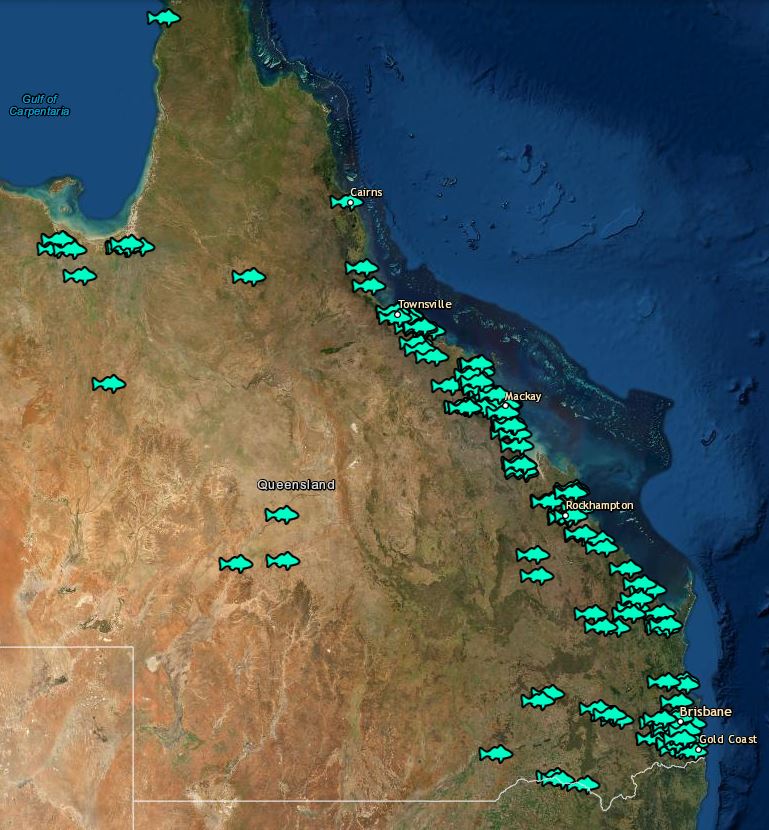
Quick links and facts
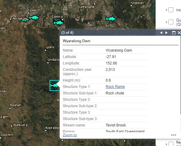
This dataset includes basic information about biopassage structures (i.e. fishways) in Queensland, including location, construction year, height, region and sub-basin. Barriers to biopassage may need more than one type of biopassage structure (fishway) to successfully facilitate aquatic fauna movement, and this dataset addresses this with the use of types and subtypes. Height (in metres), for the purposes of this dataset, is the measure of approximate head loss (barrier height to bed level) to inform the type of structure. How to useThe biopassage structure (fishway) dataset can be viewed on WetlandMaps, or downloaded from QSpatial. To access the biopassage structure (fishway) dataset on WetlandMaps, follow the steps below.
Last updated: 10 May 2021 This page should be cited as: Department of Environment, Science and Innovation, Queensland (2021) Biopassage structure (fishway) mapping, WetlandInfo website, accessed 8 May 2025. Available at: https://wetlandinfo.des.qld.gov.au/wetlands/management/fish-passage/technologies/fishway-map.html |
Site footer

 — Department of the Environment, Tourism, Science and Innovation