

|
|
Rock ramp fishwayRock ramp fishway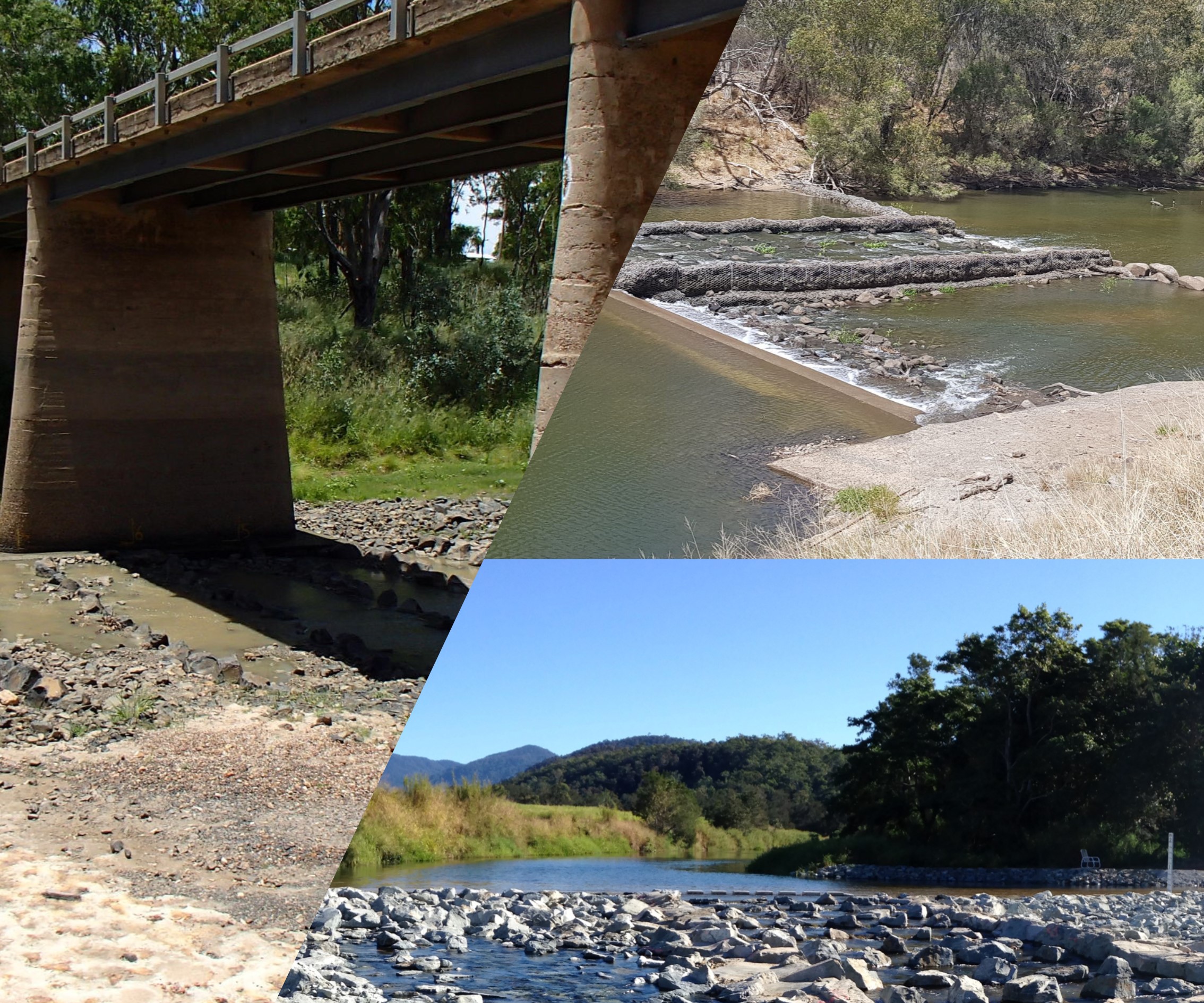 Select from the tabs below Disclaimer: In addition to the standard disclaimer located at the bottom of the page, please note the Fishways (biopassage structures) disclaimer. 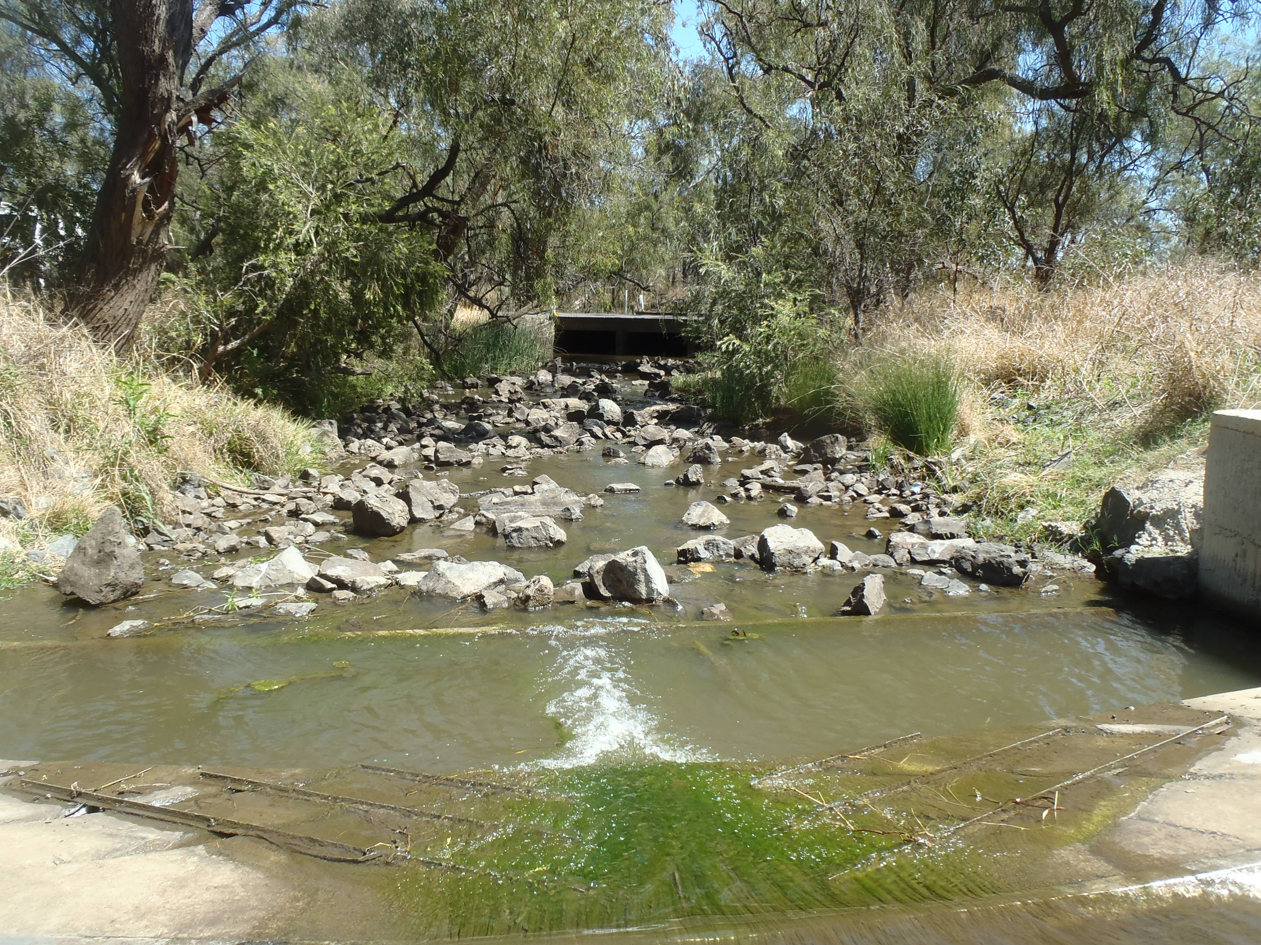 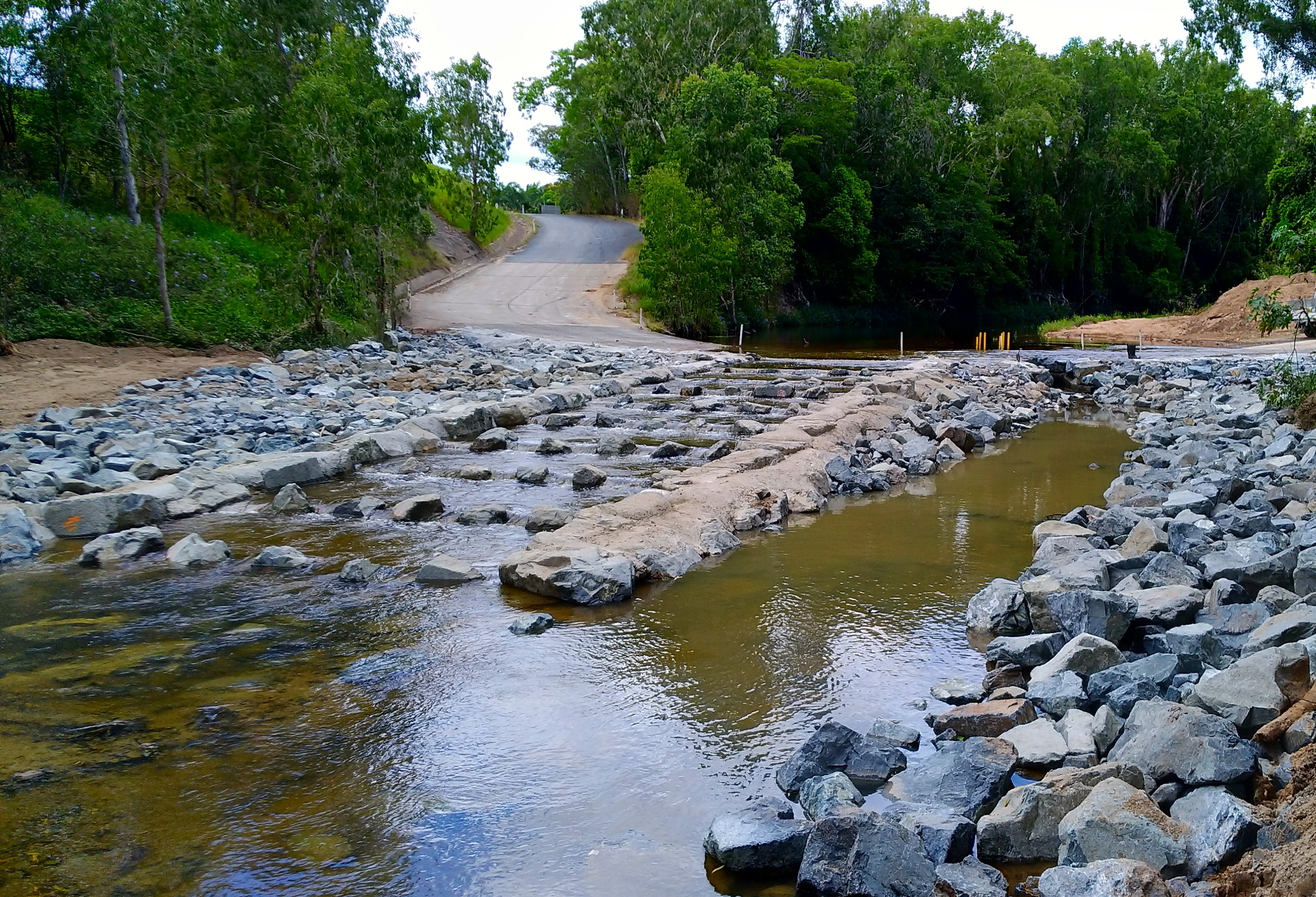 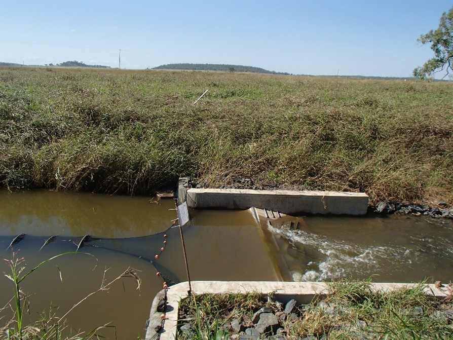 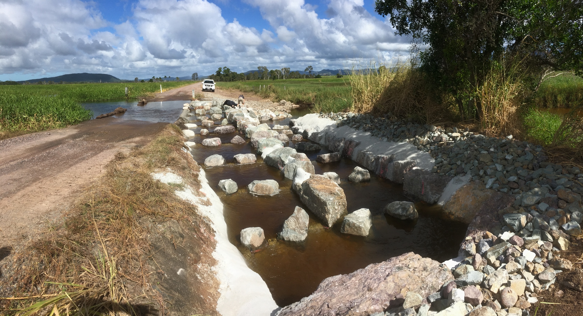 Other name/sNature-like fishways Description
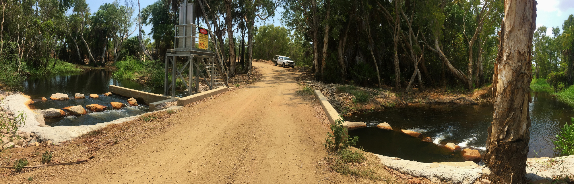
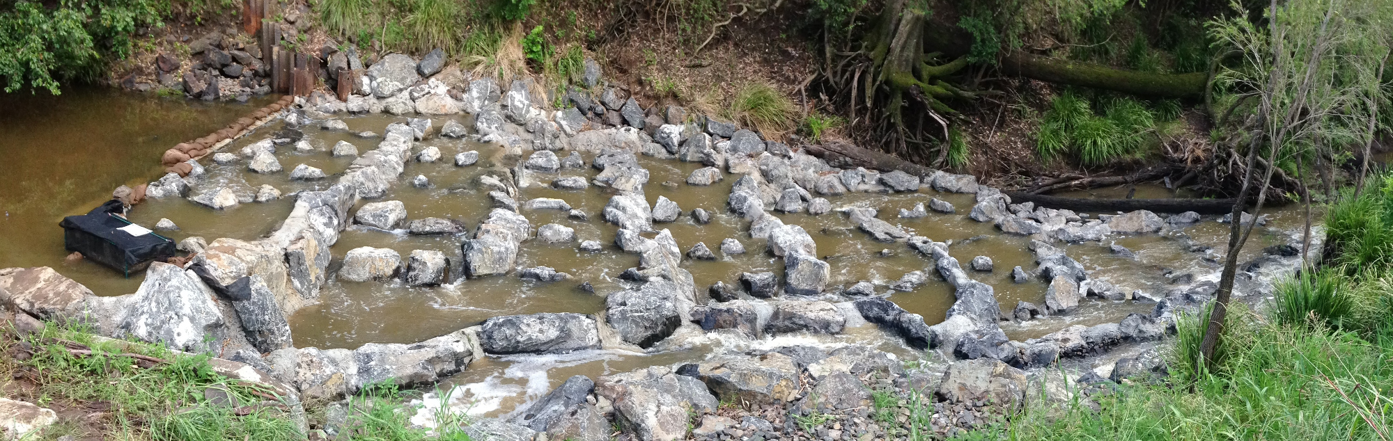
Rock ramp fishways have historically been most commonly used for barriers up to two metres high, but are increasingly being used for structures greater than two metres. They are nature-like fishways providing biopassage and aquatic habitat through a simulated natural stream environment that contains pools, runs, riffles and rapids. Developed as a more natural style of fishway structure for low water level drops, rock ramp fishways now have widespread application where upstream fish passage is required at low level weirs, grade control structures in open channels, gauging station weirs and downstream of culverts. Although they appear relatively natural, rock ramp fishways must be carefully configured and rocks strategically placed to provide appropriate hydraulic conditions for fish to overcome barriers and pass upstream. Rock ramp fishways are the most common fishway type constructed in Queensland[2]. These structures have had variable success in transferring fish upstream because of variations in design, construction, and maintenance. A well-designed, constructed, and maintained rock ramp fishway can provide excellent connectivity of fish populations, with major positive influences on upstream fish communities[1].They are useful for providing biopassage for small fish, particularly returning juvenile diadromous species (e.g. barramundi, bass, mullet) upstream into freshwater habitats. Small fish and other aquatic fauna (e.g. invertebrates, turtles, platypus) use range of water velocity profiles and turbulence, and interstitial spaces[3]. There are many variations in the design of rock ramp fishways. Rock ramps may be full or partial width, that is, they may cover the full width or part of the width of the waterway. Full width designs tend to provide considerably more functionality than partial width designs, particularly if the headwater varies, however partial width designs can also be very effective[1]. Rock ramp fishways can be built entirely in the tailwater or less commonly be entirely recessed in the headwater. They can also have a straight profile or reverse back toward the barrier for optimal entrance placement (i.e. dog leg)[1]. Rock ramp fishways are typically constructed of rocks, but they can be made of artificial material such as concrete blocks[3]. Concrete can be used to secure the rocks and ridges and ensures all levels in each ridge are exact and increase stability. Sub-typesThere are two main sub-types of rock ramp fishways. Rocks may be placed semi-randomly in the waterway for a natural aesthetic look (referred to as random rock design), or they may be placed in ridge lines to form small pools (referred to as lateral ridge design)[3]. The lateral ridge has been the most common rock ramp design for Queensland streams. This design comprises a series of small pools and riffles arranged in a transverse step configuration. There are short steps at the riffles formed by rock weirs comprising large ridge rocks, which connect with slightly longer flat sections that form the pools. That is, the ramp surface is formed into a series of ridges and pools, and the ridges typically two metres apart with a 100 mm drop between ridges[4]. The random rock design includes rocks of varying sizes that mimic a natural rocky bed. Large boulders are placed at strategic places along the rock ramp creating pools of low flow and turbulence for fish to move from pool to pool and over the barrier. In this design, large protruding rocks should be spaced two diameters apart[1].
  References
Last updated: 10 May 2021 This page should be cited as: Department of Environment, Science and Innovation, Queensland (2021) Rock ramp fishway, WetlandInfo website, accessed 30 August 2024. Available at: https://wetlandinfo.des.qld.gov.au/wetlands/management/fish-passage/technologies/fishway-options/rock-ramp/ |
Site footer

 — Department of Environment, Science and Innovation