Skip links and keyboard navigation

Rock ramp fishway

Rock ramp fishway – Construction and operation

Rock Ramp examples: <br>
		1. Left: full width lateral ridge rock ramp, Condamine Weir, Condamine, Queensland<br> 
		2. Top right: partial width lateral ridge rock ramp, Goondiwindi weir, Macintyre River, Queensland<br> 
		3. Bottom right: full width rock ramp fishway with low flow lateral ridge channel down the centre and high flow random rock graded ramp on both banks, Clews Road, Murray Creek, Queensland Photo by 1 and 2 Janice Kerr and 3 Matthew Moore

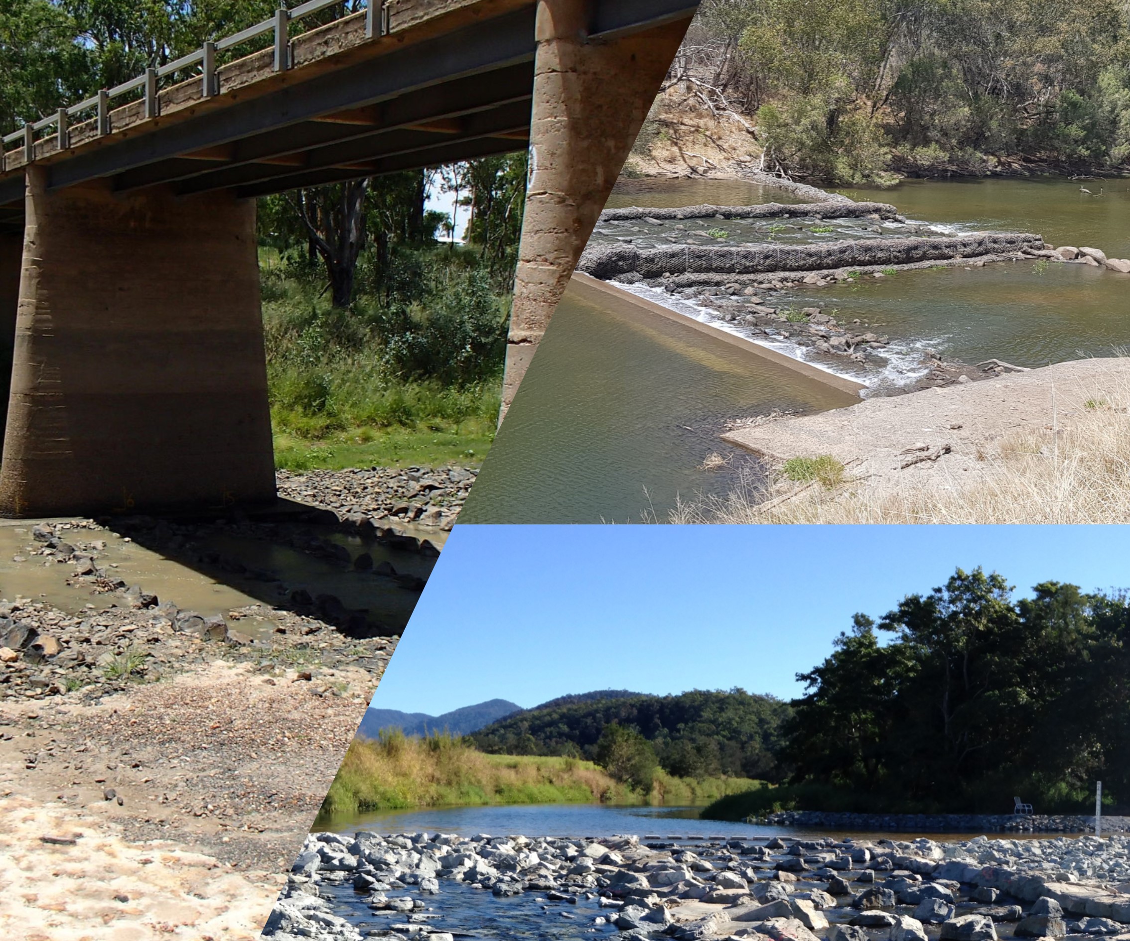
Select from the tabs below

In addition to the general information for all fishway types, the following applies to rock ramp fishways.

Construction

For rock ramp and bypass fishways, where concrete is not the main material, the commissioning process may allow a tolerance of approximately 5% because of the unpredictable or imprecise nature of rock placement and earthworks compared with pre-fabricated concrete (e.g. vertical slot or concrete cone ramp). However, basic measurements such as head loss, water depth and slope should meet design specifications within the agreed level of tolerance[2].

Rock ramp construction is a specialist operation involving skill and patience. A close relationship is required between design, construction and supervision personnel, and advice should be obtained from a rock ramp construction specialist to ensure that the requirements for configuration and integrity of the structure are met.

Construction of these fishways requires careful configuration of the ridge, cascade and apron rocks. Placement of ridge rocks and cascade rocks is critically important, and these should be carefully keyed into each other and into the foundation.

Monitoring

Fish captured during rock ramp fishway sampling, including silver scat, juvenile barramundi and empire gudgeons Photo by Matthew MooreThere are few robust assessments of rock ramp fishways,[1][3][4][6] largely due to:

  • these structures being difficult to assess because they are constructed within the waterway
  • variability in size and structure
  • the difficulty in applying quantitative sampling techniques (compared to fishways such as vertical slot or fish lock fishways)
  • limited access during high flows, and
  • budgetary constraints[5].

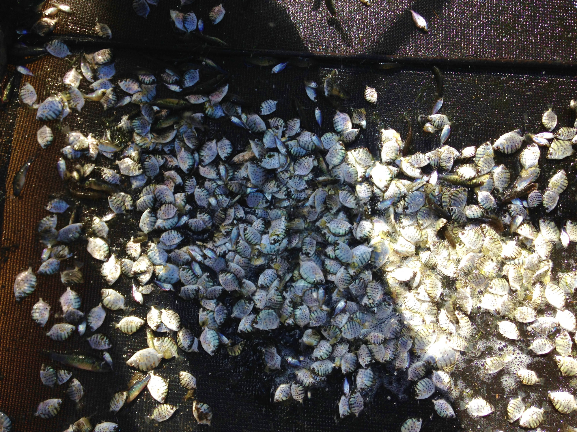
Aerial photography and 3D modelling trials are currently being undertaken to hydraulically assess a rock ramp fishway, early results are producing excellent results.

Operation and maintenance

Rock ramp fishways tend to require little human intervention to operate, however, optimal hydraulic operation and regular maintenance is crucial for the long-term passage of fish through rock ramp fishways. Rocks that move during high flows can eventually cause the hydraulics to become suboptimal and lead to functional failure of the fishway. A regular inspection schedule will ensure the fishway functions effectively in the long-term, however, it is often hard to determine when maintenance is needed, and this aspect requires training for local operators[5].

Examples of inspection and maintenance tasks for a rock ramp fishway:

  • determine timing of operational reporting arrangements and inspection times (e.g. annually and after high flow events)
  • visually inspect the entrance and exit for blockages and ensure it is trash (woody debris, flotsam etc.) free
  • visually inspect head loss at each rock ridge to ensure it meets the design specifications
  • inspect fishway for weed encroachment
  • inspect fishway for sediment deposition
  • after major flooding, check for any damage to the fishway (movement of rocks) and also to the bank armour[5].

Disclaimer: In addition to the standard disclaimer located at the bottom of the page, please note the Fishways (biopassage structures) disclaimer.


References

  1. ^ Fawcett, J & Prior, A (2020), Oakey Creek Control Weirs for Flow Monitoring and Measurement –Fish Monitoring Final Report(Amended). [online], Department of Natural Resources, Mines and Energy. Available at: https://nla.gov.au/nla.obj-2726497283/view.
  2. ^ Jones, M, O'Connor, JP & Arthur Rylah Institute for Environmental Research (2017), Monitoring the performance of fishways and fish passage works. [online] Available at: https://nla.gov.au/nla.obj-664272102 [Accessed 1 March 2021].
  3. ^ Marsden, T & Stuart, I (2 January 2019), 'Fish passage developments for small-bodied tropical fish: field case-studies lead to technology improvements', Journal of Ecohydraulics. [online], vol. 4, no. 1, pp. 14-26. Available at: https://www.tandfonline.com/doi/full/10.1080/24705357.2019.1646616 [Accessed 23 February 2021].
  4. ^ Moore, M (2016), Hilliards Creek Rock Ramp Fishway Monitoring Report. [online], Catchment Solutions. Available at: http://catchmentsolutions.com.au/files/2018/04/Hilliards-Creek-Rock-Ramp-Fishway-Monitoring-Report.pdf.
  5. ^ a b c O’Connor, J, Stuart, I & Mallen-Cooper, M (2015), 'Performance, operation and maintenance guidelines for fishways and fish passage works', Trove. [online] Available at: https://nla.gov.au/nla.obj-480267623 [Accessed 10 November 2020].
  6. ^ Power, T & McCann, J (2017), Blackrock Creek Fishway –Monitoring Report. [online], Catchment Solutions. Available at: http://catchmentsolutions.com.au/files/2017/11/BlackrockFW_MonitoringReport-1.pdf.

Last updated: 10 May 2021

This page should be cited as:

Department of Environment, Science and Innovation, Queensland (2021) Rock ramp fishway – Construction and operation, WetlandInfo website, accessed 18 March 2024. Available at: https://wetlandinfo.des.qld.gov.au/wetlands/management/fish-passage/technologies/fishway-options/rock-ramp/construction-operation.html

Queensland Government
WetlandInfo   —   Department of Environment, Science and Innovation