Get help using the Rehabilitation Process – Mapping Report
Select from the tabs below
Aquatic Ecosystem Rehabilitation Mapping Report
The report provides key information to assist with developing an Aquatic Ecosystem Rehabilitation Plan including:
- understanding the location, extent and classification of aquatic ecosystems
- understanding the components and processes of the aquatic ecosystems and the broader landscape
- understanding the conservation values of the aquatic ecosystems
- understanding planning and legislative requirements
- understanding surrounding land use
- determining the ecosystem services which may be provided by the aquatic ecosystem
- establishing objectives, undertaking detailed design and implementation of the project.
How to use
Access to the Aquatic Ecosystem Rehabilitation Mapping Report is through WetlandMaps using the steps outlined below:
- Open WetlandMaps
- Zoom to the area of interest within Queensland (performance will be affected if viewing the layer on a large scale).
- Ensure the Layer List is open, and scroll the layer to find "Cadastre"
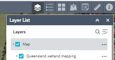
- If the area of interest is a known Lot on Plan, tick the box next to "Cadastre"

- Click on the centre of the polygon of the area of interest/Lot on Plan to select it.
- Click the Request a Report button on the top right of the page.
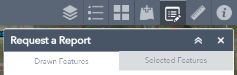
- Click on Selected Features and use the drop down menu to choose Aquatic Ecosystem Rehabilitation Mapping Report.
- Enter a Customer Reference (i.e. name or organisation name) and the email address to send the report to. The report will then be emailed to the specified email address. The report will generate information for the selected Lot on Plan.
The report can also be generated for a drawn feature:
-
After opening WetlandMaps, and selecting "Request a Report", select a draw mode to draw over the area of interest.
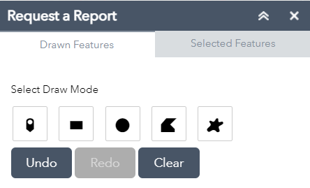
- Use the undo, redo and clear options as required to get the right area to generate a report on.
- Once the area of interest has been captured by the drawn feature, use the drop down menu to choose Aquatic Ecosystem Rehabilitation Mapping Report.
- Enter a Customer Reference (i.e. name or organisation name) and the email address to send the report to. The report will then be emailed to the specified email address. The report will generate information for the drawn feature.
Last updated: 7 June 2022
This page should be cited as:
Department of Environment, Science and Innovation, Queensland (2022) Get help using the Rehabilitation Process – Mapping Report, WetlandInfo website, accessed 8 May 2025. Available at: https://wetlandinfo.des.qld.gov.au/wetlands/management/rehabilitation/rehab-process/aerp-help/map-report.html


 — Department of the Environment, Tourism, Science and Innovation