

|
|
WetlandUpdate December 2022
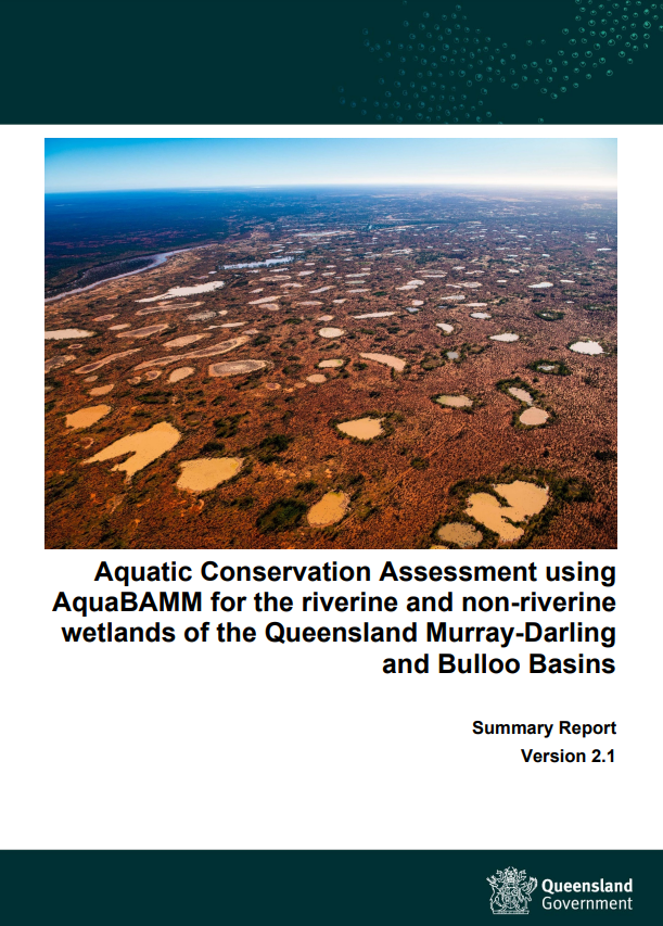
Aquatic Conservation Assessment using AquaBAMM for the riverine and non-riverine wetlands of the Queensland Murray-Darling and Bulloo BasinsThe Department of Environment and Science (DES) has completed Aquatic Conservation Assessments (ACA) for eight catchments in the Queensland Murray-Darling and Bulloo Basins using the Aquatic Biodiversity Assessment and Mapping Method (AquaBAMM). The area covered by this assessment totals 315,142 square kilometres (31,514,255 ha) and includes the Border Rivers, Moonie, Condamine-Balonne, Maranoa, Wallam, Warrego, Paroo and Bulloo hydrological basins in the southern part of the state. The Bulloo River drainage basin has been included in this assessment where it was previously included in the Lake Eyre and Bulloo Basins ACA (version 1.1). The riverine and non-riverine data and reporting (information on specific environmental values, by location) may be accessed through WetlandMaps. Information on specific environmental values, by location, is also available via Environmental reports online. For further information on AquaBAMM and the ACA results email biodiversity.planning♲des.qld.gov.au. Mangroves and associated communities of Moreton Bay - 2021 update
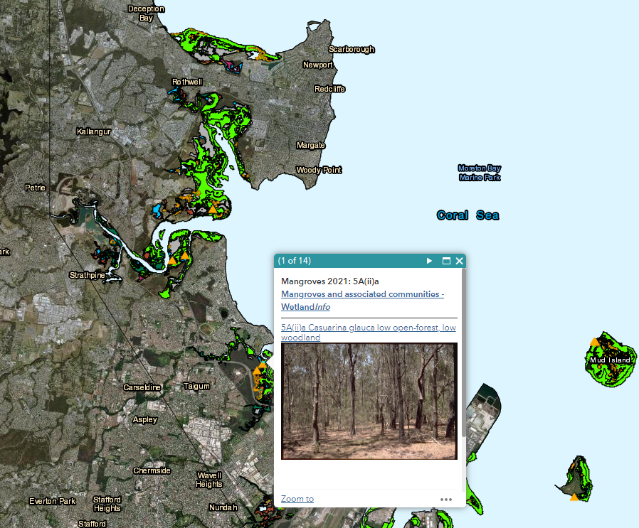
A program to monitor the mangroves and associated communities within Moreton Bay was established by the Queensland Herbarium in 2011. The newest data replaces the Mangroves and associated communities of Moreton Bay, Queensland, Australia: change in extent 1955-1997-2012 report (2016), and extends the period to include 2012-2021 (See Table 1 here). The Moreton Bay mangroves and associated communities interactive map viewer uses a swipe map to show the changes in extent of mangrove and associated communities of Moreton Bay. It has also been updated to include mangrove community data and change to 2021. This map viewer was developed to enhance the knowledge, understanding and awareness of mangrove communities and estuarine wetlands in South East Queensland. Find out more on the Mangrove and associated communities of Moreton Bay page.
Updates to the Assessment Toolbox The Final Ecosystem Goods and Services (FEGS) Framework and Metrics is a beneficiary-centric framework to identify, organise, and account for the subset of ecosystem services (services) that are directly used, enjoyed, or appreciated by people (e.g. FEGS). The FEGS Framework begins with identifying the environmental class and beneficiary of a final ecosystem good or service (FEGS) and works backwards to identify the biophysical attributes of ecosystems (e.g. “final endpoints”) that are of greatest relevance to people who care about or depend on those ecosystems (e.g. beneficiaries). The System of Environmental-Economic Accounting —Ecosystem Accounting (SEEA EA) is a spatially-based statistical framework to organise biophysical information about ecosystems, measure ecosystem services, track changes in ecosystem extent and condition, value ecosystem services and ecosystem assets, and link this information to measures of economic and human activity. The National Ecosystem Services Classification System Plus (NESCS Plus) provides a framework for for standardising ecosystem services classification. The framework can then be used to identify how ecosystem service changes, resulting from policy-induced changes to ecosystems, impact human welfare. The Wetland Tracker: Great Barrier Reef Catchment Wetland Condition Monitoring Program is a rapid assessment method for determining the condition of freshwater palustrine and lacustrine wetlands and tracking changes in wetland condition over time within Queensland’s Great Barrier Reef Catchment Area. UpdatesUpdated layers on WetlandMaps and WetlandSummary
Updated Wetland Projects Search ToolAdditional projects have been added to the wetland projects search tool from Burnett Mary Regional Group for Natural Resource Management Ltd. (BMRG). Additional links
WetlandUpdateThe WetlandUpdate is a regular bulletin sent to subscribers to provide you with the latest WetlandInfo resources and tools, as well as case studies, video information and new project fact sheets. WetlandInfo feedback and improvementsContact us via email for feedback, information or questions about wetlands. WetlandInfo feature species
Yellow mangrove (Ceriops australis). Photo by Queensland Herbarium
The feature species for December is the yellow mangrove (Ceriops tagal var. australis). This mangrove is a member of the Rhizophoraceae family. It is found throughout the Indo-Pacific region and distributed across northern Australia, extending south to the Tweed River on the east coast and to Broome in Western Australia. This species is commonly found on firm, well drained clays, clayey mud or sand clays at the upper tidal limit of the mangrove shore. Yellow mangrove also grows in soils that are poorly drained and frequently inundated by the tides, where it forms low, open shrub lands.
Additional informationThis section is updated regularly, so stay tuned for more!Last updated: 13 December 2022 This page should be cited as: Department of Environment, Science and Innovation, Queensland (2022) WetlandUpdate December 2022, WetlandInfo website, accessed 8 May 2025. Available at: https://wetlandinfo.des.qld.gov.au/wetlands/resources/publications/latest-news/2022-12-13.html |
Site footer

 — Department of the Environment, Tourism, Science and Innovation