Many Australian native fish species and other water-based fauna need a range of habitats to complete their life cycle and rely on specific seasonal and life stage habitats.
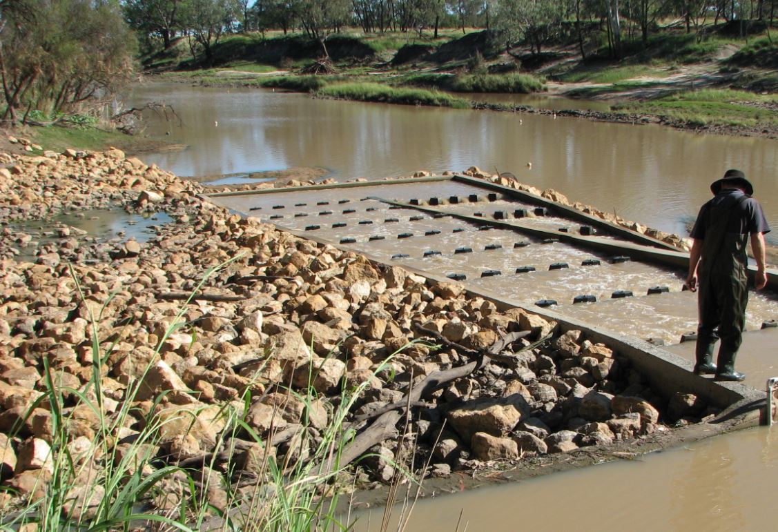
The Aquatic fauna passage (biopassage) section provides general information about biopassage, types of movement and ways to facilitate improved biopassage, barriers to biopassage and biopassage structure (fishway) mapping.
The collated biopassage structure information, has been a collaborative effort between the Queensland Government (Department of Agriculture and Fisheries), biopassage experts, fisheries, local government,biologists, and natural resource management groups.
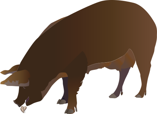
Feral pigs
Feral pigs can cause extensive environmental, social, cultural, and economic damage. They predate on native wildlife, destroy habitats, compete for resources with native wildlife, introduce invasive weeds, and disrupt the ecosystem services provided by wetlands.
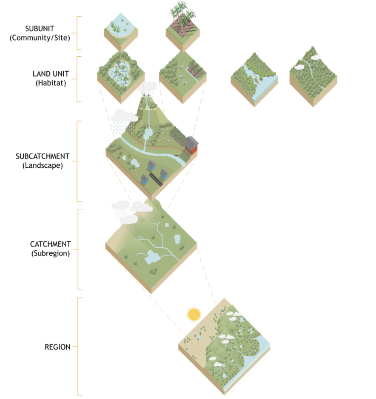
Hydrology
Hydrology includes the properties of the water and its distribution and movement between the land, groundwater and atmosphere. Information in the following section explains how hydrology operates at a range of scales (such as catchment, regional or global) and from different perspectives (e.g. focusing on a particular wetland, a river catchment or a groundwater aquifer).
Additional projects have been added to the wetland projects search tool including a number from Natural Disaster Relief and Recovery Arrangements as well as from the Herbert River Catchment and Landcare Group and the Hinchinbrook Shire Council.
The programs, policies and legislation pages have been updated to reflect changes to Queensland’s planning programs, policy and legislation relating to wetlands, aquatic ecosystems and species.
The WetlandUpdate is a regular bulletin sent to subscribers to provide you with the latest WetlandInfo resources and tools, as well as case studies, video information and new project fact sheets.
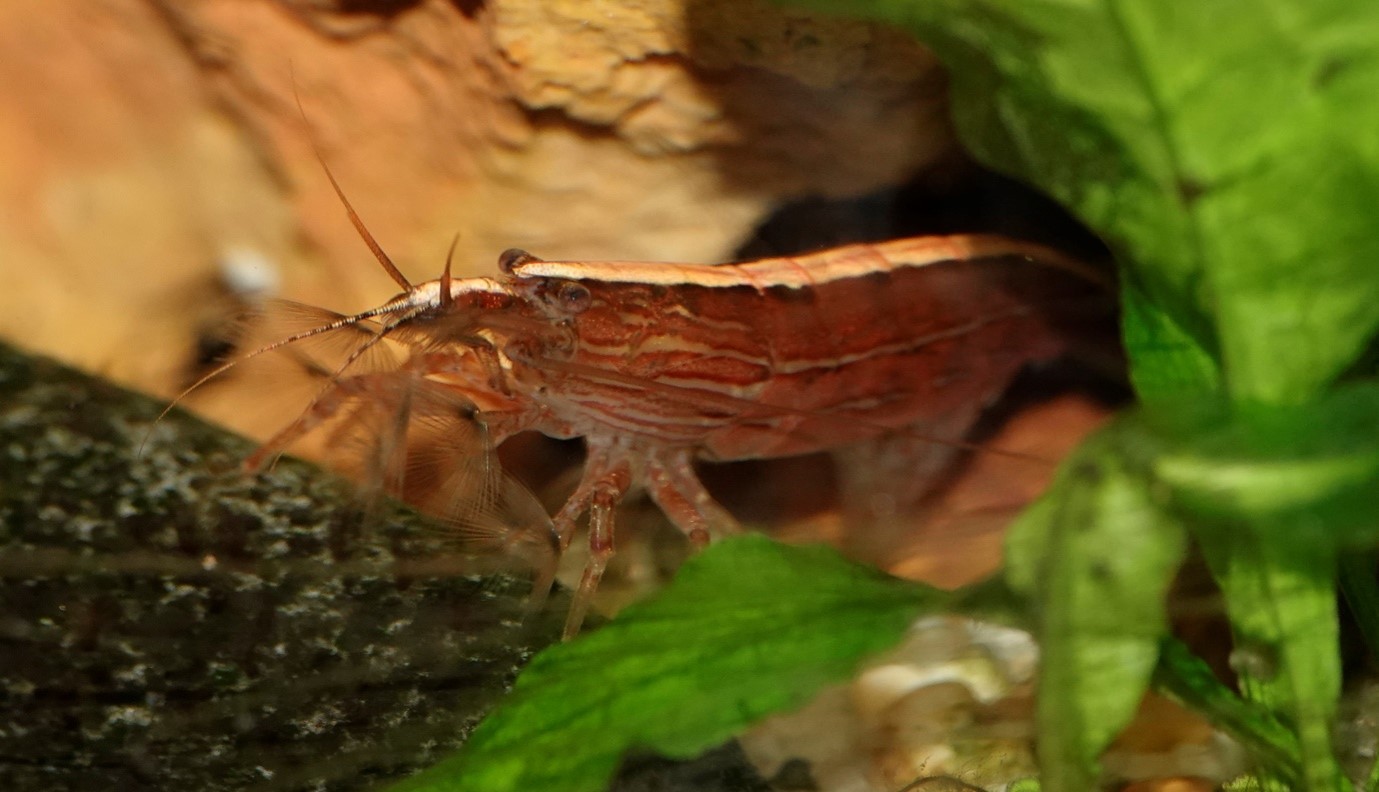
WetlandInfo feature species - Riffle Shrimp (Australatya striolata)
Riffle Shrimp (Australatya striolata)
Photo by Jon Marshall
The feature animal for April is the Australatya striolata (Riffle Shrimp). All species in the genus use habitats of fast-flowing, rocky streams, which gives them their common name of riffle shrimps.
Australatya striolata is a large and distinctive freshwater shrimp species of the family Atyidae, which includes other more commonly encountered local ‘glass shrimp’ from the genera Paratya and Caradina.
They grow to a maximum size of around 8 cm, and are recognised by this large size and robust body shape. They have a well-defined, pale, mid-dorsal stripe that interrupts their general body colouration that ranges from green, to red or tan-brown to black.
They occur in coastal catchments from Victoria (where it is listed as endangered) to the Sunshine Coast region of southern Queensland.
This section is updated regularly, so stay tuned for more!
Last updated: 10 May 2021
This page should be cited as:
Department of Environment, Science and Innovation, Queensland (2021) WetlandUpdate May 2021, WetlandInfo website, accessed 8 May 2025. Available at: https://wetlandinfo.des.qld.gov.au/wetlands/resources/publications/latest-news/2021-04-30.html


 — Department of the Environment, Tourism, Science and Innovation