

|
|
WetlandUpdate May 2025Wetlands Mapping Version 7.0
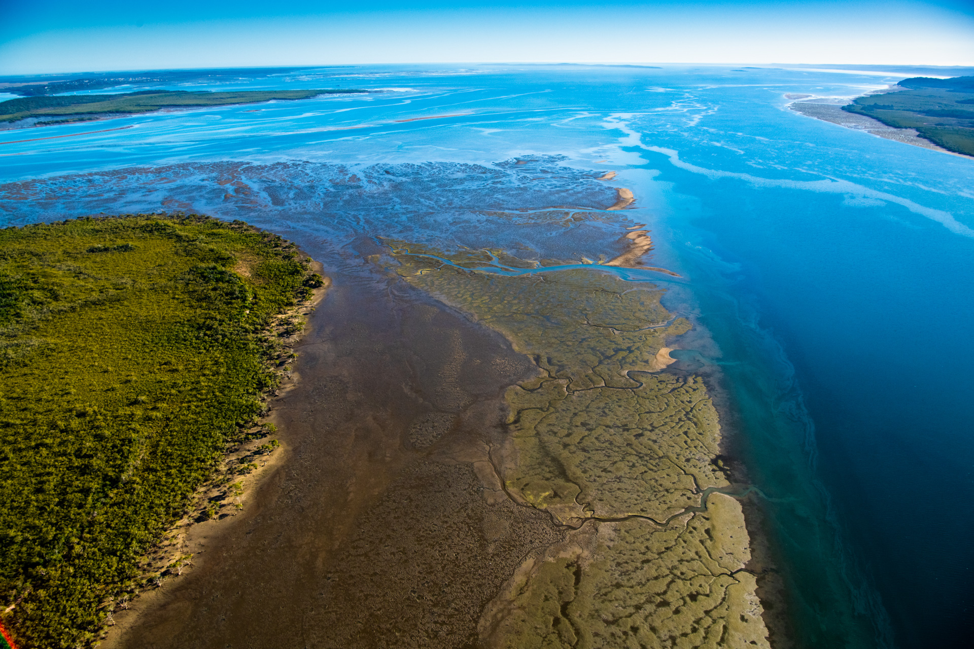
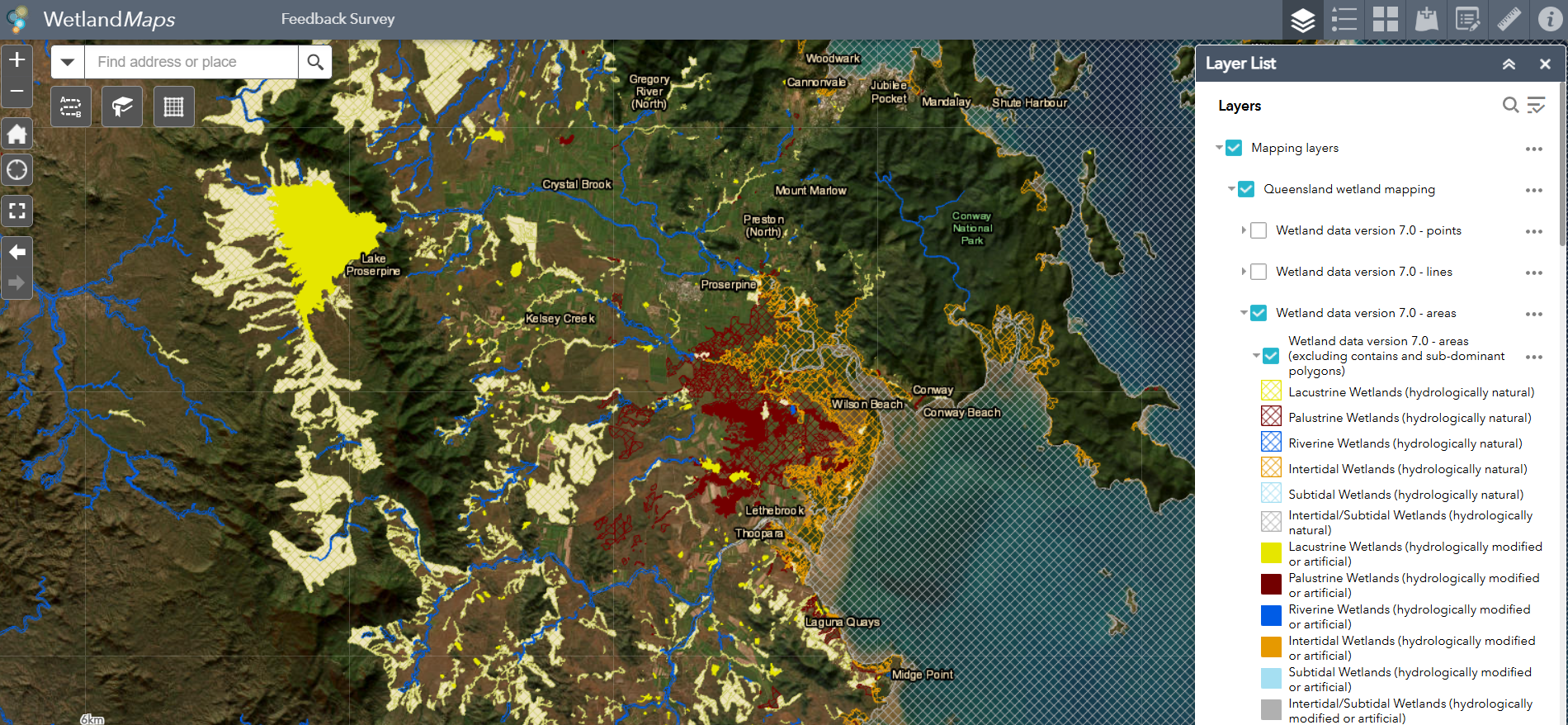
The Queensland wetland mapping and classification has been updated, based on 2021 wetland extent. Wetland mapping is used by State and local governments, natural resource management groups, consultants, and in research institutions to assist with prioritising management and conservation of wetlands and the various values that wetlands support. The release includes updates to the documentation, including:
This release also includes:
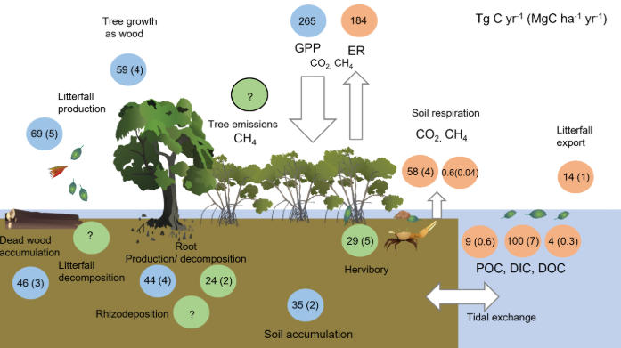
 Updated and new Ecology pagesA new Ecology page on Tides have been added to the Processes section, to assist with identifying, understanding and quantifying the components and processes of wetlands. Updates were also made to the Tidal inundation and tidal planes page. New definition for peatA definition for peat has been added to the Australian soil and land survey field handbook. The definition for peat was developed by the national peat working group and was adapted from a variety of sources, including international, national and state definitions. A link to the definition is now in the Glossary. New mangrove pagesTwo new pages have been added, on Nutrient effects on mangroves and Mangroves and the carbon cycle. These pages are based off scientific publictions and provide further insight into the impact of nutrients on mangroves, and the role mangroves play in the carbon cycle. Synthesis of evidence of the effectiveness of wetlands in water quality improvement, costs and cost-drivers in the Great Barrier Reef catchment area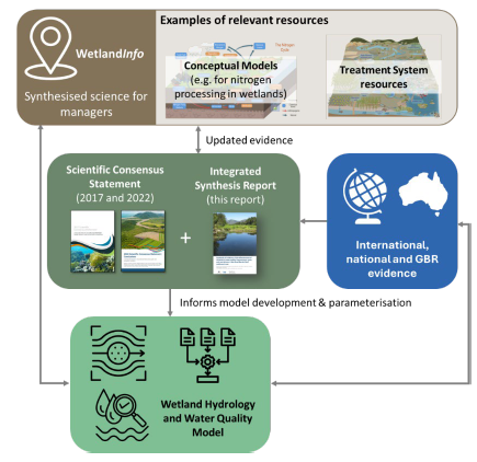 The Synthesis of evidence of the effectiveness of wetlands in water quality improvement, costs and cost-drivers in the Great Barrier Reef catchment area report provides evidence to demonstrate the current understanding of the effectiveness of wetlands in water quality improvement and builds on the extensive information already available on WetlandInfo. The report was based on international, national and local (Great Barrier Reef) evidence including 238 tropical and sub-tropical studies in agricultural areas and 145 studies in non-agricultural areas, and 17 studies from the Great Barrier Reef across different wetland and treatment systems. The report has been added to the Great Barrier Reef catchments, reef and islands, Pressures, Nitrogen processes and cycle, and Treatment systems and Wetland management tools and guides pages. Updates to the Litter and Illegal Dumping Management Framework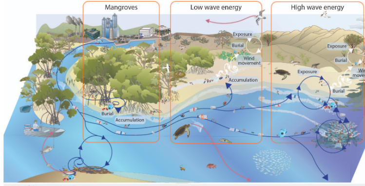 The Litter and Illegal Dumping Management Framework has been updated, in response to a review conducted on the Framework in 2023. Updates include new and updated conceptual models and updates to referencing throughout. UpdatesUpdated layers on WetlandSummary and WetlandMapsPrograms, Policy and Legislation pagesReviewed and updated content to maintain accuracy and relevance. Additional links
WetlandUpdateThe WetlandUpdate is a regular bulletin sent to subscribers to provide you with the latest WetlandInfo resources and tools, as well as case studies, video information and new project fact sheets. WetlandInfo feedback and improvementsContact us via email for feedback, information or questions about wetlands. WetlandInfo feature species The feature species for May is the southern purple-spotted gudgeon (Mogurnda adspersa). The southern purple-spotted gudgeon (Mogurnda adspersa) is a small, freshwater, carnivorous fish found across east and south-eastern Australia. These fish are characterised by broad blueish bands overlaid with numerous small tan, orange and purple spots along their sides (more prominent during breeding periods) and three horizontal, red bars along either side of their faces. This species of gudgeon can grow up to 13cm in length but, normally, when found as adults, they are approximately 8cm long. They are found in small, slow-flowing wetland systems, typically hidden amongst aquatic vegetation, rocks and woody structures. During breeding, females lay batches of eggs up to 1,300 and place them on underwater objects. Once laid, male fish guard them until they hatch, which can take between 3-9 days, depending on conditions. The species saw significant declines in populations throughout South Australia, Victoria, and New South Wales during the 1980's due to introduced predatory species, competition for food sources, and changes to their habitats that impacted on breeding processes. Populations in Queensland appear to be relatively stable. Additional information
This section is updated regularly, so stay tuned for more! References
Last updated: 24 April 2025 This page should be cited as: Department of Environment, Science and Innovation, Queensland (2025) WetlandUpdate May 2025, WetlandInfo website, accessed 8 May 2025. Available at: https://wetlandinfo.des.qld.gov.au/wetlands/resources/publications/latest-news/2025-05-01.html |
Site footer

 — Department of the Environment, Tourism, Science and Innovation