

|
|
WetlandUpdate September 2016Walking the Landscape—catchment storiesTo effectively manage a catchment it is important to have a collective understanding of how the catchment works. Map journals provide a mechanism for integrating spatial information, photographs and animations with an informative narrative to demonstrate the features of the catchment. The information in the 'catchment stories' was compiled with experts using the 'walking the landscape' process, where experts systematically worked through a catchment in a facilitated workshop, to incorporate diverse knowledge on the landscape. The stories describe the location, extent and values of the Lockyer and Mid-Brisbane catchments. They demonstrate the key features which influence water flow, including geology, topography, rainfall and runoff, natural features, human modifications and land uses. Additional catchment stories are under development so watch this space! Lake Eyre Basin Springs Assessment Project Groundwater Dependent Ecosystem Mapping ReportThe Lake Eyre Basin Springs Assessment (LEBSA) project report provides the latest scientific data on Groundwater Dependent Ecosystems, including spring ecosystems, in 13 drainage sub-basins covering approximately 714,232 square kilometres or 41.3% of Queensland. The 13 drainage sub-basins mapped were: Barcoo River, Bulloo River, Cooper Creek, Diamantina River, Flinders River, Lake Frome, Nogoa River, Paroo River, Saxby River, Suttor River, Thomson River, Wallam Creeks, and Warrego River. The Hydrogeology, cultural history and biological values of springs in the Barcaldine, Springvale and Flinders River supergroups, Galilee Basin and Tertiary springs of western Queensland report is also available. Groundwater dependent ecosystems guideline for environmental impact statementThe Department of Environment and Heritage Protection (EHP) is responsible for coordinating environmental impact statement (EIS) processes under Chapter 3 of the Environmental Protection Act 1994. Environmental impact assessment is used to integrate environmental management with the approvals process for proposals. The Groundwater dependent ecosystems guideline has now been included with other EIS resources. Torilla Plains grazing case studyManagers of the five grazing properties that cover Torilla Plain, adjoining Broad Sound in Central Queensland, have developed productive resilient enterprises for breeding and fattening of cattle. Wise use of natural pastures on their marine plain is the key. Wetlands across the plain also support biodiversity of national and global importance. By implementing externally-supported programs, often in collaboration with neighbouring properties, managers have enhanced the sustainability of their natural resources, livelihoods and wildlife. The case study can be found on the wetland projects search tool and reports pages. Additional WetlandSummary areasNew summary areas have been added to the WetlandSummary tool:
Updates, improvements and links
WetlandUpdateThe WetlandUpdate is a regular bulletin sent to subscribers to provide them with the latest WetlandInfo resources and tools, as well as case studies, video information and new project fact sheets. View all of the previous WetlandUpdates Updated tools fact sheetQueensland Wetlands Program tools fact sheet. WetlandInfo feedback and improvementsSend us your useful wetland information and links to add to WetlandInfo. Do you have a wetland question you just can't answer? Email us WetlandInfo feature bird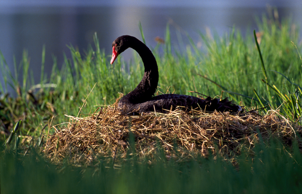
Cygnus atratus
Photo by DETSI
Our WetlandInfo feature bird is Cygnus atratus, commonly known as the black swan. They prefer larger salt water, brackish or freshwater waterways and permanent wetlands, requiring more than forty meters of clear water to take off. Outside of the breeding season, black swans travel long distances. These birds fly at night and rest during the day with other species of swan. WetlandInfo updates this section regularly, so keep your eyes and ears open! For more information on wetland birds, visit Birdlife Australia, Atlas of Living Australia or the Queensland Wader Study Group website, or view species profiles in your area using WetlandSummary. Last updated: 30 August 2016 This page should be cited as: Department of Environment, Science and Innovation, Queensland (2016) WetlandUpdate September 2016, WetlandInfo website, accessed 8 May 2025. Available at: https://wetlandinfo.des.qld.gov.au/wetlands/resources/publications/latest-news/2016-09-20.html |
Site footer

 — Department of the Environment, Tourism, Science and Innovation