  |
Wetland mapping statistics
Wetland system statistics based on Queensland wetland mapping and classification.
|
| |
Drainage divisions
Drainage divisions are defined by major landscape features and climatic zones to form broad hydrological regions as represented in the Australian Hydrological Geospatial Fabric (Geofabric) version 1 developed by the Bureau of Meteorology.
|
| |
Drainage basins
The boundaries and names of the Queensland Drainage Basins are as defined by the Australian Water Resources Management Committee (WRMC). These areas are a further breakdown of the drainage divisions.
|
| |
Drainage sub-basins
This dataset depicts a subdivision of the major drainage basins as defined by the Australian Water Resources Management Committee (WRMC).
|
| |
Regional natural resource management (NRM) bodies
Regional NRM bodies are responsible for protecting and managing Australia's natural resources. To do this, regional NRM plans were developed to outline how a regional body will identify and achieve the region's NRM targets. There are 56 bodies in Australia, 14 of which are located in Queensland.
|
| |
Local government areas
Local government plays an important role in community governance. As a forum for local decision making, it helps deliver the Queensland Government's priorities locally and regionally.
|
| |
100K map tiles
1:100,000 Australian geoscience map sheet index.
(Note, printable PDFs of wetland mapping and mapping of wetlands and groundwater dependent ecosystem in KML format have been developed based on the 100K map tiles).
|
| |
Climate zones
Australian climatic zones based on the Köppen classification.
|
| |
Bioregions
Bioregions, also known as biogeographic regions, are areas based on bioregions (there are 13 bioregions recognised in Queensland), landzone and vegetation.
|
| |
Biogeographic subregions
Biogeographic subregions are a breakdown of the bioregions.
|
| |
IBRA bioregions
Interim Biogeographic Regionalisation for Australia (IBRA) bioregions represent a landscape based approach to classifying the land surface of Australia.
|
| |
IBRA subregions
IBRA subregions are a breakdown of the IBRA bioregions.
|
| |
Regional plans
The regional plans are based on Queensland Government regional planning areas.
|
| |
National parks
Lists national parks in Queensland.
|
| |
Conservation parks
Lists conservation parks in Queensland.
|
| |
State forests
Lists state forests in Queensland.
|
| |
Forest reserves
Lists forest reserves in Queensland.
|
| |
Resources reserves
Lists resources reserves in Queensland.
|
| |
Timber reserves
Lists timber reserves in Queensland.
|
| |
Marine parks (Queensland)
Marine parks are established over tidal lands and waters and protect and conserve the values of the natural marine environment while allowing for its sustainable use.
|
| |
Fish habitat areas
Declared fish habitat area (FHA) plans indicate the outer boundaries (or limits) of FHAs. Check the Fisheries Regulation 2008 (Schedule 3) for details on the area included within the boundary of an FHA and its management.
|
| |
Coastal management district
Coastal management district is established under the Coastal Protection and Management Act 1995 (Coastal Act).
|
| |
Nature refuges
A nature refuge is an area of land voluntarily dedicated and protected for conservation purposes while allowing compatible and sustainable land uses to continue.
|
| |
Freshwater biogeographic provinces
The riverine systems of Queensland are 'regionalised' using a biota approach. This resulted in 9 Freshwater Biogeographic Provinces with more homogenous biota than the whole state. The approach used macroinvertebrate and freshwater fish data to group similar catchments.
|
| |
Wetland (aquatic ecosystem) type—conceptual models
Conceptual models, based on wetland types, diplict the current understanding of these ecosystems.
|
| |
Groundwater dependent ecosystem type—conceptual models
Conceptual models based on ecosystems types depict the current understanding of groundwater dependent ecosystems.
|
| |
Wetland (aquatic ecosystem) type—management profiles
Wetland management profiles provide information about the distribution, ecology, cultural values, conservation status, threats and management of particular wetland types, and wetland regional ecosystems (REs) within Queensland.
|
| |
Water resource planning areas
The water resource planning process is designed to plan for the allocation and sustainable management of water to meet Queensland's future water requirements.
|
| |
Aquatic ecosystem monitoring programs
Queensland's water quality, water quantity and aquatic ecosystem monitoring programs.
|
| |
Wetland soil indicator case studies
Soil fact sheets or case studies based on the testing of wetland soil indicators in 58 wetlands.
|
| |
Area specific conceptual model case studies
Wetland conceptual model area specific case studies are vibrant, easy-to-understand illustrated guides to selected individual wetlands in Queensland.
|
| |
World Heritage areas
World Heritage areas are outstanding examples of the world's natural or cultural heritage. The World Heritage Committee oversees listing these areas on behalf of the United Nations Educational, Scientific and Cultural Organisation (UNESCO).
|
| |
Study areas
Project specific study areas.
|
| |
Report cards
Report card study areas.
|
| |
Great Barrier Reef
Great Barrier Reef contributing catchments and intertidal/subtitdal wetland statistics
|
| |
DIWA nationally important wetlands
Nationally important wetlands listed in the Directory of Important Wetlands in Australia (DIWA). It includes an inventory of wetlands assessed as meeting criteria for national importance.
|
| |
Ramsar internationally important wetlands
Internationally important wetlands listed the Convention on Wetlands especially as Waterfowl Habitat (Ramsar, Iran, 1971)—called the 'Ramsar Convention'.
|
| |
Report card organisations
Report card study areas are based on Healthy Waterways and Heathy Rivers to Reef monitoring programs that provide regional assessments of the ecosystem health.
|
|
Wildlife
Wildlife lists for area based on WildNet data. Information links to species profiles and further information.
|
WetlandSummary
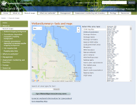
WetlandSummary allows users to access wetland and other related information by natural resource management (NRM) region, local government area, catchment and many more pre-defined areas. Presenting the information in summary form saves time and effort in accessing data layers. In addition, species lists and new species information is delivered through the search function of this tool. Find out more by viewing an online animation.


 — Department of the Environment, Tourism, Science and Innovation